Hidden on the quieter Ohakune side of Tongariro National Park, the Waitonga Falls Track leads to the tallest waterfall in the entire park.
Exploring this side of Tongariro on our final day in the park felt like discovering a completely different atmosphere — far quieter than the busy trails around Whakapapa Village and the Tongariro Alpine Crossing.
Rather than crowds, we found quiet forest paths, open alpine wetlands, and beautiful views of Mt Ruapehu unfolding along the trail.
In this guide, I’ll show you exactly what to expect on the Waitonga Falls Track, including trail conditions, viewpoints along the way, and a helpful tip if you want to reach the base of the waterfall.
Waitonga Falls Track Overview
This short but rewarding hike sits on the southern slopes of Mt Ruapehu in Tongariro National Park.
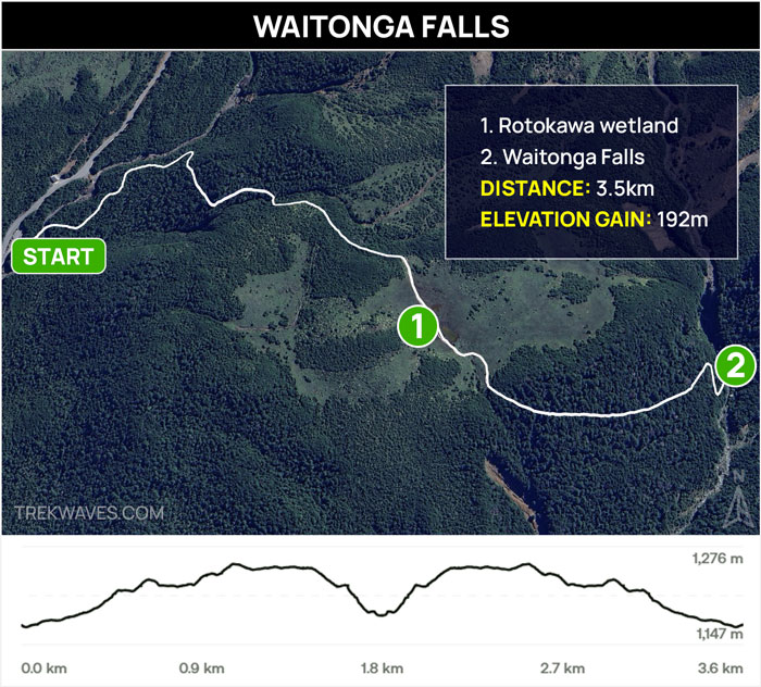
The trail climbs gradually through native forest before reaching the Rotokawa Pools, an alpine wetland area dotted with small ponds where, on calm days, you can see reflections of Mt Ruapehu mirrored on the water’s surface.
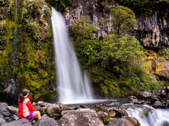
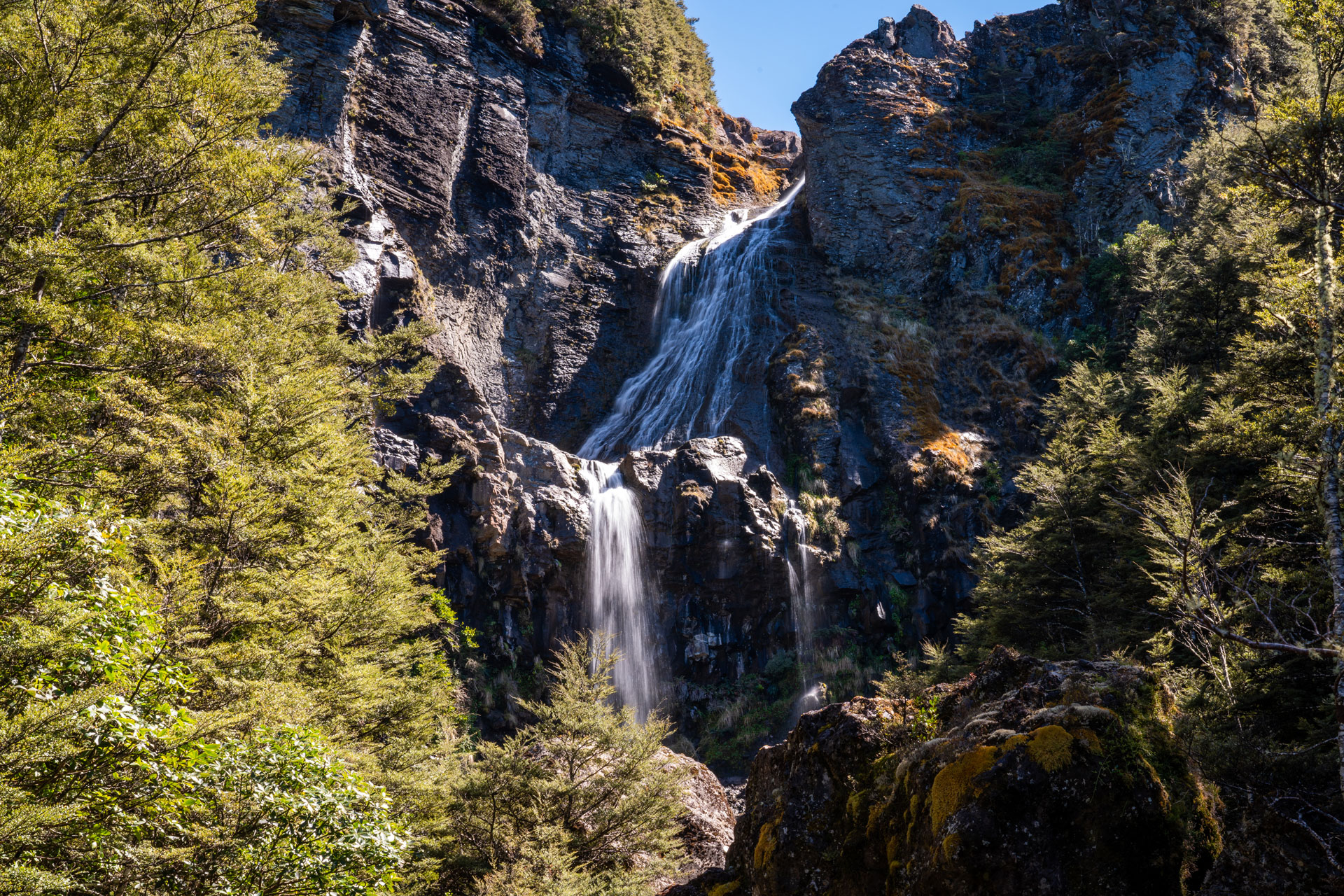
The track eventually leads to Waitonga Falls, an impressive 39-metre waterfall that plunges down a narrow gorge, making it the tallest waterfall in Tongariro National Park.
Trail Stats:
- Distance: 3.5 km return
- Elevation Gain: 192 m
- Time: ~2 hours
- Difficulty: Easy to Moderate
- Start: Ohakune Mountain Road
Getting to the Waitonga Falls Track
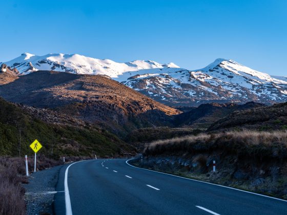
The track starts from a small car park along Ohakune Mountain Road, located about 15 km (a 15–20 minute drive) from the town of Ohakune.
From Ohakune, follow Ohakune Mountain Road as it winds up the mountain toward the Turoa Ski Field. The car park for the Waitonga Falls Track is clearly signposted along the road and has space for many vehicles.
Ohakune makes a great base for exploring this quieter side of Tongariro National Park, offering plenty of accommodation, cafés, and restaurants.
During our visit, we stayed at the nearby Mangawhero Campsite, a simple DOC campsite located a short drive north of town along the same road leading toward the trailhead.
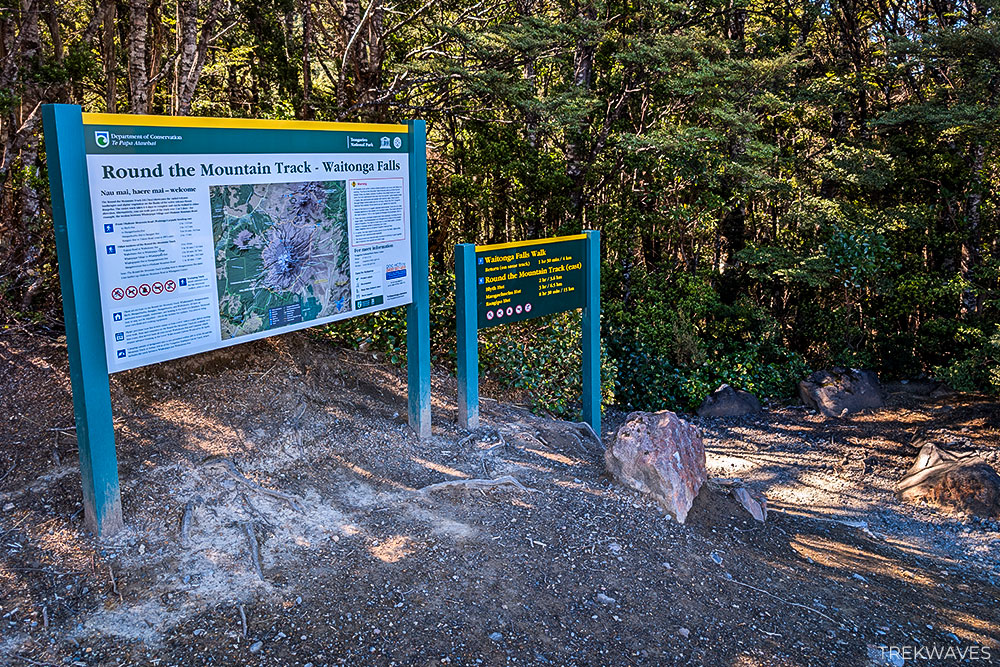
Starting the Waitonga Falls Track
The track begins by crossing a small swing bridge over the Mangawhero River shortly after leaving the car park.
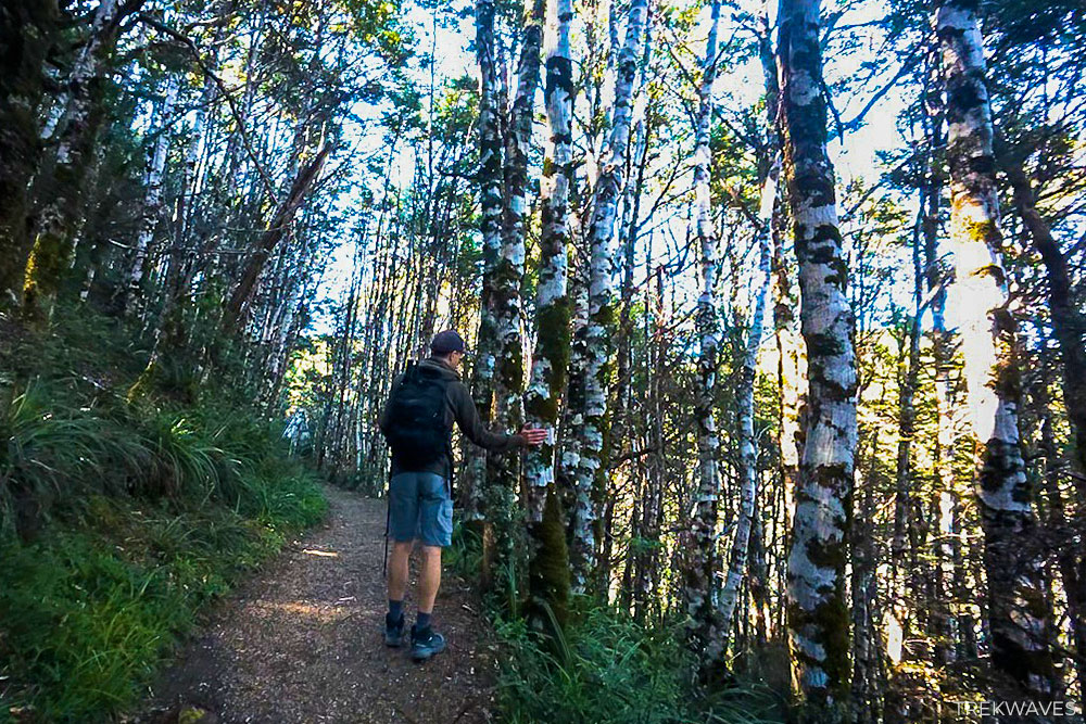
From here, the trail immediately starts climbing through a cool native forest of mountain beech and alpine vegetation, gradually gaining elevation as it heads deeper into the valley.
One thing that surprised us early in the hike was that the trail actually climbs uphill toward the waterfall. Unlike many waterfall walks where the path descends toward the base, the Waitonga Falls Track steadily gains elevation right from the start.
The path is generally well formed and easy to follow, with a mix of compact gravel trail and natural forest sections.
After about 20-25 minutes, the dense forest begins to open up as the trail approaches the Rotokawa Pools, one of the most scenic parts of the hike. The track continues across a series of wooden boardwalks that pass through the wetlands.
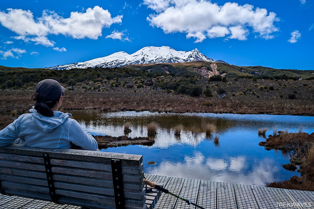
On calm days, the small ponds throughout the wetlands often reflect Mt Ruapehu, creating one of the most photogenic spots along the entire track.
Approaching Waitonga Falls
After crossing the Rotokawa Wetlands, the trail continues toward the forested valley where Waitonga Falls crashes down the gorge. As you get closer, the sound of rushing water gradually becomes louder, hinting that the waterfall isn’t far away.
Soon the track reaches the rocky stream bed, where you can finally see the waterfall further upstream.
From this point, the waterfall drops 39 metres into the gorge, with water cascading over large rocks before continuing down the valley.
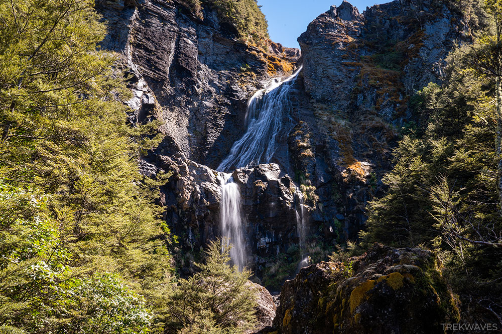
While the view from here is already impressive, big boulders block part of the lower section of the falls.
How to Reach the Base of Waitonga Falls
While the main track ends at the Waitonga Stream, it is actually possible to reach the base of the waterfall with a short detour.
At first, I tried crossing the stream and walking upstream toward the falls, hoping to find a path along the rocks.
However, the route quickly ended at a cluster of large boulders with water flowing through them from multiple directions, making it hard to continue any further.
After speaking with another hiker, I learned there is a much easier way to reach the base. Just before the final steps leading down toward the stream, look for a small unmarked side trail branching off the main path.
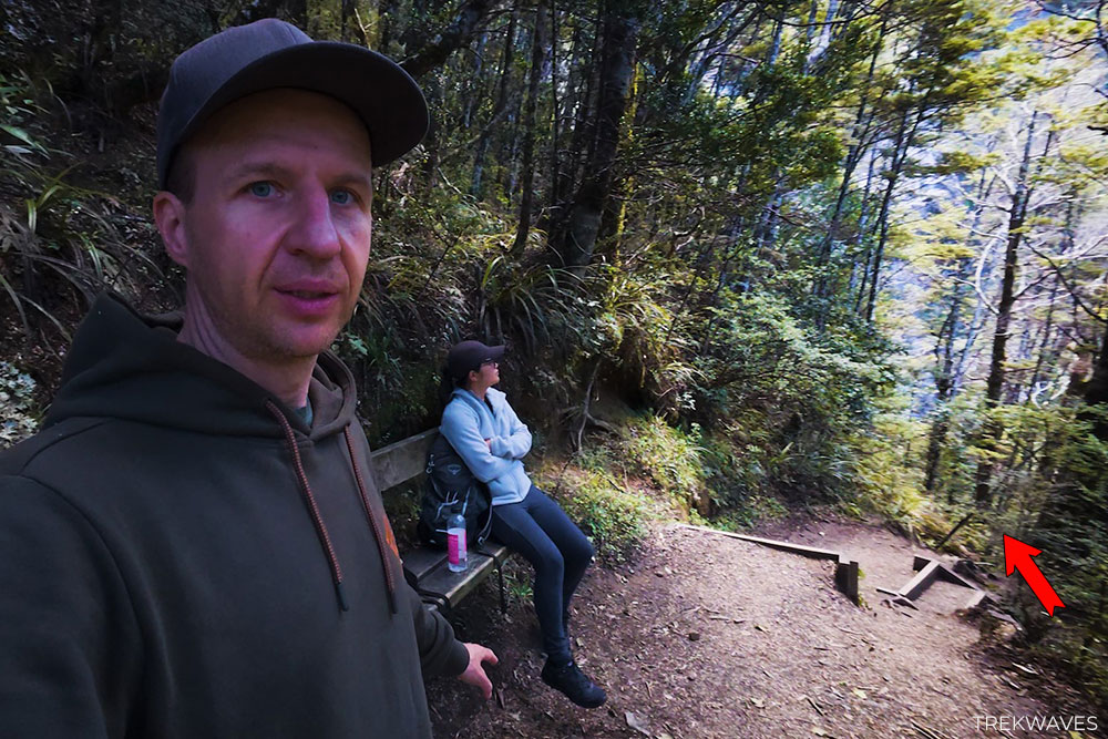
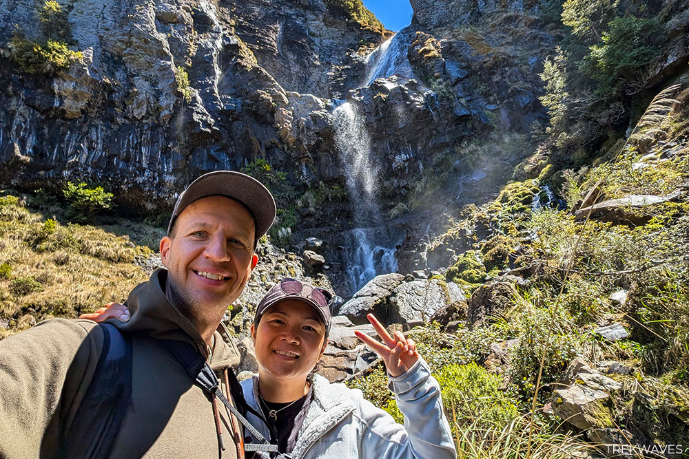
This narrow track descends through the trees and leads directly to the base of Waitonga Falls.
The path is steep, muddy, and a bit rooty in places, so good footwear helps. But the effort is worth it — standing below the falls gives you a much better sense of its scale as the water crashes down into the rocky basin.
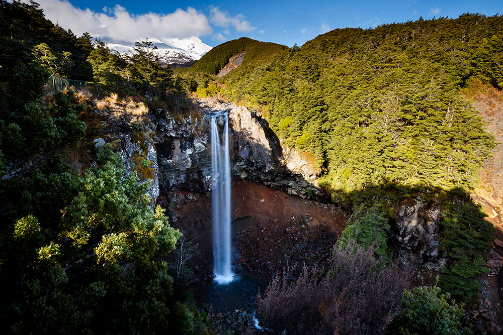
Bonus Stop: Mangawhero Falls
If you’re already driving along Ohakune Mountain Road to reach the Waitonga Falls Track, it’s worth making a quick stop at Mangawhero Falls as well.
Located further up the same road, this waterfall requires only a very short 300-metre return walk from the roadside car park and takes just a few minutes to reach.
Unlike Waitonga Falls, where you view the cascade from the stream below, Mangawhero Falls is best seen from a small viewing platform overlooking the gorge.
While the pool below the falls is relatively small, the setting is still impressive — especially on clear days when Mt Ruapehu rises directly behind the waterfall, creating one of the most photogenic scenes in this part of Tongariro National Park.
Because the walk is so short, Mangawhero Falls makes a great quick add-on stop after visiting Waitonga Falls, and it’s an easy way to see another beautiful waterfall without committing to another hike.
Final Thoughts
If you’re exploring this side of Tongariro National Park, the Waitonga Falls Track is a fantastic short hike that offers a surprising amount of scenery for the effort.
Combined with the quick stop at Mangawhero Falls, it makes for an easy half-day adventure near Ohakune.
If you’re planning more hikes across the island, you can also check out my guide to the best hikes in North Island New Zealand, where I share some of the most rewarding trails we discovered during our trip.
Found it Helpful? Pin it for Later!