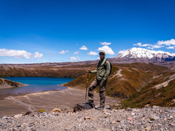
Are you ready for an unforgettable adventure in Capertee National Park? If your answer is yes, then you absolutely have to check out the Valley of the Dinosaurs trail.
As you step into the Mugii Murum-ban State Conservation Area, prepare to embark on an off-the-beaten-path trail that will make you feel like a true Aussie bush explorer.
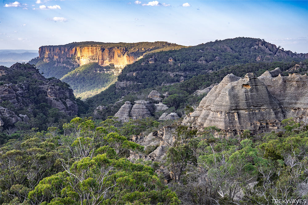
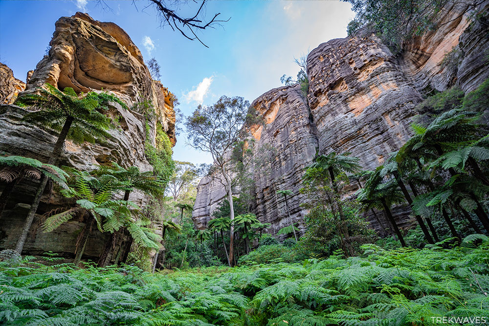
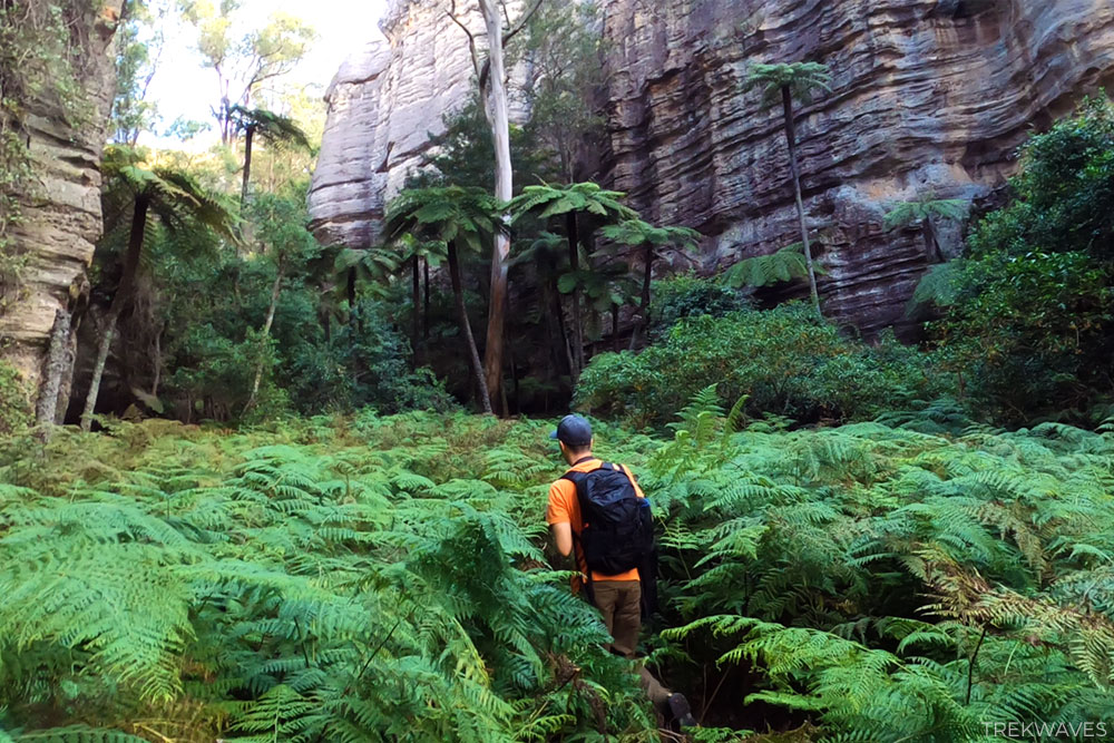
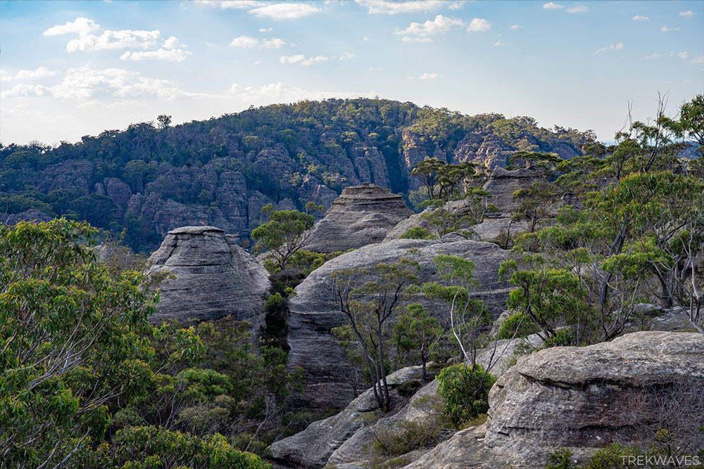
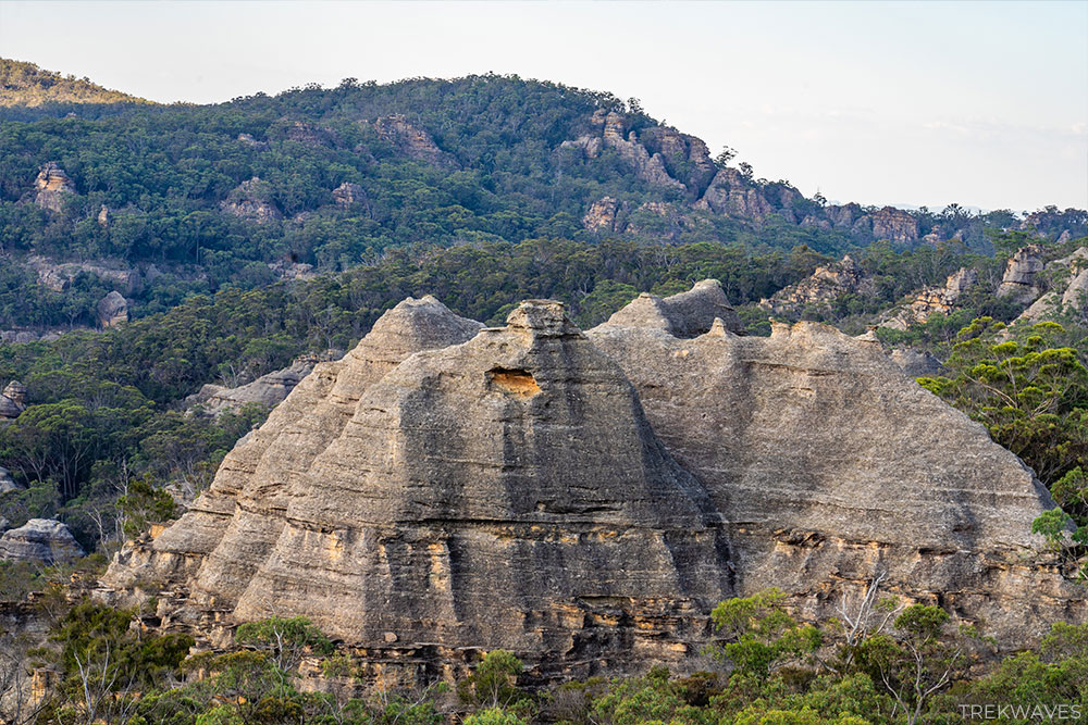
Along this trail, you’ll have the chance to walk inside massive slot canyons, meander through dense fields of emerald green ferns, and uncover lookout points that unveil breathtaking panoramic vistas of the one-of-a-kind pagoda rock formations exclusive to this region of New South Wales.
Eager to discover what else awaits you on this remarkable trail?
Stay tuned because I’m about to give you all the information you need to ensure you’re fully prepared for this amazing adventure!
Getting To The Valley of Dinosaurs Trail
If you’re planning to undertake this trek, a car is a must as public transport isn’t available in this area.
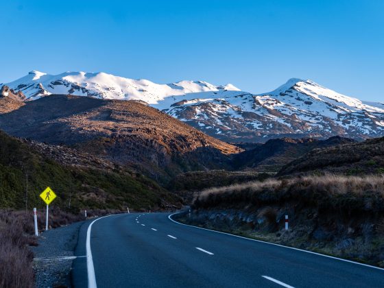
The start of the trail is situated along Glen Davis Road, in the Reedy Creek area. But don’t expect any official signs leading you there – they’re nonexistent! Make sure to set up your Google Maps to these coordinates before you set out.
After turning off Glen Davis Road, you’ll follow a fire trail through a grassy area surrounded by trees, with a few abandoned houses along the way.
If you’re driving a 2WD vehicle, start looking for parking about 200 meters after the turn.
For those with 4WD, drive as far as you’re comfortable, but be cautious. Upper sections of the road become quite steep and there are some tight hairpin turns. Only drivers comfortable with navigating such terrain should proceed.
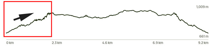
Valley of the Dinosaurs Trail Overview
- Distance from 2WD car park: 9.2km return
- Time: 3-4 hours
- Elevation Gain: 438m
- Difficulty: Hard (unmarked trail, requires navigation skills)
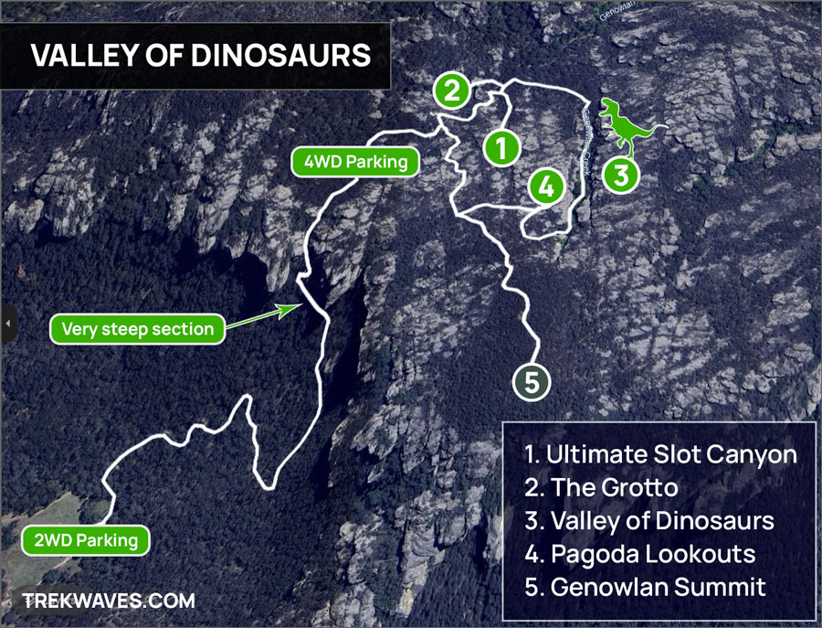
The map provided above is laid out based on the assumption that you will be trekking in a clockwise direction.*
if you’re planning to start your adventure later in the morning, around 10-11am, I’d recommend going clockwise along the trail.
This way, you’ll be greeted by some lovely light filtering into the Slot Canyon and Grotto.
And as the day unfolds, you’ll have the pleasure of witnessing the soft, enchanting glow of the evening sun on the Valley of Dinosaurs’ lush green ferns.
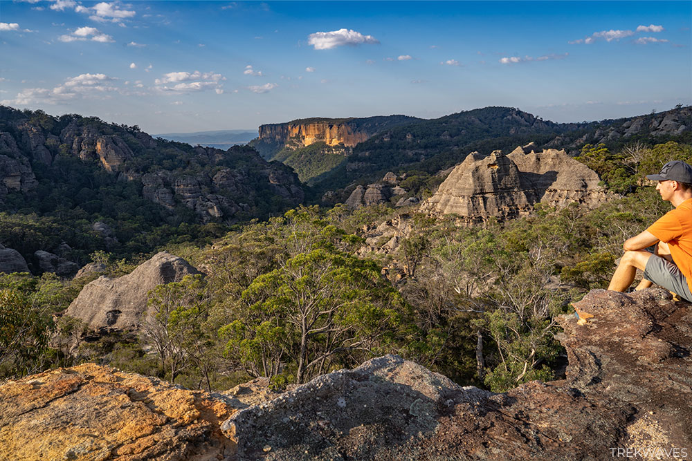
Plus, what better way to end your day than by enjoying the sunset from one of the incredible pagoda lookout locations?
*Just a quick heads-up: this article won’t be exploring the Genowlan Summit Trail. It’s an optional route, but if you have the time and energy, feel free to add it to your walk.
Walking Along Genowlan Fire Trail
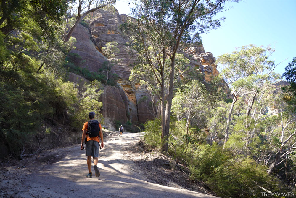
If you’re beginning at the 2WD car park area and hiking from the base of the fire trail, get ready to put in some effort.
You’ll start at roughly 700m elevation and ascend to about 950m. That’s a gain of around 250m over a stretch of approximately 2km, with the last few hundred meters being the steepest.
Once you’ve parked your car and set out on foot, keep an eye out for a sign on the left side of the road indicating the start of the Mugii Murum-ban State Conservation Area.

The first stretch of the climb might not be too demanding, but as you progress, it’ll become increasingly steep.
As you make your way up, keep an eye out for passing 4WD vehicles. This can be the most inconvenient aspect of the walk, as the cars on the road often stir up large dust clouds.
During our Easter long weekend visit, there was a lot of traffic heading up, but we were pleasantly surprised by the friendliness of the drivers. Almost everyone slowed down and greeted us with big smiles.
Continuing along the trail, you’ll notice it becoming steeper, offering captivating views of the unfolding Capertee Valley to your left.
Soon, you’ll arrive at a spot where the road sharply turns to the right, revealing the first stunning set of pagodas right in front of you.
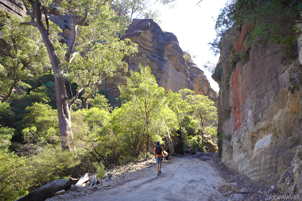
Following that, there’s another sharp turn, this time to your left, marking the beginning of the toughest and most visually striking part of this fire trail climb.
It’ll take you through a canyon-like passage surrounded by imposing pagoda walls.

After conquering the last, most challenging hill, you’ll come upon the signposted junction featuring directions for Diamond Mine and Genowlan Mountain Trail.
Ensure you remain on the right path by continuing straight along the Genowlan Mountain Trail.
Trail to Ultimate Slot Canyon
As you continue along the Genowlan Mountain Trail, you’ll soon reach another junction. If you’ve chosen to hike the trail clockwise, you’ll need to turn left at this point. The left path leads downhill, whereas the right path leads uphill.
Continue walking for another 300 meters while keeping an eye on your right side.
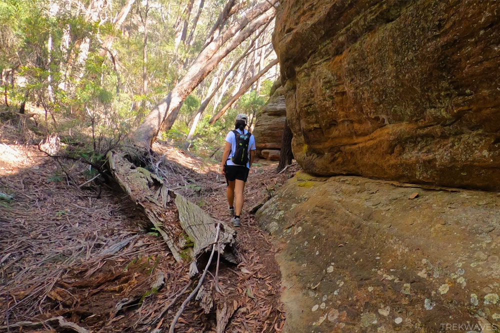
Eventually, you’ll notice a fairly obvious path leading off to the right (without any signage), which will guide you towards the Ultimate Slot Canyon.
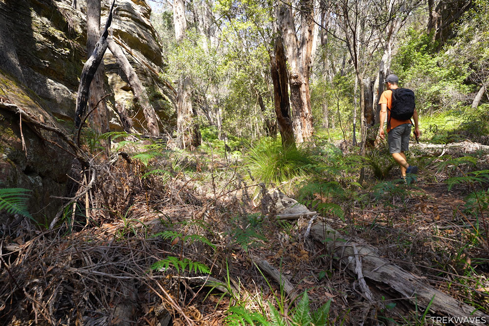
Initially, you’ll be walking along a small rocky pagoda wall on your left, with a larger wall visible in the distance on your right.
Keep following this route until you come upon a large fallen tree. Once you see an increase in the number of ferns, you’ll know you’re on the right path.
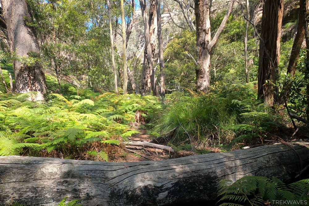
Continuing forward, you’ll see more and more ferns lining the trail, and the path may become slightly more obscured as the ferns increase in height. Nonetheless, you should still find it relatively easy to navigate this route.

After making your way through the fern field, the path will begin to ascend gently, featuring a few obstacles like another fallen tree to overcome.
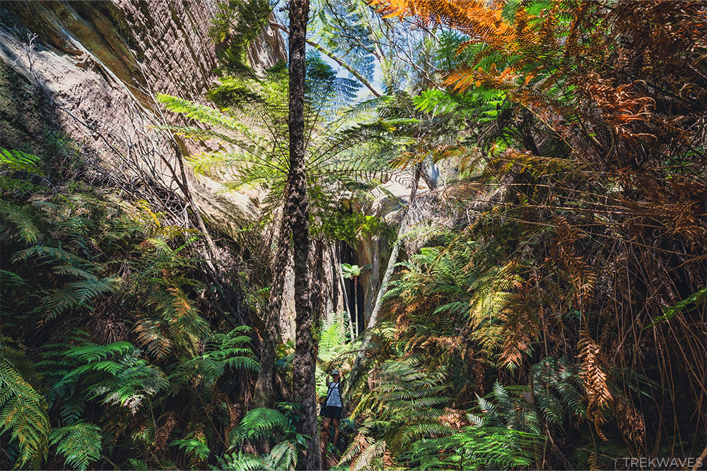
As you progress, you’ll find yourself surrounded by two imposing cliff walls, and the gap between them will steadily decrease.
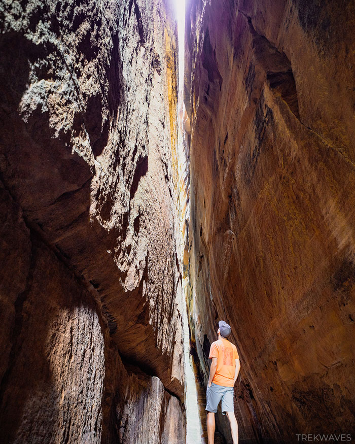
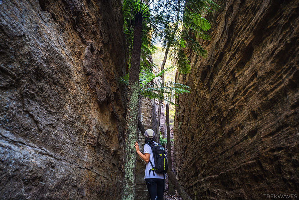
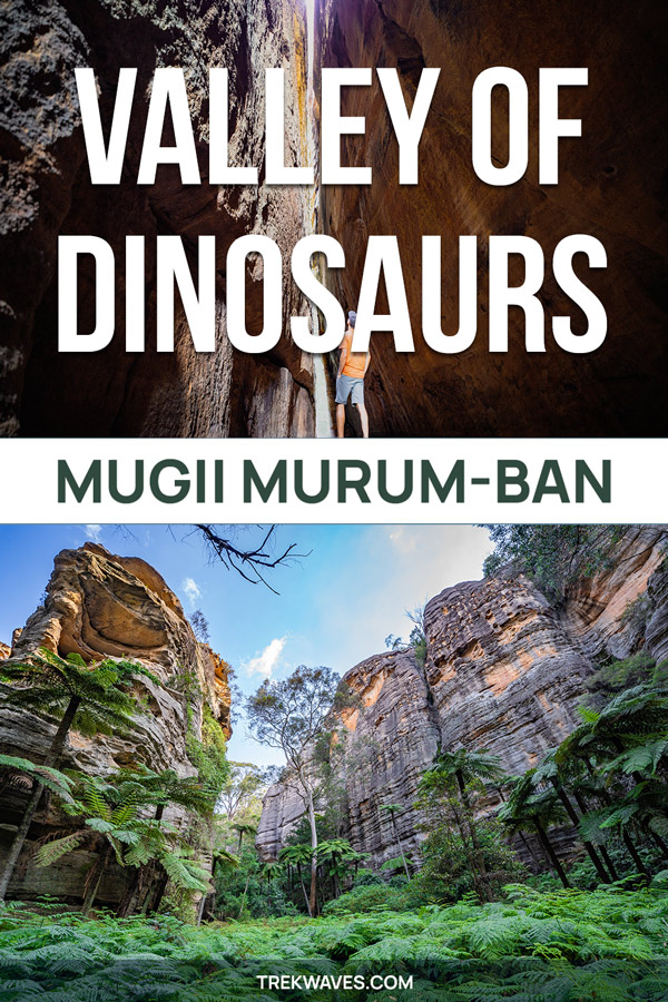
Ultimate Slot Canyon
Once you’ve made it to the entrance of the canyon, you’ll notice the temperature starting to drop. If you’re trekking the trail on a hot day, you’ll likely be eager to step inside and cool down a bit after the demanding climb up the fire trail.
Entering the slot canyon is an unforgettable experience, one you’ll likely remember for a long time.
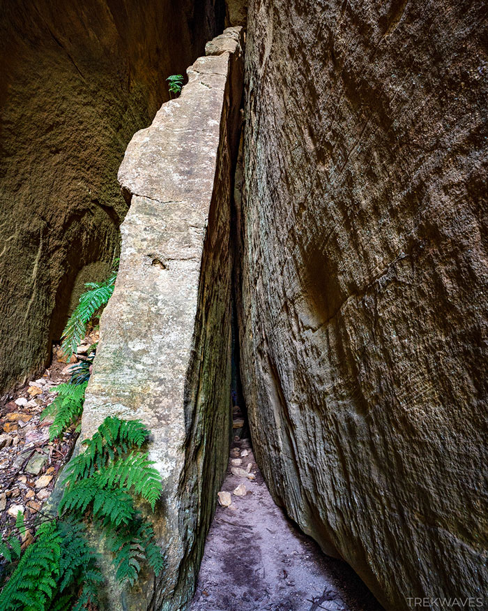
As you move deeper into the canyon, the walls tighten around you, demanding you to squeeze through and walk sideways to reach the end.
As you enter, the surroundings will become significantly darker, and you may need to rely on a torch or flashlight, to navigate through the canyon.

The slot measures 55 meters in length and stands at an impressive 80 meters in height, with parallel walls extending all the way to the top.
The acoustics inside the canyon are amazing, creating an ambiance reminiscent of being inside a grand cathedral.
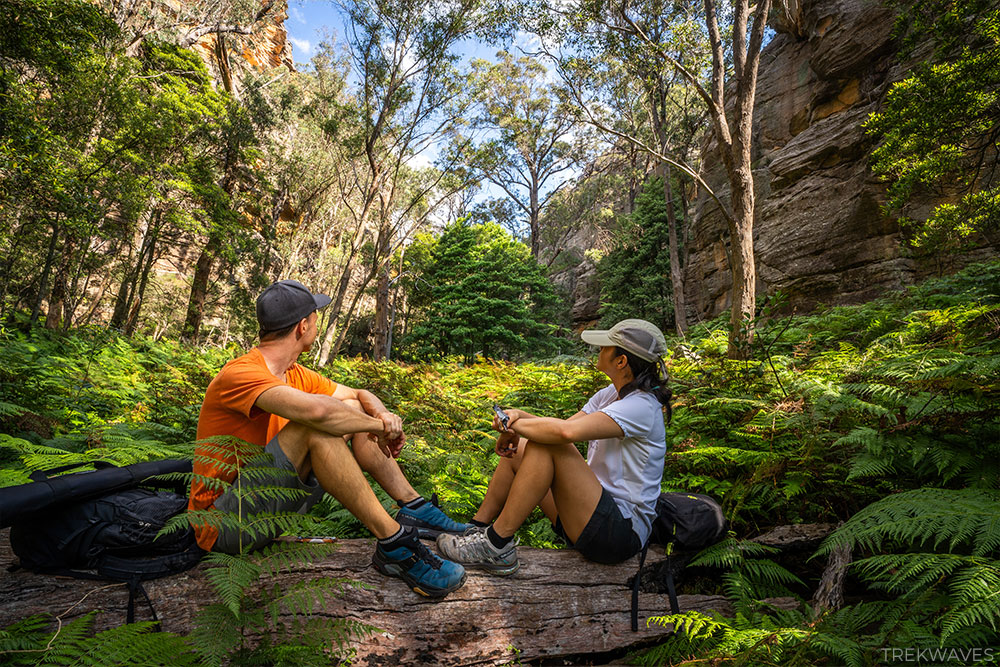
In the midst of the canyon, you’ll find a couple of rocks ideal for a lunch break, providing an opportunity to fully absorb the magical atmosphere.
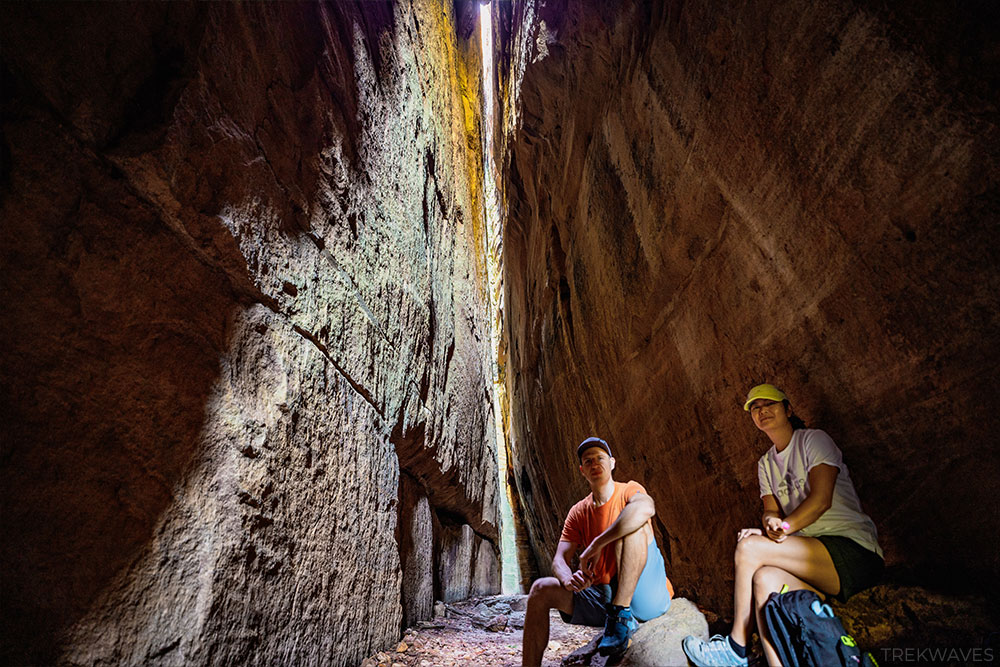
Lastly, if you’re planning to capture some photos inside the slot canyon, bringing along a small tripod for your camera might be a good idea.
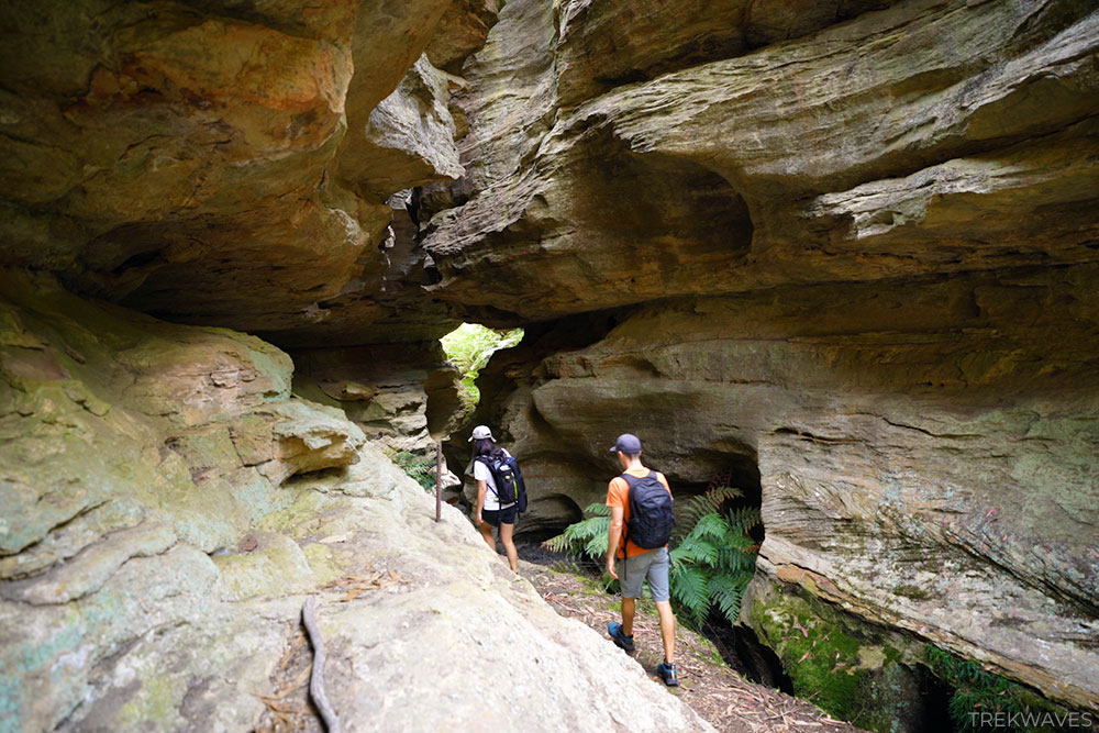
The Grotto
Our next destination will be The Grotto. To access this side trail, simply retrace your steps all the way back to the fire trail, then turn right and look for another unmarked trail, this time to your left.
It’s located about 50 meters from the slot canyon trail, and it’s quite easy to spot due to the presence of old and rusty metal railings installed along the right side of the rocky overhang wall.
Getting through this section could be tough, especially if you’re tall. Take your time and be mindful not to hit your head as you move forward.
Try not to depend too much on the railings, as they appear to be quite unstable.
Once you’ve passed the initial hurdle, you’ll find yourself standing between the beautifully sculpted, smooth walls of the canyon.
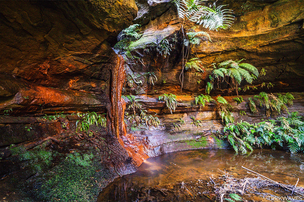
The ambiance of this place is truly remarkable, with the soft sound of trickling water in the background and green ferns dispersed randomly throughout the different “rooms” of the canyon.

The Grotto trail is relatively short, and eventually, you’ll come to a point where you’ll need to climb up next to a small waterfall trickling down.
After walking another 25 meters, you’ll reach The Grotto, with a small waterfall flowing down a strikingly colorful wall.
While it may not immediately catch your eye due to the subdued lighting, it’s actually a remarkable little gem ideal for capturing some exceptionally unique photos.
The hues of orange, red, and yellow rocks, coupled with the vibrant green ferns peeking out from the canyon walls, create a scene straight out of a fairy tale.
The Valley of Dinosaurs
After you’ve finished exploring The Grotto, it’s time to return to the fire trail, turn left, and begin searching for another unmarked trail that will lead you to the Valley of Dinosaurs.
It’s located approximately 50 meters down the road to your right.
Continuing along, you’ll be walking beside a medium-sized rocky wall on your right, slowly climbing upwards.
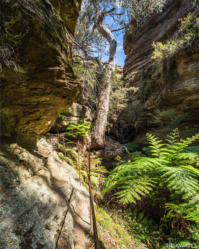
Soon enough, you’ll arrive at a spot with a fallen tree, offering a stunning view of the expansive field of green ferns stretching between the valley walls.
Here’s where the fun really starts, as you make your way through the valley’s picturesque green fern fields.
Just keep in mind, the farther you go, the taller the ferns get. To avoid scratches or stings from stinging nettles, it’s best to wear long pants (we changed ours after few minutes of walking).
Getting around the valley is fairly straightforward, and sticking to the path feels quite intuitive. However, it’s worth noting that the trail itself is quite overgrown in many spots.
Take your time exploring the hidden gems within the valley and capturing some photos. When you’re ready, begin searching for a steep path to your right that leads out of the valley.
The exit out of the valley passes through a narrow canyon passage nestled between two large cliff walls.
Pagoda Lookouts
Once you’ve made it out of the valley by climbing up the steep path, you’ll arrive at a large open field area with multiple pagodas, giving you the chance to take a break.
As it was getting late and dusk was approaching, we had to pick up the pace. I regret that I can’t provide detailed directions to the lookout spot directly overlooking the Valley of Dinosaurs.
Nonetheless, it won’t be too distant from the point where you exited the valley, so you should be heading in this direction.
This also means that I’ll probably revisit this place in the future to make updates to this article and to explore more trails that this remarkable area has to offer.
Found it Helpful? Pin it For Later!
Frequently Asked Questions (FAQs):
How long does the trail take?
- Half day at a slow pace
What about signage and trail quality?
- You’ll only come across signs for the fire trails
How difficult is the trail?
- Climbing the fire trail is tough, and navigating the unmarked trails requires some basic navigation skills
What should I wear?
- Good hiking shoes and long pants are highly recommended
What essentials should I carry?
- Torch or head lamp for the slot canyon, water, sunscreen, hat and snacks
Is the trail wheelchair accessible?
- Unfortunately, the trail is not wheelchair accessible
When is the best time to visit?
- It is entirely up to you, we started the walk around 10:30am
Is there phone service?
- Very limited
Can I bring my dog?
- According to the sign at the bottom of the fire trail, dogs are not allowed in this area