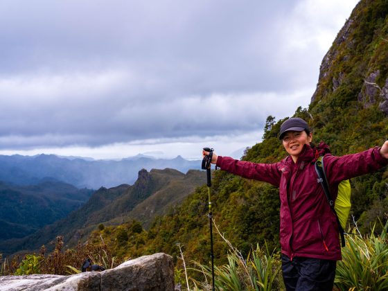
Most mornings in Tongariro National Park begin the same way: packed shuttle buses ferrying hundreds of hikers toward the Tongariro Alpine Crossing trailhead, everyone chasing the same volcanic vistas they’ve seen in a thousand Instagram posts.
Meanwhile, less than 20 kilometres away at Whakapapa Village, a different trail sits virtually empty, offering equally dramatic volcanic scenery without any of the hassle.
The Tama Lakes track via Taranaki Falls doesn’t attract crowds because it requires commitment beyond a casual waterfall visit. After the falls, where most day-trippers snap their photos and head back, the real walk begins.
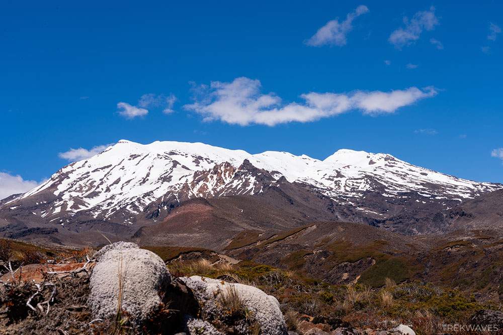
The forest gives way to exposed volcanic highlands, and suddenly you’re traversing terrain that rivals anything on the Crossing itself.
If you’re willing to put in the effort, this hike delivers the Tongariro experience you actually came for, just without the queues, the tight booking windows, and the feeling that you’re part of a guided tour you never signed up for.
Trail Overview & Key Details
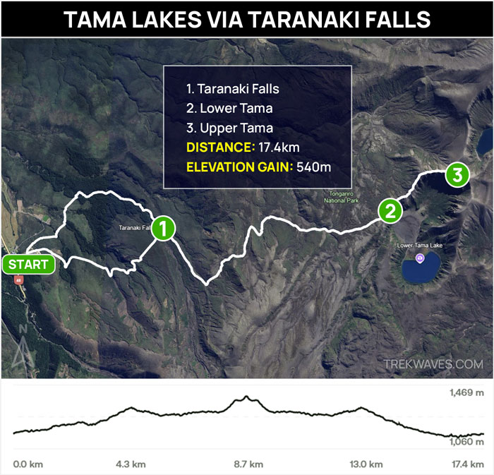
The Tama Lakes track via Taranaki Falls is a 17.4 km full-day hike that takes you from Whakapapa Village into the alpine terrain between Mount Ruapehu and Mount Ngauruhoe. It’s a well-marked trail that gradually climbs through native forest before opening up into volcanic highlands, ending at a viewpoint overlooking Lower Tama Lake.
While it’s longer and more demanding than the short walk to Taranaki Falls alone, the track doesn’t require any technical skills or special equipment beyond standard day hiking gear.
The main considerations are fitness level, weather conditions, and allowing enough time to complete the return journey comfortably.
Here’s what you need to know before you go:
- Distance: 17.4 km return
- Elevation Gain: 540m
- Time required: 5-7 hours
- Trail Start & End: Whakapapa Village
Difficulty
The section from Whakapapa Village to Taranaki Falls is classified by DOC as an easy track. It is well-formed with good footing, boardwalks, and goes through forested sections.
Beyond the falls, the track becomes significantly more challenging and is unformed at times, with loose volcanic gravel, scoria, and uneven rocky terrain.
The final approach to the Upper Tama viewpoint is steep, unstable, and slippery in places, with no shelter from the elements.
Best Season to Hike
November through April (late spring to early autumn).
Summer offers the most stable weather and longest daylight hours, though the track is exposed with little shade, so sun protection is essential.
Winter hiking is possible for experienced trampers. The snow and ice at higher elevations require proper gear. Weather in Tongariro can turn quickly year-round, so always check conditions before setting out.
Getting There & Logistics
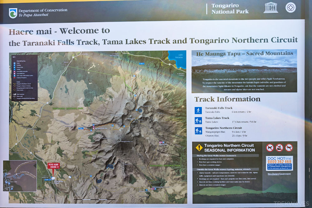
The Tama Lakes via Taranaki Falls hike starts near Whakapapa Village in Tongariro National Park, the main visitor hub on the western side of the park. This is the same access point used for several popular walks, including the Tongariro Northern Circuit, so signage is clear and easy to follow once you arrive.
The main carpark for this track is located on Ngauruhoe Terrace, near the Whakapapa Visitor Centre and Chateau Tongariro. This small carpark sits directly at the trailhead and fills quickly during peak hours and holiday periods—aim to arrive before 9am for the best chance of securing a spot.
If the main carpark is full, there’s plenty of overflow parking available along Ngauruhoe Terrace and further down along State Highway 48. All parking in the area is free, and even on busy days, you should find space somewhere within a short walk of the trailhead.
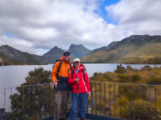
Accommodation Options in the Area
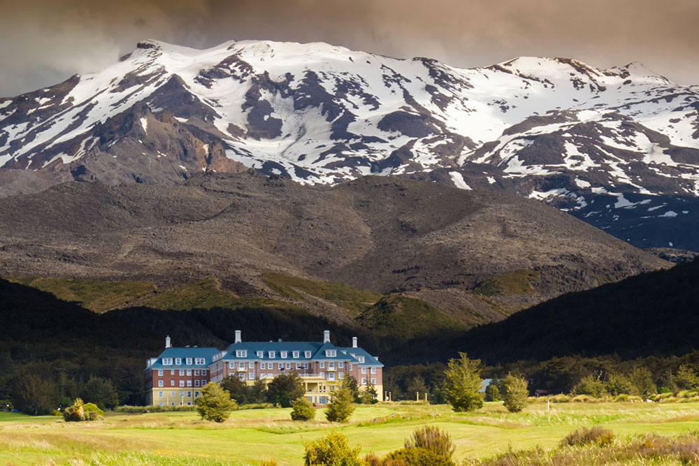
Whakapapa Village itself has limited accommodation options, particularly since the historic Chateau Tongariro Hotel closed permanently in February 2023 due to seismic safety concerns.
The most convenient place to stay is Whakapapa Holiday Park, which offers powered and unpowered campsites, simple cabins (beds only), a self-contained cabin, and a large lodge.
We stayed here and found it an excellent base for our entire stay in Tongariro National Park. The campsites are affordable and set among native beech forest with good privacy.
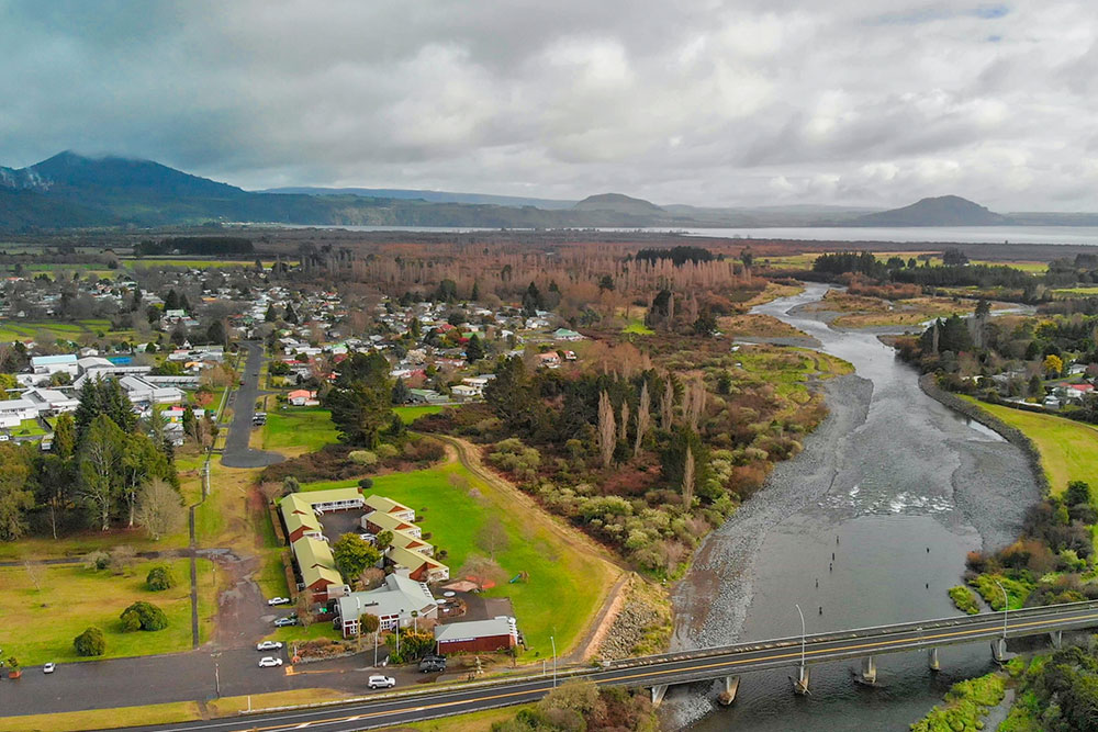
For more varied accommodation, National Park Village (Waimarino) offers hotels, motels, lodges, and hostels, with options ranging from budget backpackers to more comfortable lodges, and it is located only 12 minutes drive from the trailhead.
Turangi (35 minutes) has a wider selection of motels and holiday parks, while Ohakune (35 minutes south) provides good dining options alongside its accommodation.
The Hike: Stage-by-Stage Breakdown
1. Whakapapa Village to Taranaki Falls
From the trailhead you can reach Taranaki Falls via a scenic loop, choosing between two directions.
The Taranaki Falls Track that follows the Wairere Stream offers more shelter from the sun and a slightly more intimate feel as it winds through the quiet mountain beech forest and alongside the water — this was my preferred option.
The alternative Upper Taranaki Falls Track takes a higher, more exposed route across open terrain with broader views toward Mount Ruapehu before descending to the falls. Both routes meet at the waterfall, forming a loop.
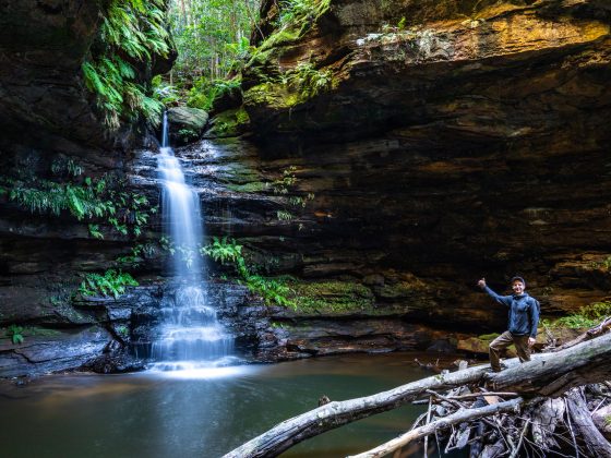
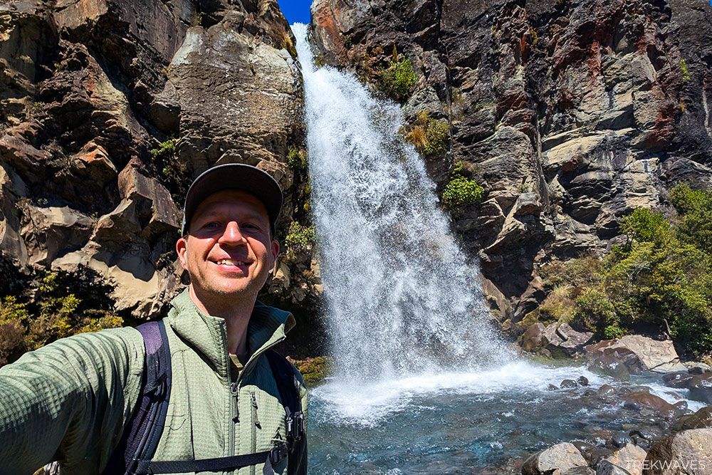
As you approach Taranaki Falls, the roar of water announces its presence long before the viewing platform comes into sight.
The 20-metre waterfall plunges over an ancient lava flow—andesite that erupted from Mount Ruapehu approximately 14,600 years ago and flowed down what is now the Wairere Stream valley.
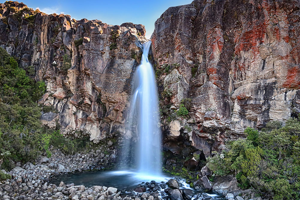
An information board at the falls explains the geology: this particular lava flow cooled around the edges first, forming a hard outer crust while the molten interior continued to move, eventually grinding to a halt.
The result is the dramatic columnar rock face you see today, with the stream cutting through a slot worn into the rock over millennia.
A brief track branches down to the waterfall’s base, allowing you to stand directly beneath the cascade. On a warm day, the cool mist is refreshing and makes the short scramble worthwhile.
2. Taranaki Falls to Lower Tama Lake
Once past the falls, the atmosphere shifts noticeably. The number of hikers drops, the track narrows slightly, and the landscape opens into wider volcanic plains shaped by ancient lava flows.
The climb toward the Tama Saddle is steady rather than steep, but it becomes more noticeable as you gain elevation.
As you ascend, views toward Mount Ruapehu expand dramatically, with the mountain dominating the skyline and providing a constant visual anchor that makes the effort feel worthwhile.
The rest of the route is completely exposed, zigzagging through a wide stretch of volcanic terrain with little protection from the elements. With active volcanoes rising on either side, the sheer scale of the terrain feels both powerful and humbling.
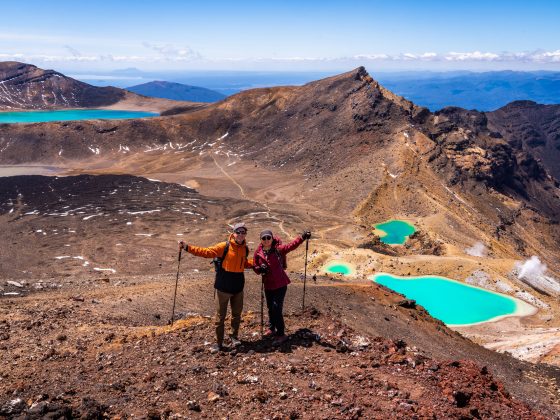
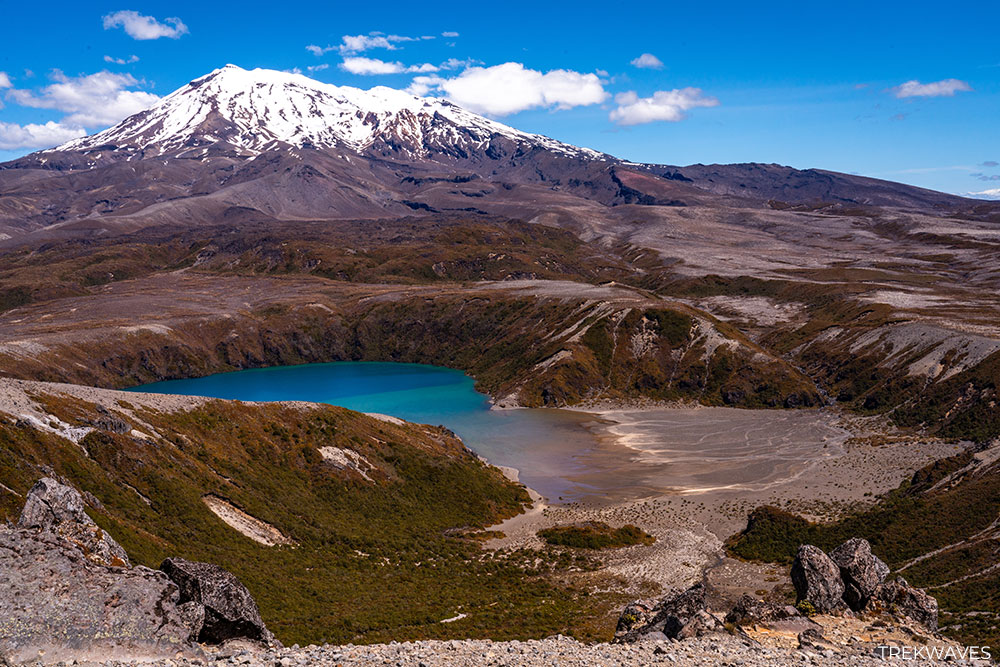
Roughly 10 minutes beyond the junction — marked by the only toilet along this section and a common pack drop point for Northern Circuit hikers — Lower Tama Lake comes into view below, cradled within an ancient explosion crater.
The panorama is breathtaking, with the lake’s vivid teal waters contrasting sharply against the surrounding dark volcanic rock.
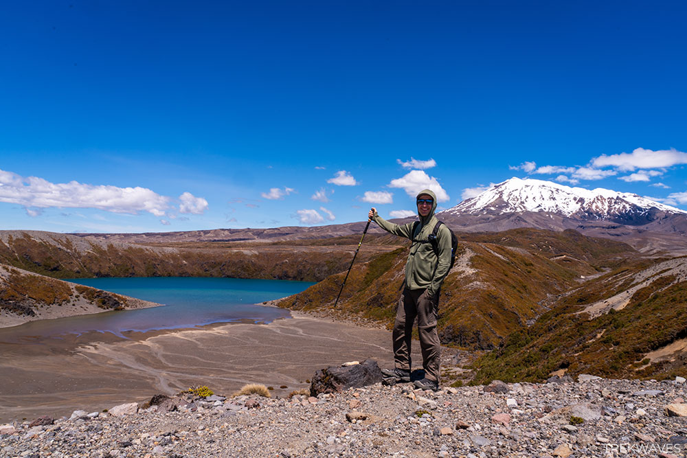
On a clear day, you can see across the entire Tongariro volcanic complex, and the lack of crowds makes it feel like you’ve stumbled onto something few people know about.
3. Lower Tama to Upper Tama Lake
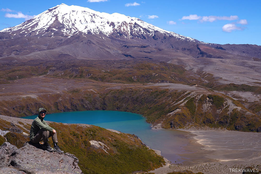
Lower Tama Lake is a natural place to rest, refuel, and soak in the views. While many walkers treat this as the endpoint and begin their descent, pushing on to Upper Tama Lake adds another dimension to the hike that’s well worth the additional climb.
The climb is noticeably steeper than anything earlier on the trail, with sections of loose scree that require a bit more care, but this is also where the biggest payoff unfolds.
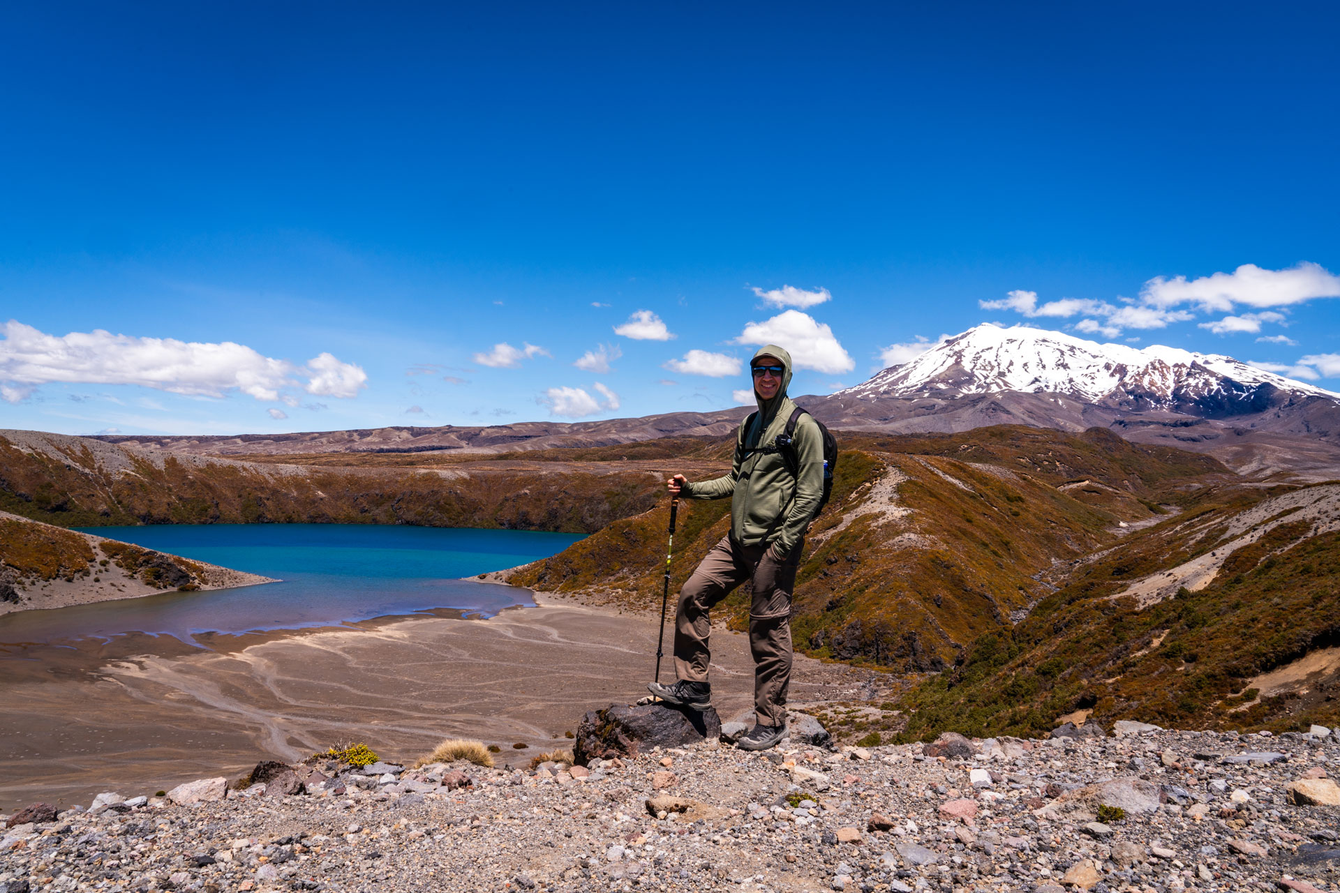
With every metre gained, the perspective back over Lower Tama Lake becomes more impressive, framed by the massive slopes of Mount Ruapehu behind it.
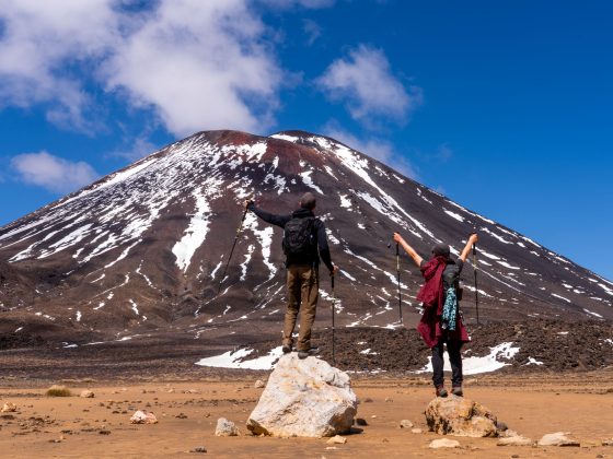
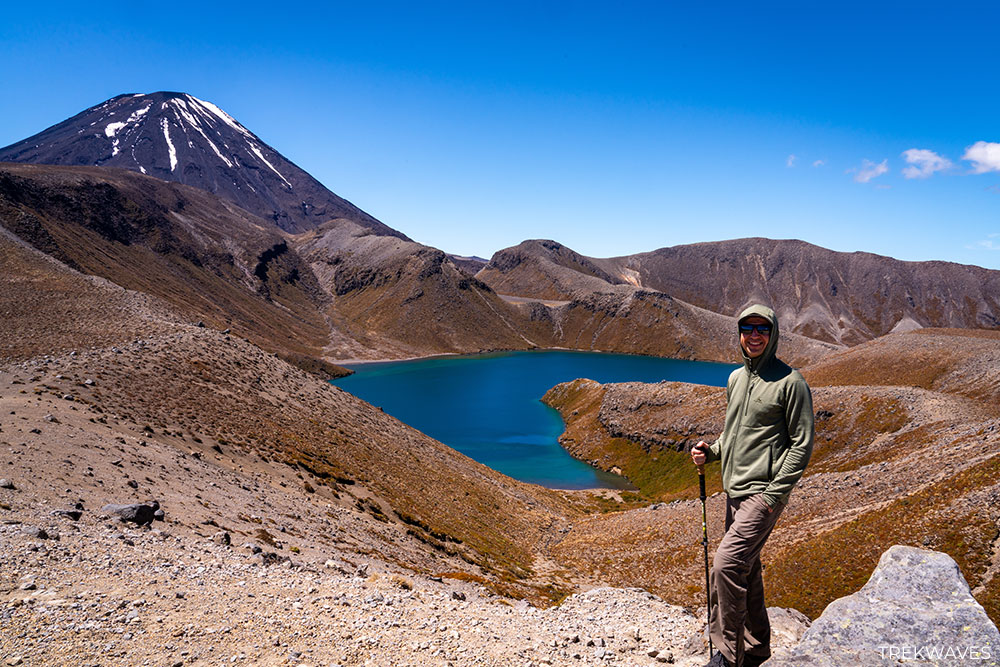
Near the top, the landscape opens again to reveal Upper Tama Lake sitting in its own volcanic basin, perfectly aligned with the cone of Mount Ngauruhoe (Mount Doom). It’s a dramatic and memorable finale that elevates the entire hike.
The Geology Behind Tama Lakes
The dramatic landscape around the Tama Lakes isn’t just beautiful — it’s the result of powerful volcanic forces that shaped this part of Tongariro National Park thousands of years ago.
Unlike the towering cones nearby, the lakes weren’t formed by lava flows or glaciers. Instead, they sit inside large volcanic explosion craters, which explains their distinctive circular shape and steep surrounding walls.
How the Lakes Were Formed
Both Lower Tama and Upper Tama are what geologists call maar craters. These form when rising magma meets underground water, triggering an intense steam explosion that blasts a crater into the earth.
Rather than building a mountain, the eruption excavates a wide basin. Over time, rain and snowmelt filled these craters, creating the lakes you see today.
The two lakes were formed by separate eruptions, which is why Upper Tama sits higher above Lower Tama, each occupying its own crater basin.
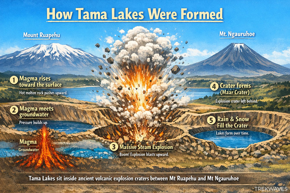
A Young Landscape (Geologically Speaking)
Although the scenery feels ancient, these craters are actually considered relatively young in geological terms — likely formed within the last 10,000 to 20,000 years. That’s one reason the terrain still looks raw and minimally eroded compared to older mountain landscapes elsewhere.
Understanding how the lakes were created adds another layer to the experience — you’re not just looking at beautiful alpine scenery, but standing on the remains of powerful volcanic events that shaped the region we see today.
Is It Worth It? / Why It’s Overlooked
The Tama Lakes hike is absolutely worth it — and in many ways, it delivers one of the most rewarding day hikes in Tongariro National Park. You get waterfalls, alpine terrain, crater lakes, and dramatic volcano views, all without the crowds and logistical challenges of the Tongariro Alpine Crossing.
So why is it overlooked?
The biggest reason is visibility. The Alpine Crossing dominates search results, social media, and travel itineraries, so many visitors simply don’t realise there are other hikes in the park offering similar volcanic scenery.
Tama Lakes also sits slightly off the main tourist narrative, despite starting from the same general area at Whakapapa Village.
Another factor is perception. Some hikers assume the lakes are a “shorter alternative” rather than a destination in their own right. But once you reach the upper viewpoints — especially above Lower Tama Lake — it becomes clear this hike stands on its own.
If you’re looking for a quieter experience with equally impressive scenery, this trail can easily become a highlight of your trip to New Zealand!
Tips for Hiking Tama Lakes
Start early if the weather is good
Even though this trail is far less crowded than the Alpine Crossing, it’s still popular on clear days. Starting early means calmer winds, softer light for photos, and more parking availability.
Prepare for exposure
Once you leave the forest near Taranaki Falls, there is very little shade. Bring sun protection, layers, and a windproof jacket — conditions can change quickly at altitude.
Don’t skip Upper Tama Lake
Many hikers turn around at Lower Tama Lake, but the final climb is where the biggest payoff is. The views improve dramatically with elevation, and the perspective over both lakes is unforgettable.
Check the forecast carefully
Cloud, wind, and rain can move in fast around Mt Ruapehu. Clear conditions make a huge difference to the overall experience.
Wear proper footwear
The climb toward Upper Tama Lake involves loose volcanic scree and steeper gradients. Good grip makes the ascent much more comfortable and safer.
Carry enough water and snacks
There are no facilities beyond the toilet near the junction below the lakes. The exposed terrain and elevation gain can be more tiring than expected.
Respect alpine conditions
Weather can change rapidly, even in summer. If winds are extreme or visibility drops, turning around is always a smart decision.
Found it Helpful? Pin it for Later!