If there’s one hike on New Zealand’s North Island that consistently tops the list for photographers, adventurers, and first-time visitors alike, it’s the Pouakai Tarns via Mangorei Track in Egmont National Park.
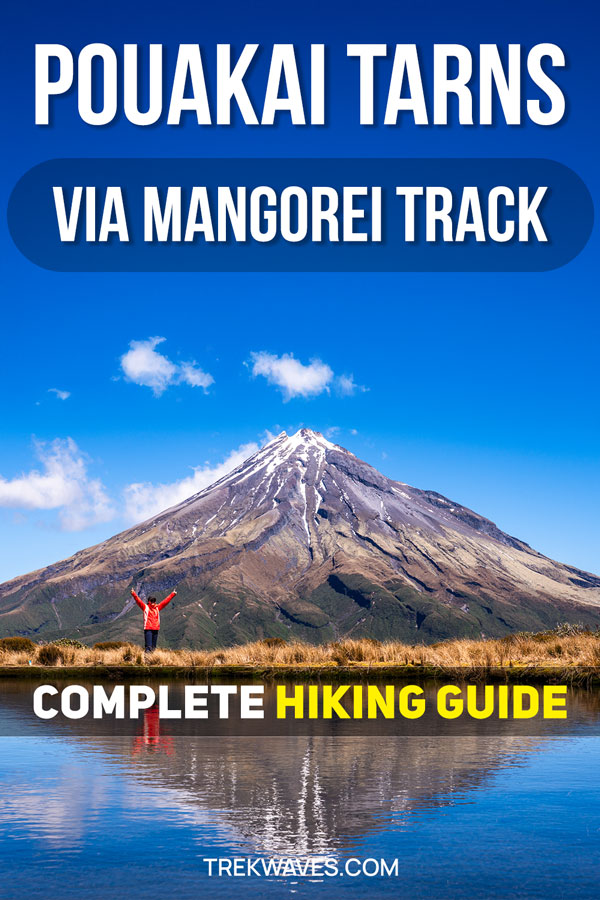
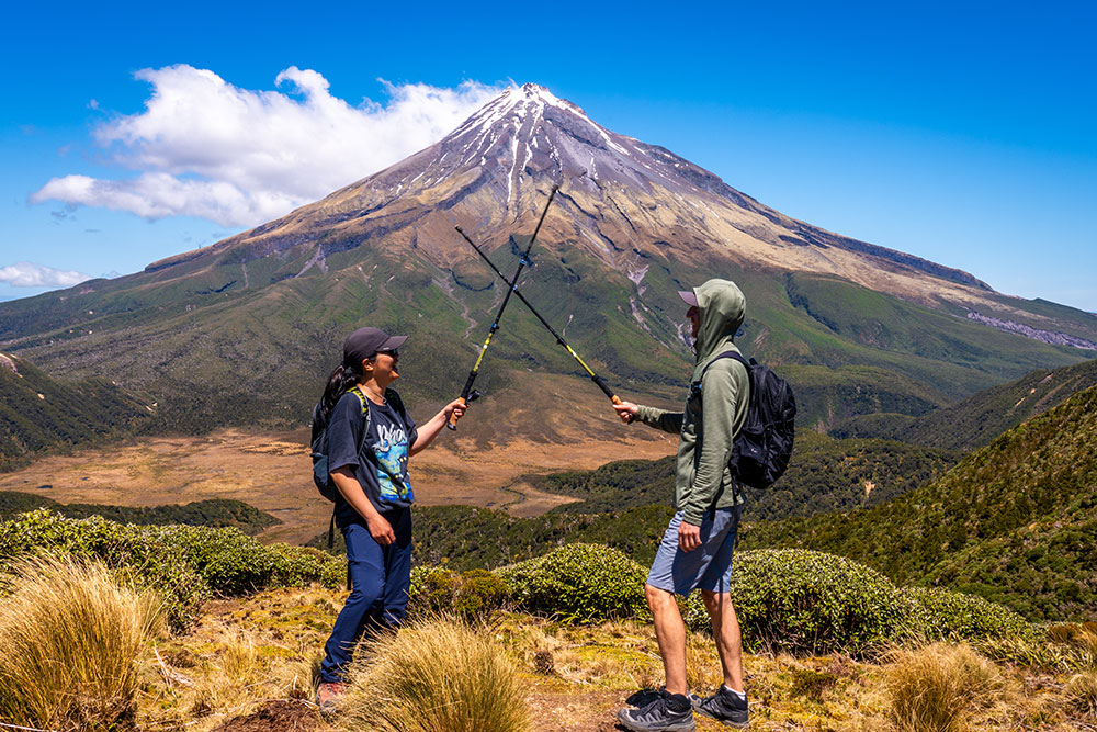
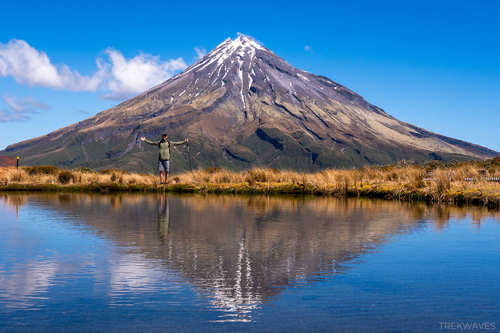
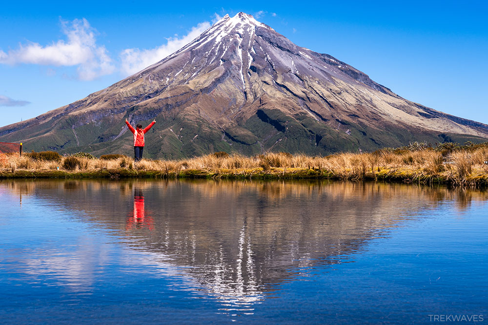
And it’s easy to see why the Pouakai Tarns Walk is one of the most popular hikes in New Zealand. When conditions align — calm winds and clear skies — the tarns at the end of the trail become a natural mirror, creating the famous Mount Taranaki reflection.
The mountain’s near-perfect volcanic cone appears duplicated in the still water, forming one of the most iconic and photographed landscapes in the country.
We hiked to the tarns via the Mangorei Track, adding a visit to the brand-new Pouakai Hut, which opened in August 2025 and has transformed the way hikers experience this trail overnight.
Whether you’re planning a long day hike or considering staying the night on the Pouakai Ridge, this guide covers the full route, the hut, the viewpoints, and everything you need to plan your trip.
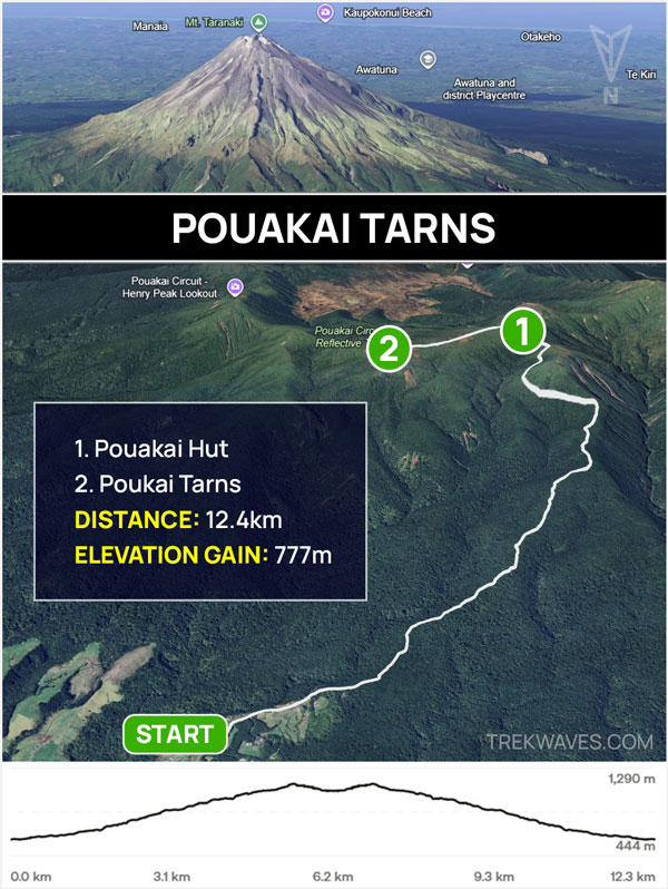
Pouakai Tarns Walk Overview (Mangorei Track)
The Pouakai Tarns Walk isn’t technically complex, but it’s far from a casual stroll. While much of the route follows structured boardwalk and steps, the climb is steady and consistent, gaining elevation quickly as you work your way up through the forest toward the ridge.
This is one of those hikes where the effort builds gradually — no scrambling, no exposure, just a sustained uphill push that rewards patience and pacing. By the time you reach the tarns, you’ve definitely earned the view.
If you’re wondering how long it takes, how difficult it really is, or whether it’s manageable as a day hike, here’s a clear breakdown of the key details to help you plan properly:
- Distance: 12.4 km return
- Elevation Gain: 777m
- Time required: 4-6 hours
- Trail Start & End: Pouakai Crossing Carpark
- Difficulty: Moderate / Hard (very long ascent)
- Location: Egmont National Park (Te Papakura O Taranaki)
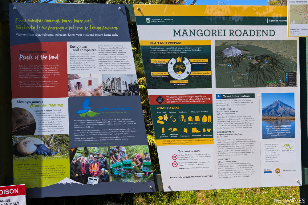
- Hut Booking: Required — book via DOC website in advance
How to Get to the Pouakai Tarns Trailhead
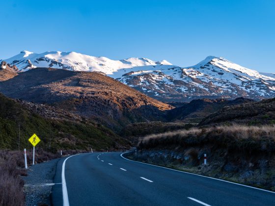
The trailhead is located at the end of Mangorei Road, around 20 minutes’ drive from New Plymouth. From the city, head south on State Highway 3 towards Inglewood, turn right onto Mangorei Road, and follow it for 13.6 km to the car park on the right just before the road end.
Parking is free with no time limit, and there are toilets at the car park. Shuttle services from New Plymouth are also available if you’d prefer not to drive.
When to Visit for the Best Mount Taranaki Reflection
Catching the famous Mount Taranaki reflection at Pouakai Tarns comes down to a few key conditions. When everything lines up, the reflection can look almost unreal — but if even one factor is off, it can disappear completely.
Wind:
Wind is the biggest factor. Even a light breeze will ripple the surface of the tarns and break the reflection. What you’re looking for is near-zero wind at tarn level, not just calm conditions at the car park. Checking the forecast around Pouakai Hut can give you a better idea of what conditions might be like higher on the ridge.
Cloud cover:
Clear skies around the summit are just as important. If clouds wrap around Mount Taranaki, the reflection won’t appear no matter how calm the water is. Early mornings often offer the best window before the mountain starts pulling in cloud later in the day.
Time of day:
Patience helps. Heading up on a heavily overcast day makes it unlikely you’ll see the mountain at all, let alone a reflection. If you’re doing the hike as a day trip, try to keep your schedule flexible and pick the clearest weather window you can.
Staying overnight at Pouakai Hut improves your chances significantly. You’ll be in position for both sunrise and sunset, when winds are usually calmest — and on very clear nights, you might even catch the Milky Way reflecting in the tarns, which is just as impressive as the daytime view.
Pouakai Tarns Walk – Trail Breakdown
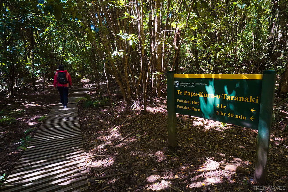
Section 1 – Into the Forest (Trailhead to Pouakai Hut)
From the Mangorei Road car park, the trail briefly follows the roadside before entering the bush — and almost immediately stepping onto the wooden boardwalk that defines most of this climb.
From here to Pouakai Hut, around 90% of the ascent is structured timber: steps, platforms, and raised sections weaving through dense native forest.
The forest itself is beautiful. Towering trees create a cool, sheltered canopy for much of the way, with the final stretch gradually opening up as you near the ridge.
But despite the polished infrastructure, don’t mistake this for an easy walk. The climb is steady and unrelenting — a continuous rhythm of steps that steadily chips away at your legs.
If we’re being completely honest, we didn’t love this section. The boardwalk felt excessive at times, even running across flatter sections where natural trail would have been perfectly fine.
With gaps between the planks, hiking poles become more frustrating than helpful, constantly catching or slipping through.
The uniform surface also removes some of the variety you normally get on a forest trail, turning the ascent into more of a grind than an adventure.
That said, context matters. This was one of our final big hikes after nearly three weeks on the road in North New Zealand, so tired legs may have shaped our perception. On fresher legs, it might feel more enjoyable. Either way, the climb demands patience — and saving energy for what comes next.
Section 2 – Pouakai Hut
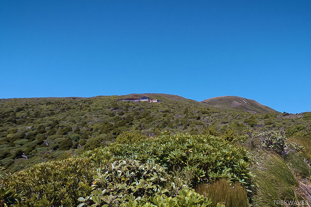
Pouakai Hut deserves its own section, as the experience on this trail has changed significantly compared to what many older guides still describe.
The brand new Pouakai Hut opened in August 2025, replacing the older facility and significantly upgrading the overnight experience on the Pouakai Ridge.
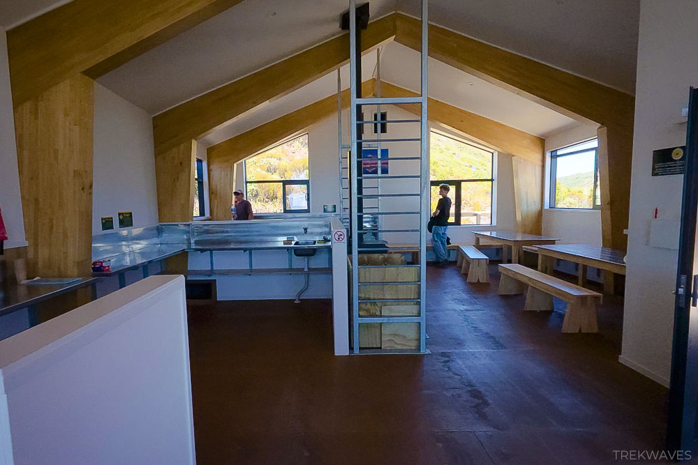
The new hut comes equipped with:
- 4 bunk rooms — three with 9 beds and one with 7 (34 beds total)
- Mattresses provided
- Heating
- Kitchen space
- Toilets
- Shower facilities
Water is available at the hut from a tap, though it’s untreated and should be boiled before drinking.
If you’re planning to stay overnight, bookings must be made in advance through the DOC website.
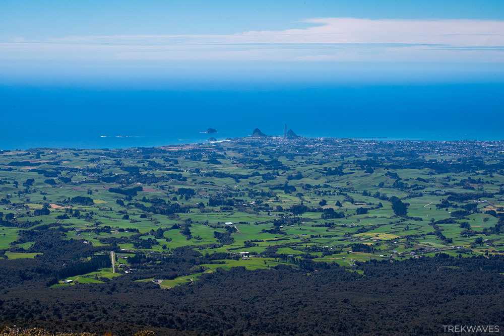
Even for day hikers, the hut is an ideal halfway point. It’s the perfect place to rest, refuel, enjoy the sweeping views toward the coastline, and recharge before the final push to the tarns.
Section 3 – Pouakai Ridge to the Tarns
Although Mount Taranaki isn’t visible from the hut itself, it doesn’t take long after leaving to see it. A short climb above Pouakai Hut brings you onto an open section of the ridge where the mountain suddenly dominates the view.
It’s a great spot to pause for a moment and snap a few photos before continuing toward the tarns.
From here, the boardwalk descends gently across the open wetlands of Ahukawakawa Swamp. The forest is now behind you, replaced by wide alpine terrain with tussock, low shrubs, and big views toward the coastline.
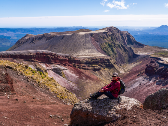
Maude Peak and Henry Peak sit prominently along the ridge ahead as the track leads you toward the tarns.
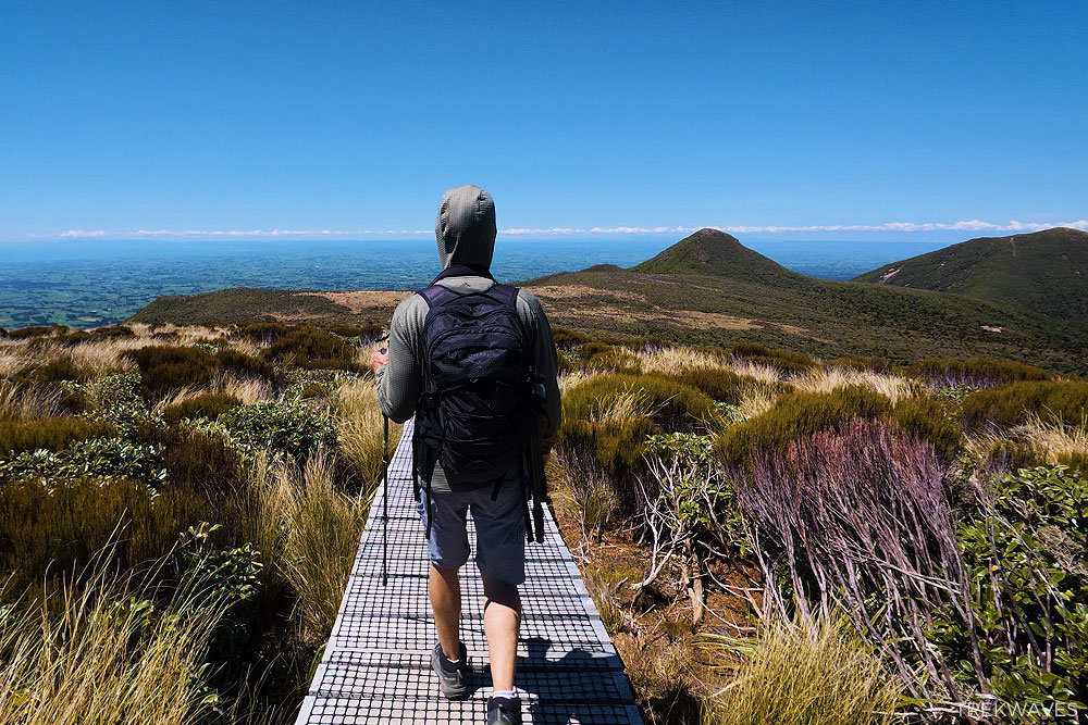
After another short stretch, the tarns finally appear beside the boardwalk.
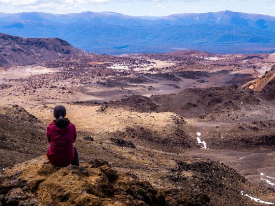
This is what most hikers come for. When conditions are calm, the small alpine pools transform into perfect mirrors, reflecting the symmetrical cone of Mount Taranaki with remarkable clarity.
When we arrived the wind was still lightly moving across the water, so the reflection wasn’t perfectly glassy — but it was calm enough to capture some really nice photos and appreciate the scene.
Doing this as a day hike was great, but looking at how nice the new hut is, staying overnight could be an even better option — especially if you want the best chance of catching those famous reflections at sunrise.
The Return
The descent follows the same route back down the Mangorei Track. While we didn’t particularly enjoy the endless boardwalk on the way up, it definitely has its advantages on the way down. The structured steps and platforms make for a fast and straightforward descent compared to many steep forest trails.
That said, I can easily imagine this section becoming quite slippery after rain. The timber steps and leaf-covered boardwalk could turn the descent into a careful shuffle rather than a quick cruise.
Allow around 1.5–2 hours to return to the Mangorei Road car park at a comfortable pace. Most of the hard work is already behind you, so it’s mostly a matter of letting gravity do the rest.
Frequently Asked Questions – Pouakai Tarns Walk
Most hikers take 4–6 hours return, depending on pace and how long you spend at the tarns and Pouakai Hut. The climb to the hut typically takes about 2 hours, with another short walk to the tarns beyond it.
The hike is generally considered moderate. The trail is technically straightforward and well-maintained, but the steady climb of roughly 700–800 metres of elevation makes it physically demanding.
Yes — most visitors complete the hike as a half-day or full-day walk from the Mangorei Road car park. However, many hikers now choose to stay overnight at Pouakai Hut to increase their chances of catching calm conditions for the famous reflection.
You’ll need clear skies and very little wind. Early morning or sunset usually offers the calmest conditions, which is why staying overnight at the hut can dramatically increase your chances of seeing the reflection perfectly.
Yes. The Mangorei Track is very well maintained and clearly marked, with boardwalks and steps covering much of the route. Navigation is straightforward, and it’s difficult to get lost.
The trail begins at the Mangorei Road car park, located about 20 minutes from New Plymouth on New Zealand’s North Island.
No. Swimming in the tarns is strongly discouraged. The small alpine pools are part of a fragile wetland ecosystem, and entering the water can damage the delicate environment. Visitors should remain on the boardwalk and enjoy the view from the designated viewing areas.
The trail begins at the Mangorei Road car park, located about 20 minutes from New Plymouth on New Zealand’s North Island.
The hike can be done year-round, but late spring through autumn (October–April) usually offers the most stable weather conditions. Winter can bring snow, ice, and rapidly changing weather around Mount Taranaki, which may make the trail more challenging.
Found it Helpful? Pin it for Later!