At 2:00am on June 10, 1886, Mt Tarawera violently split open. Within hours, a chain of eruptions ripped across the mountain along a 17-kilometre rift, destroying villages, killing more than 150 people, and wiping out one of the natural wonders of the world (Pink and White Terraces).
Today, you can walk directly along that volcanic scar — but only on a guided hike.
Before arriving in Rotorua, we already knew this was something we absolutely wanted to do. Even though the experience comes with a price tag, the chance to walk across the crater of one of New Zealand’s most dramatic eruptions quickly became the most exciting item on our Rotorua itinerary.
But to really understand why this hike feels so different from anywhere else in New Zealand, you first need to understand what happened here that night.
What is Mt Tarawera?
Mt Tarawera is a prominent volcanic ridge located about 20 kilometres southeast of Rotorua, in the Bay of Plenty region of New Zealand’s North Island.
Rising above the shores of Lake Tarawera, the mountain is part of the Okataina Volcanic Centre, one of the most volcanically active zones in New Zealand’s Taupo Volcanic Zone.
Unlike the classic cone-shaped volcano many people imagine, Tarawera is actually a long volcanic ridge formed by repeated eruptions over thousands of years.
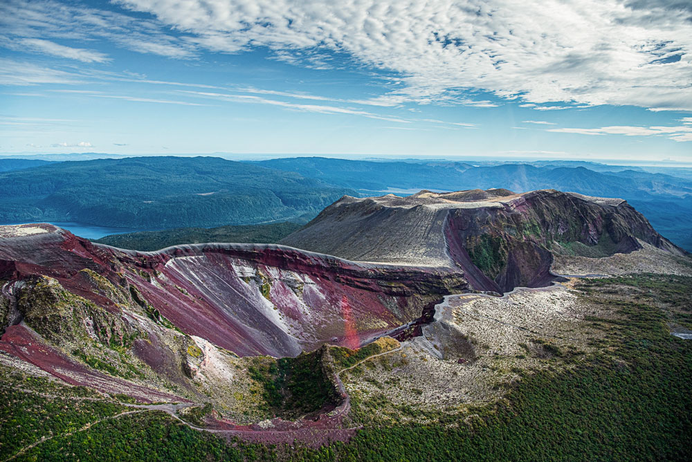
Today, its landscape is strikingly raw — with loose volcanic rock, deep red slopes, and a massive rift cutting across the summit. Much of this dramatic terrain is the direct result of the catastrophic 1886 eruption, which violently reshaped the mountain and the surrounding region.
For Ngāti Rangitihi, the iwi with ancestral ties to this land, Tarawera is a sacred mountain — a place of deep spiritual significance that long predates the tourism that now surrounds it.
Mt Tarawera Eruption of 1886: What Happened?
In the early hours of 10 June 1886, one of the most dramatic volcanic events in New Zealand’s recorded history began. At around 2:00am, a series of powerful explosions ripped open Mt Tarawera, marking the start of what is now known as the Mt Tarawera eruption.
Instead of erupting from a single crater, the volcano fractured along a massive 17-kilometre fissure, with multiple vents erupting almost simultaneously. Columns of ash and debris shot high into the sky while volcanic material rained down across the surrounding region. Entire landscapes were transformed within just a few hours.
One of the hardest-hit places was the nearby settlement of Te Wairoa, where homes and buildings were buried under metres of ash and mud. More than 150 people lost their lives, making it the deadliest volcanic disaster in New Zealand since European settlement.
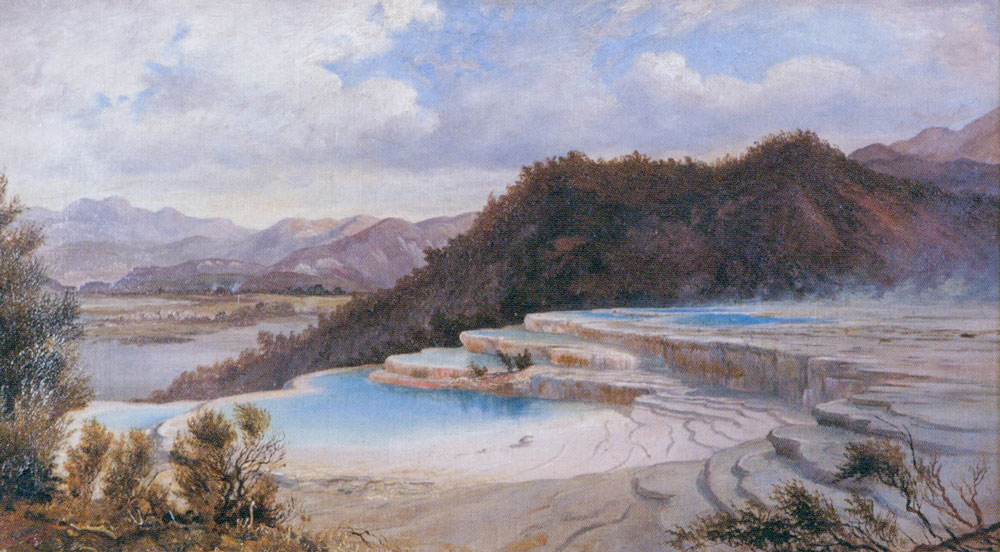
The eruption also destroyed one of the country’s most famous natural attractions — the spectacular Pink and White Terraces. These beautiful silica terraces once lined the shores of Lake Rotomahana and were often described as the “Eighth Wonder of the World.”
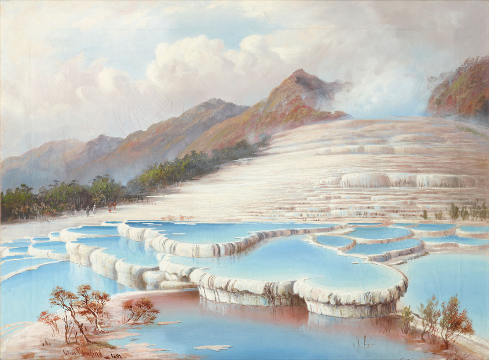
The eruption dramatically reshaped the region. Lake Rotomahana expanded and deepened, new craters formed, and the summit of Mt Tarawera was permanently split open.
Today, the massive volcanic rift formed during that eruption is still clearly visible — and it’s exactly the landscape hikers walk along on the Mt Tarawera guided hike.
Mt Tarawera Guided Hike — Getting to the Trailhead
When confirming our tour with Kaitiaki Adventures, we were told to meet the group in front of the Te Puia entrance in Rotorua. There’s a large free car park right outside, so leaving the car there for half the day wasn’t an issue.
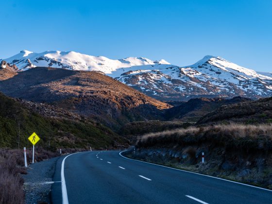
Our guide picked the group up right on time and we hopped into a Toyota Hiace van before setting off toward Mt Tarawera. The drive to the trailhead takes around 30 minutes, gradually leaving the city behind as the landscape transitions to farmland and forest.
Toward the end, the road becomes a narrow and bumpy forest track. At that point I assumed we would switch into a 4WD vehicle, but instead the van kept going along the private access road all the way toward the mountain.
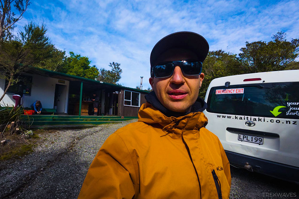
Eventually we arrived at a small hut used by members of the local iwi — a place where they stay when visiting the mountain for hunting, gathering, and other traditional activities.
This is also the last toilet stop before the hike, and there’s a small gear station where anyone can borrow equipment such as gaiters, hiking poles, or even hiking boots if they didn’t bring suitable footwear.
Mt Tarawera Trail Overview
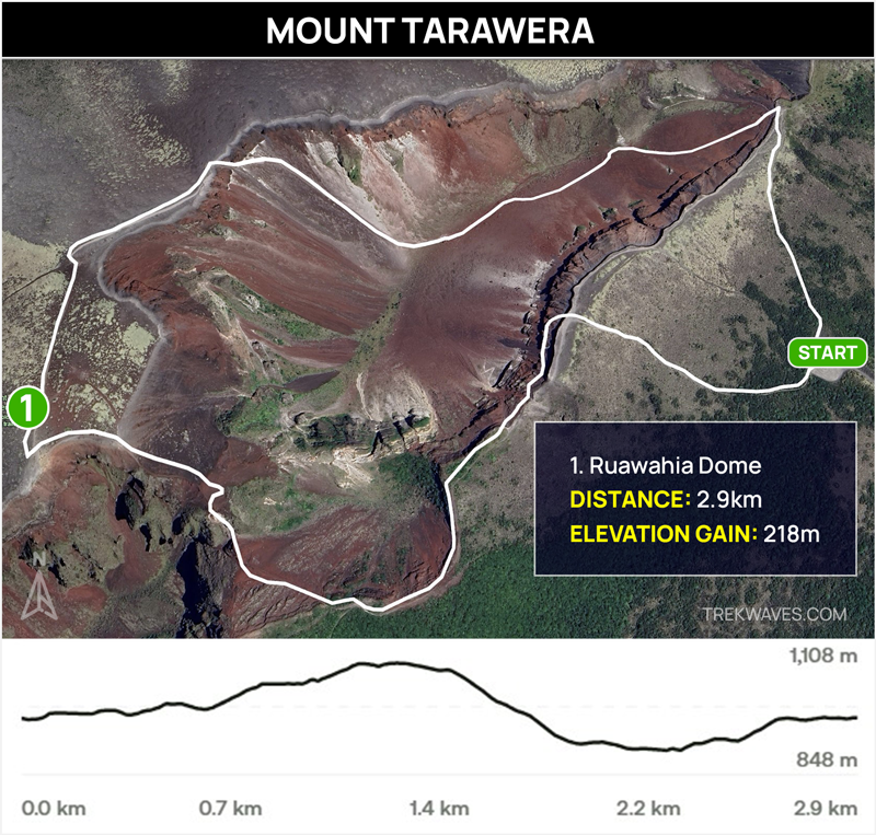
The Mt Tarawera guided hike follows a unique route across the volcano’s fractured summit before descending into the vast crater basin below.
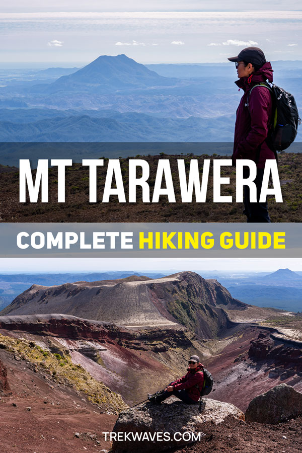
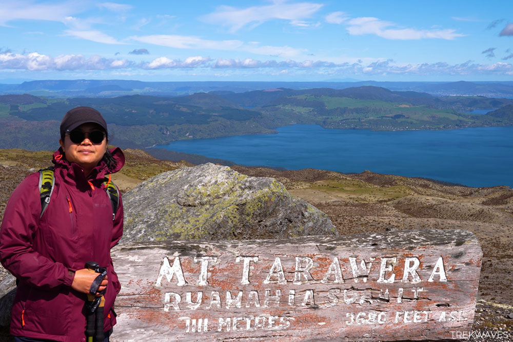
Starting high on the mountain, the trail first heads toward Ruawahia Summit (1,111 m), before continuing along the crater ridge and eventually dropping down a steep scree slope into the heart of the crater, where the walk loops back toward the starting point.
Trail Stats:
- Location: Mt Tarawera, Bay of Plenty, ~20 km southeast of Rotorua
- Highest Point: Ruawahia Summit – 1,111 m
- Distance: ~3 km loop
- Duration: ~2–3 hours
- Elevation Gain: ~220 m
- Difficulty: Moderate
- Best Time to Visit: Year-round (clear weather offers the best views)
1. Climbing Toward Ruawahia Summit
The hike begins with a gradual ascent across the upper slopes of Mt Tarawera, heading toward Ruawahia Summit (1,111 m), the highest point on the mountain.
Before we even set off, our guide gave the group some fascinating background about the Tarawera Range and the cultural significance of the surrounding peaks.
One of the most important places in the range is Wahanga (1,025 m), which lies further along the ridge. Wahanga holds deep cultural importance for local Māori.
Along the back of the mountain are caves that were used as resting places for the bones of esteemed ancestors. Despite the powerful events that altered the region, these sacred sites remained undisturbed.
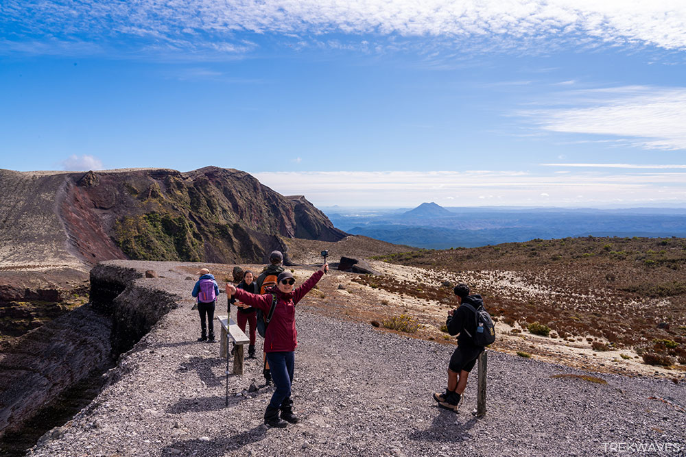
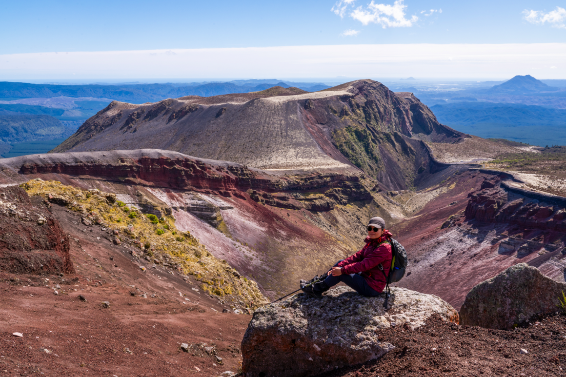
The first part of the trail is very scenic and steadily climbs uphill along the crater ridge. Along the way we stopped at several points where the views opened up dramatically — easily some of the best photo spots of the entire hike.
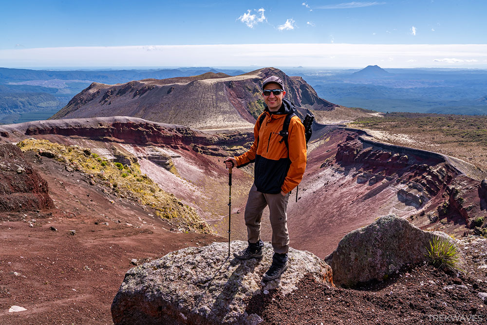
As we gained elevation, the terrain became more exposed to wind and the path turned into a patchwork of loose red volcanic rock.
The colour comes from iron-rich basalt and scoria, which have oxidised over time to create the deep red slopes that define Mt Tarawera’s landscape.
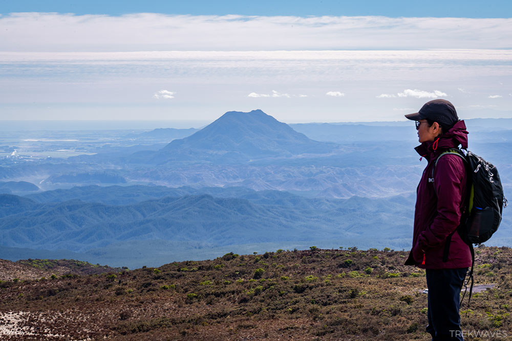
Eventually we reached the summit of Ruawahia, where we took a short 10–15 minute break for photos and a quick snack. From the top, the views stretch across the surrounding volcanic plateau.
Below you can see the deep blue waters of Lake Tarawera, while to the south the darker waters of Lake Rotomahana sit within the wide crater basin. Standing there, it’s easy to appreciate just how vast the volcanic landscape around Rotorua really is.

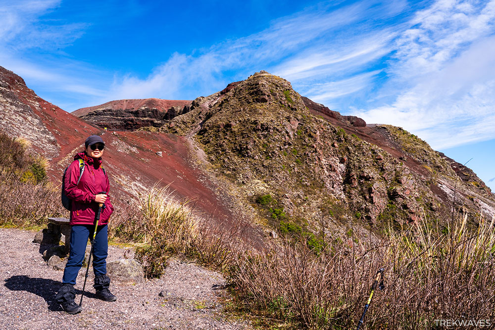
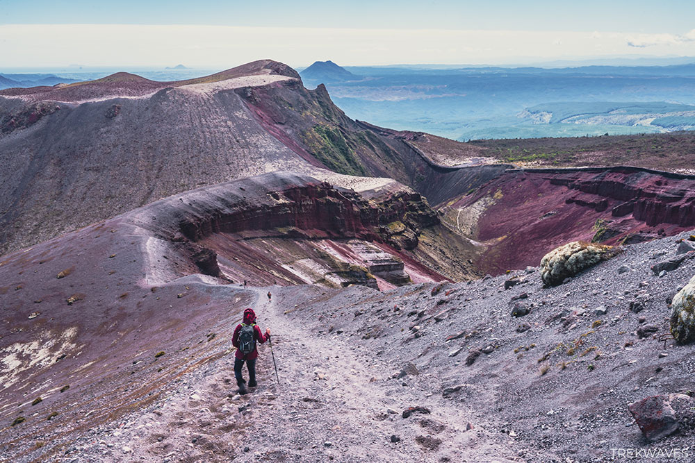
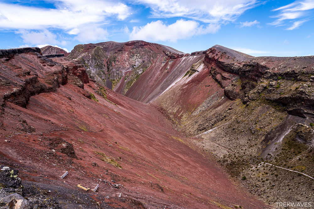
2. Descending the Crater Rim
From Ruawahia, the second part of the hike heads downhill along the opposite side of the crater. The trail here follows a narrow ridge and the terrain becomes noticeably looser underfoot, with sections of slippery volcanic scree.
About halfway down we reached a spot marked with a “Sacred Tapu Maori Land” sign — a reminder that parts of the mountain remain culturally protected.
Just beyond this point comes one of the most memorable sections of the entire hike: the steep descent into the crater.
Rather than carefully stepping down the slope, our guide suggested leaning back slightly and running down the loose scree, allowing the volcanic gravel to carry us downward almost like sliding on sand.
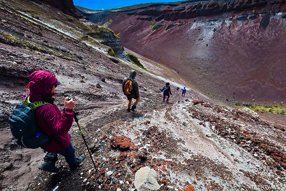
It quickly became one of the most memorable parts of the hike, and our guide even captured the moment on video as we descended into the crater basin.
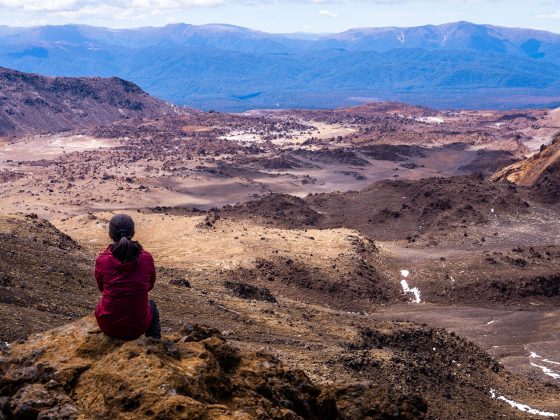
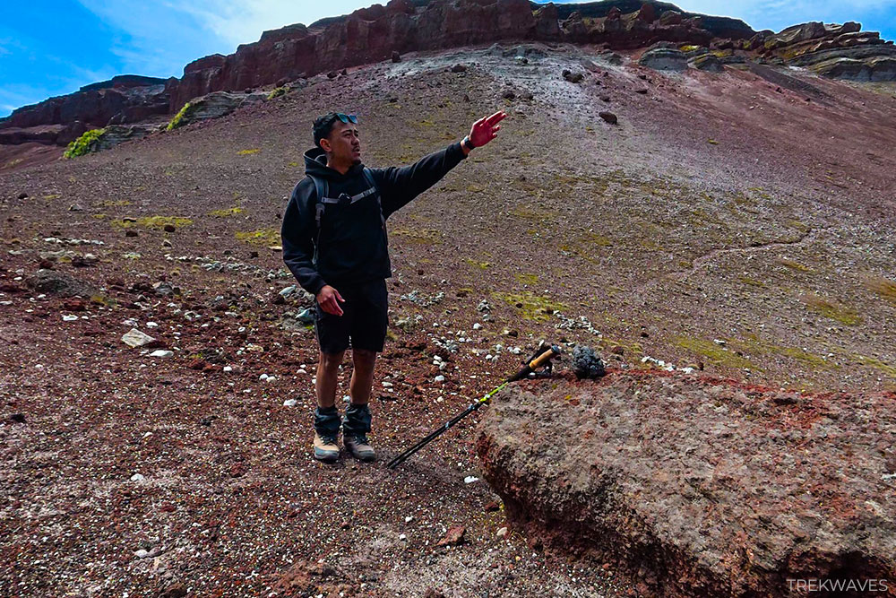
3. Walking Through the Crater Basin
Once inside the crater, the landscape changes again. The terrain opens into a wide volcanic basin surrounded by steep crater walls, giving you a sense of the immense forces that shaped the mountain.
This section of the hike also comes with a short geology lesson from the guide, explaining some of the different volcanic rocks scattered across the crater floor.
Among them are “cauliflower bombs” — rounded chunks of lava that cooled quickly after being ejected during an eruption — as well as rhyolite, a silica-rich volcanic rock that forms much of the Tarawera range. Many of the rocks here are incredibly light and porous, formed by gas bubbles trapped in molten lava as it cooled.
After crossing the crater floor, the final part of the hike involves a short but steady climb out of the basin, eventually returning to the starting point where the vehicle picks up the group for the drive back to Rotorua.
Is the Mt Tarawera Guided Hike Worth It?
Even though the Mt Tarawera hike requires joining a guided tour, it’s one of the most unique walking experiences in New Zealand.
Few places allow you to walk across the crater of a volcano, descend down loose volcanic scree into a vast crater basin, and learn about the eruption that reshaped the entire region — all within a relatively short hike.
The guided aspect adds a lot to the experience. Hearing stories about the eruption, Māori history, and the mountain’s geology helps bring the landscape to life in a way that would be difficult to appreciate on your own.
If you’re planning a North Island adventure, this hike is easily one of the most memorable experiences in the region — and a great addition to a wider itinerary exploring the best hikes in North New Zealand.
Mt Tarawera Guided Hike — Practical Info
If you’re planning the Mt Tarawera guided hike, here are the key details to know before booking. The experience is operated exclusively by Kaitiaki Adventures, who manage access to the mountain in partnership with local iwi.
The half-day tour includes transport to the upper slopes of the volcano and a guided walk across the crater ridge before descending into the crater basin.
Tour Operator:
Kaitiaki Adventures – official operator of the Mt Tarawera crater walk
Booking: kaitiaki.co.nz
Duration:
Approximately 4.5 hours including transport and hiking time
Distance:
Around 3–4 km
Elevation Gain:
Approximately 220 metres
Highest Point:
Ruawahia Summit – 1,111 m
Difficulty Level:
Easy to moderate. The hike is relatively short, but sections involve loose volcanic scree and exposed terrain.
Cost:
Typically around NZD $170-200 per person
Departure Point:
Meeting location outside Te Puia, Rotorua
What’s Included:
- Guided volcano hike
- Transport to the mountain
- Safety briefing and geological interpretation
- Optional gear (gaiters, walking poles, boots if needed)
Best Time of Year:
The hike operates year-round, but clear weather provides the best views across the surrounding lakes and volcanic landscape.
What to Bring:
- Above-ankle hiking boots
- Comfortable outdoor clothing
- Windproof jacket
- Water and snacks
- Sunglasses and sunscreen
- Hiking poles*
- Gaiters*
*Hiking poles and gaiters will be provided by the tour guide if you don’t have your own
Frequently Asked Questions
The Mt Tarawera guided hike is generally considered easy to moderate. The distance is relatively short (around 3-4 km), but sections of the trail involve loose volcanic scree and exposed terrain, which can feel slightly challenging for some hikers.
The full experience usually lasts around 4.5 hours, including transport to the mountain, the hike itself, and short breaks along the way.
No — independent hiking on Mt Tarawera is not permitted. The mountain sits on privately managed land with cultural significance, so access is only allowed through guided tours operated by Kaitiaki Adventures.
Yes, the hike can be suitable for older children (+7 years old) with reasonable fitness. The terrain includes loose volcanic gravel and steep scree sections, so younger kids may find parts of the descent challenging.
Wear above-ankle hiking boots to help prevent loose volcanic rocks from getting into your shoes, along with comfortable outdoor clothing and a windproof jacket, as the crater ridge can be quite exposed. Sunglasses and sunscreen are also recommended due to the open volcanic terrain.
The Mt Tarawera guided crater hike typically costs around NZD $170-200 per person for the half-day experience, which includes transport to the mountain, a professional guide, and safety gear if needed.
Yes. Because access to the mountain is restricted and tours operate with limited group sizes, booking in advance is recommended, especially during the busy summer travel season.
No technical hiking experience is required. The hike is relatively short, but the loose volcanic gravel and exposed terrain mean a moderate level of fitness and comfortable walking ability are helpful.
Yes. The hike is considered safe when completed with a licensed guide. Guides provide safety briefings, help navigate the loose volcanic scree, and share important information about the terrain.
Found it Helpful? Pin it for Later!