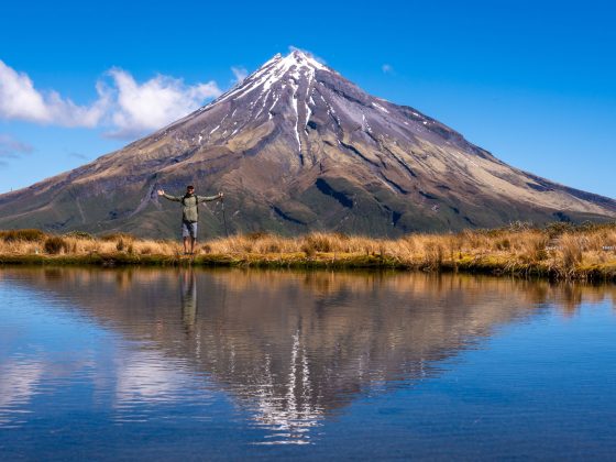
Mount Banks is a hidden gem in the Blue Mountains, often overlooked by many despite offering the most expansive views and lookout points in the Greater Blue Mountains area.
Here, you will find 12 kilometers of picturesque trails winding through the heart of Grose Wilderness.
While the majority of the trails in this area are generally easy to follow, Mount Banks summit walk adds a fun and adventurous element to your day spent here.
Let me introduce you to this lesser-explored but stunning part of the Blue Mountains and explain why it’s worth the journey to reach the final lookout at the Banks Walls.
How To Get To Mount Banks
To reach the starting point of Mount Banks’ walking trails, input Mount Banks Summit Walk into your GPS and follow the B59 Bells Line of Rd until you reach Mount Banks Rd.
Although Mount Banks Road isn’t sealed, it’s well-maintained and should be fine for 2WD vehicles.
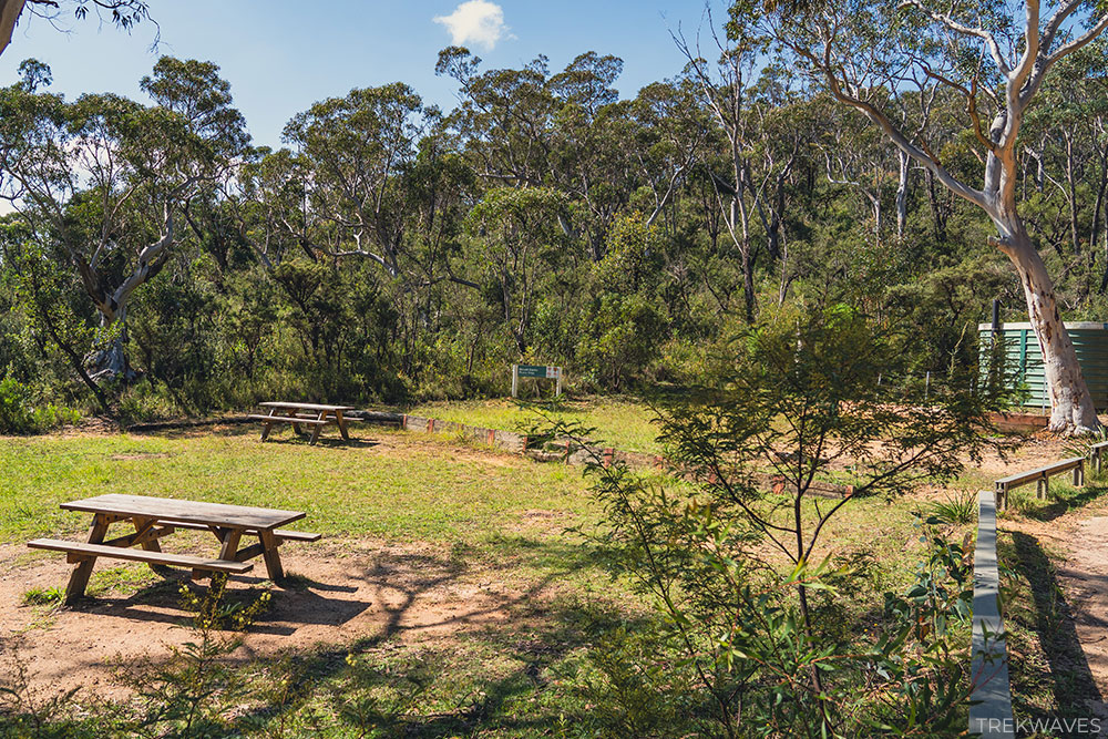
Drive 2 km along this road to reach the main parking area and a picnic spot.
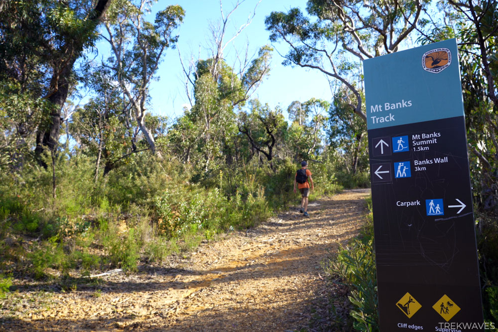
Mount Banks Parking & Picnic Area
Parking space at Mount Banks car park is limited, with roughly 10 spots available in the upper section and a few more near the bench area.
It might be a good idea to arrive early, especially on weekends. During my weekday visit, there was only one other car in the parking lot.
Mount Banks Trails
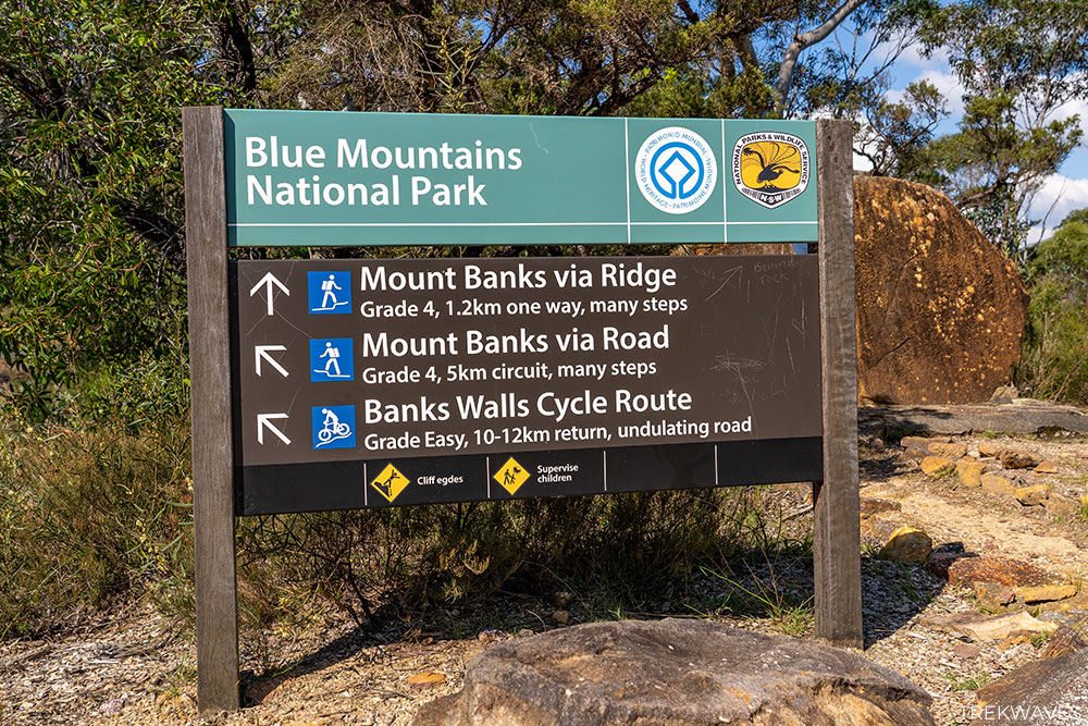
Once you’ve parked and checked the information board, you’ll see three trails listed here:
- Mount Banks Summit via Ridge (2.4km return, Grade 4)
- Mount Banks Summit via Road (5km circuit, Grade 4)
- Banks Walls Cycle Route (10-12km return, Grade Easy)
Although all three trails are excellent choices, my suggestion would be to merge them into one.
Start by heading towards Banks Walls, then loop back to the car park via the Mount Banks Summit Walk.
While the Banks Walls trail is labelled a ‘Cycle Route,’ it’s essentially a scenic fire trail offering beautiful views throughout.
I’ve hiked along plenty of uninspiring fire trails, but this one is different—it’s genuinely enjoyable, especially given the absence of steep climbs and descents.
So, if you’re up for a relatively easy 12.1km walk and wish to explore all 3 trails in one day, here’s the trail map to guide you:
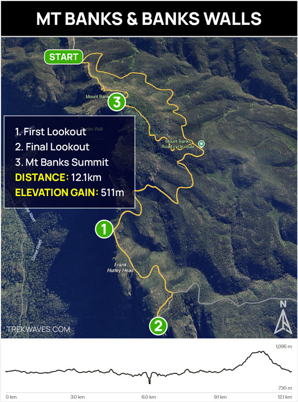
Mt Banks & Banks Walls Trail Overview:
- Distance: 12.1km return
- Time: Half day
- Elevation gain: 511m
- Grade: Moderate
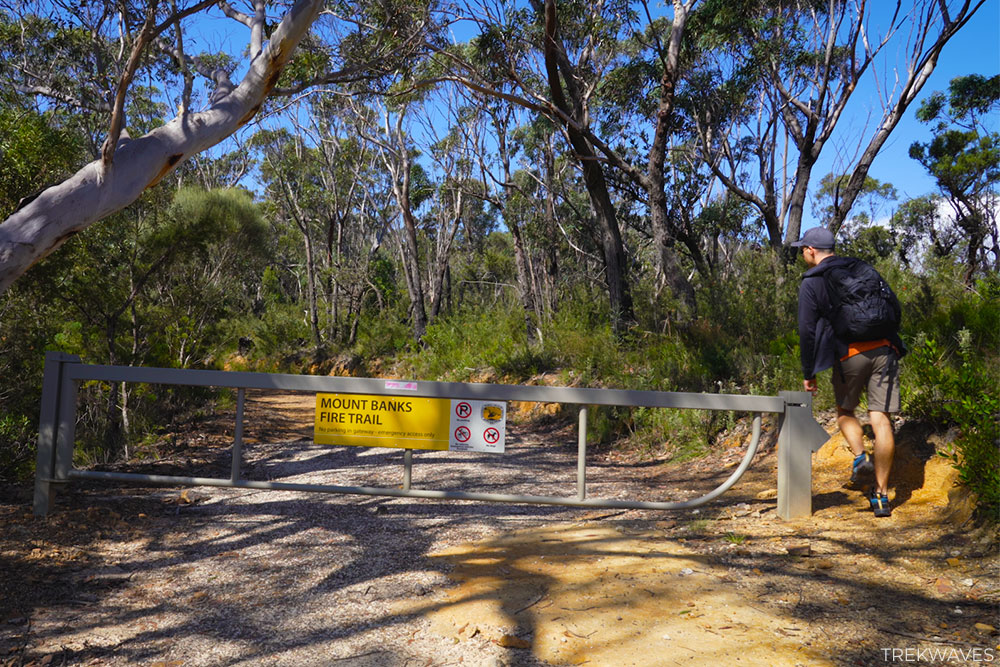
Fire Trail to Banks Walls
If your choice is to follow the Banks Walls Cycle Route as indicated on the maps above, you’ll start your hike by walking along the Mount Banks Fire Trail.
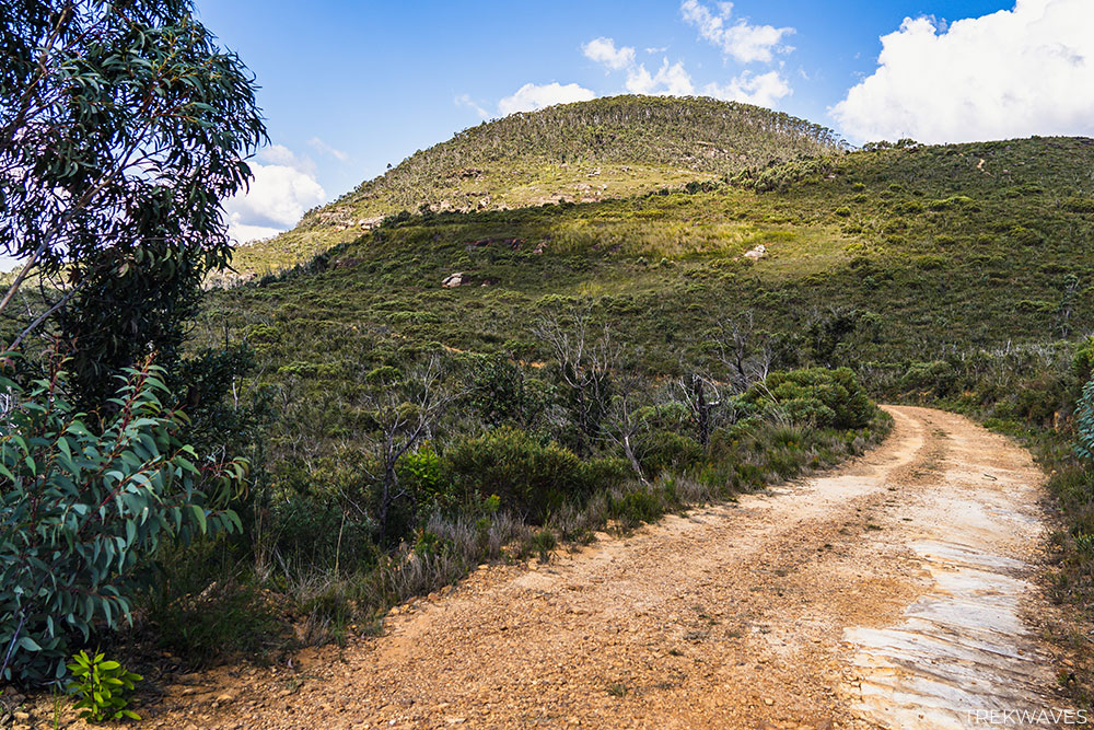
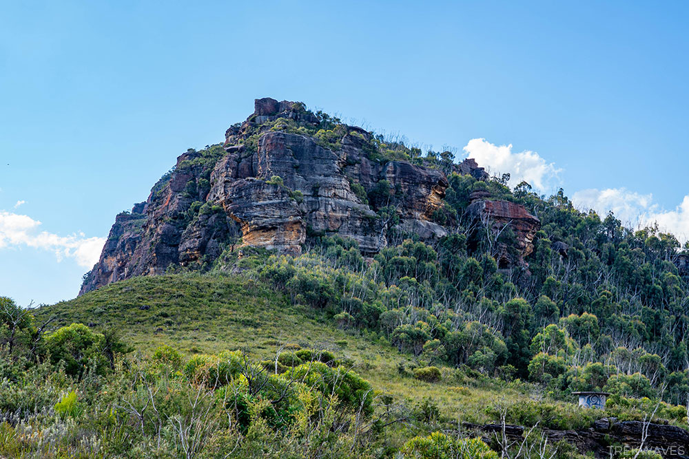
As you start your walk, you’ll be greeted by a lovely stretch of road with Mount Banks on your right.
The view remains unobstructed for much of the time, giving you plenty of chances to appreciate the mountain from different angles.
Soon enough, you’ll come upon the sign marking the beginning of Grose Wilderness.
You’ll be going through diverse plant environments, ranging from low heath dominated by sedges and dwarf casuarina, to stands of scribbly gums with their distinctive hard leaves, and towering eucalypts alongside lush rainforest ferns.
Following nearly 3 kilometers of walking, you’ll arrive at a junction.
From here, you’ll continue your trek towards Banks Walls, saving the ascent to the Mount Banks summit for the return journey.
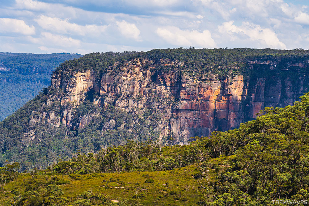
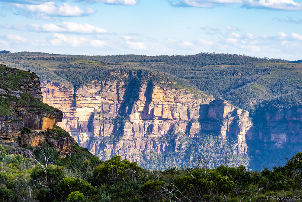
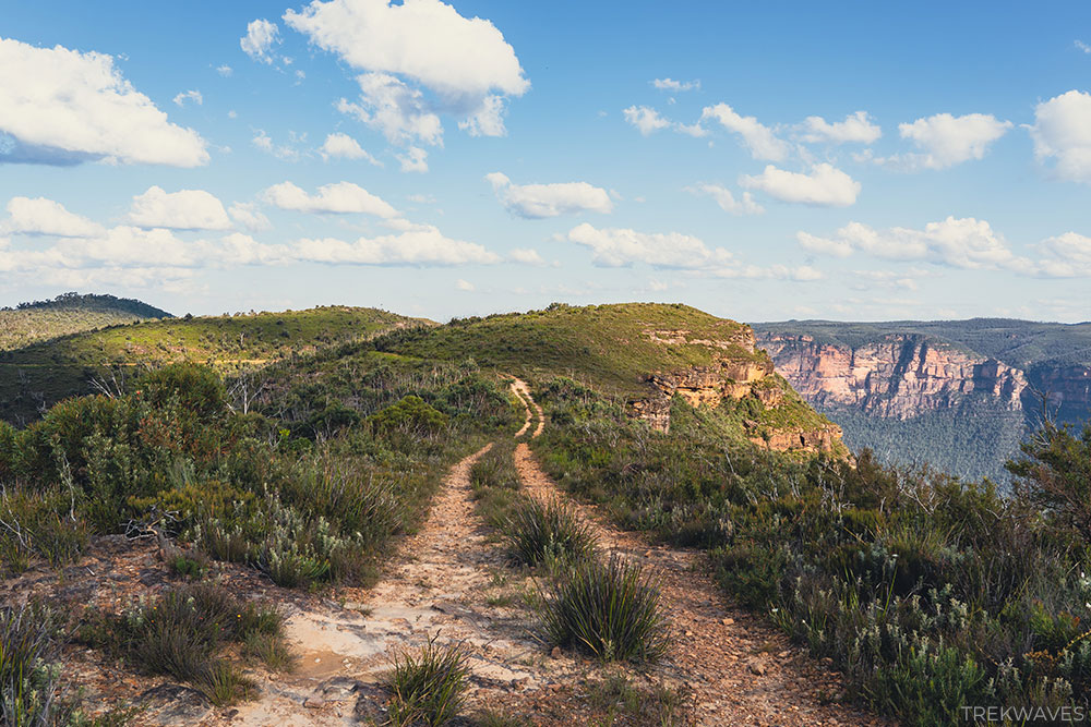
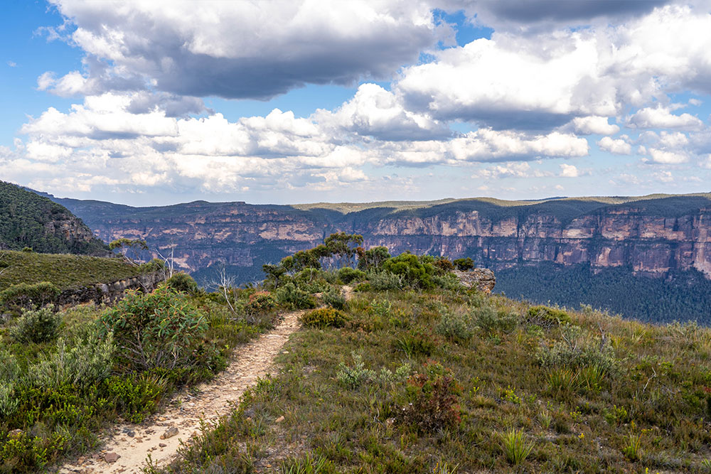
Beyond this point, the trail becomes increasingly scenic as you walk alongside towering sandstone cliffs to your right.

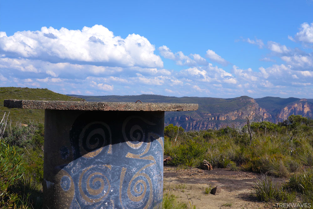
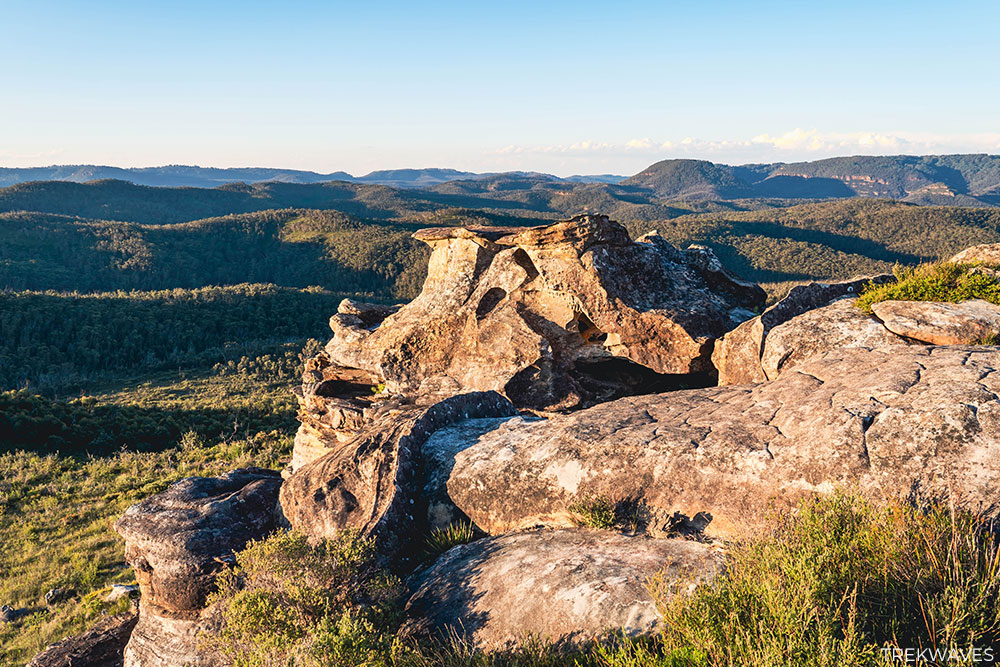
Banks Walls – First Lookout
As the trail starts to open up and the trees become less dense, you’ll arrive at a section where there’s a round concrete structure on your left (painted blue and decorated with golden brown spiral patterns).
This marks the spot not far from the first lookout point, where you can venture to the cliff’s edge and enjoy the panoramic 180-degree views stretching across the Grose Valley.
As you approach the cliff line, you’ll see several smaller rocks scattered along the edge, providing excellent opportunities to capture some unique photos.
Continuing ahead, the trail extends along the fire trail, and this part of the walk, approximately 1.5 km long, leading to the final lookout, stood out as my favourite.
Here, you’ll be surrounded by amazing 360-degree views, creating a feeling of true remoteness deep within the heart of the Blue Mountains.
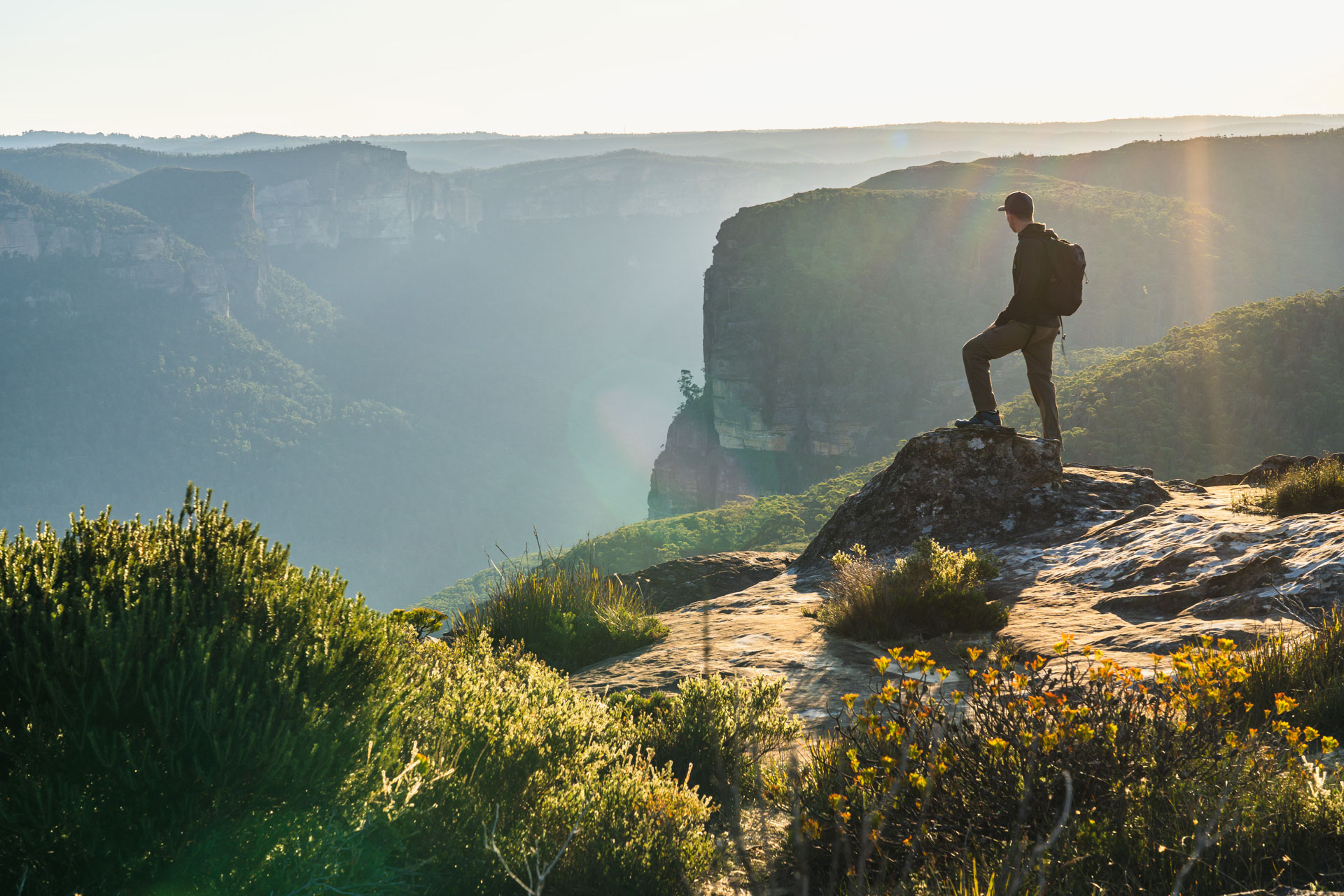
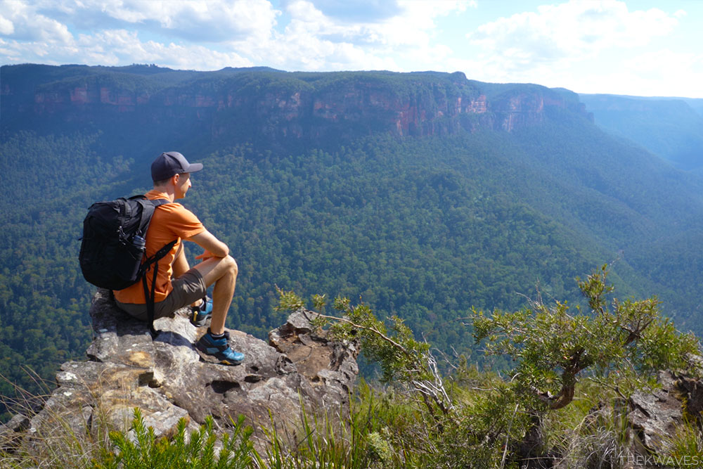
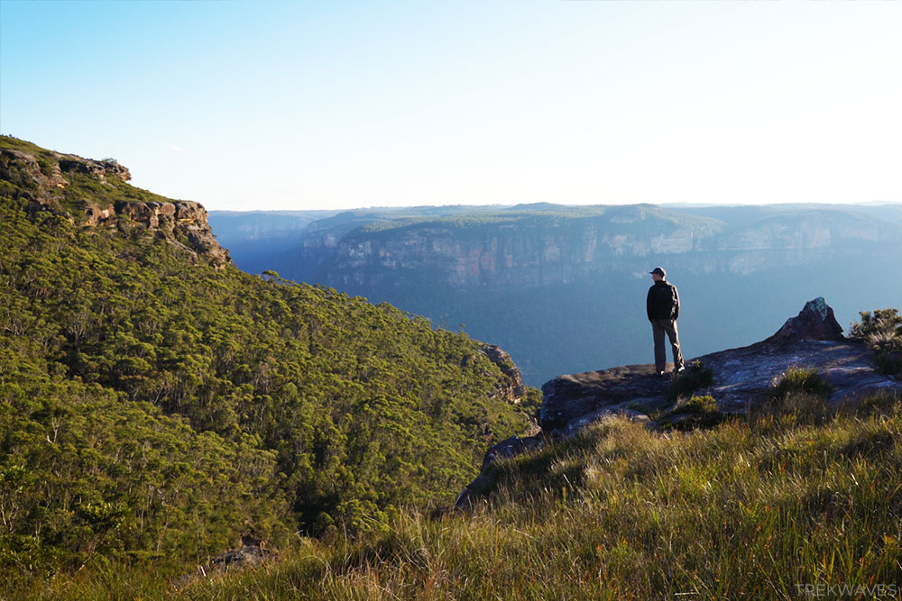
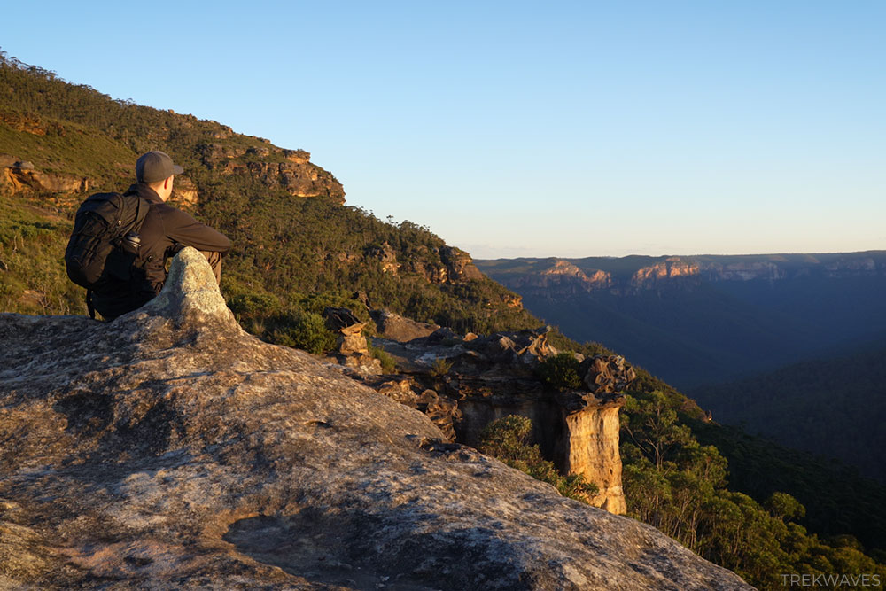
Banks Walls – Final Lookout
After another 15-20 minutes of wandering along this beautiful stretch of the trail, you’ll reach the point where the trail comes to an end, guiding you to the most spectacular lookout spot of the entire hike.
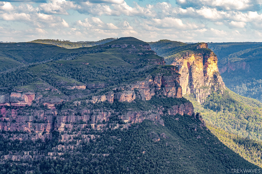
On your right, you’ll catch sight of Perrys Lookdown, with Acacia Campground lying beneath it amidst the heart of Blue Gum Forest.
Directly ahead lies Du Faur Head with Lockley Pylon, while to your left you will see Butterbox Point, with the Mount Hay looming in the distance.
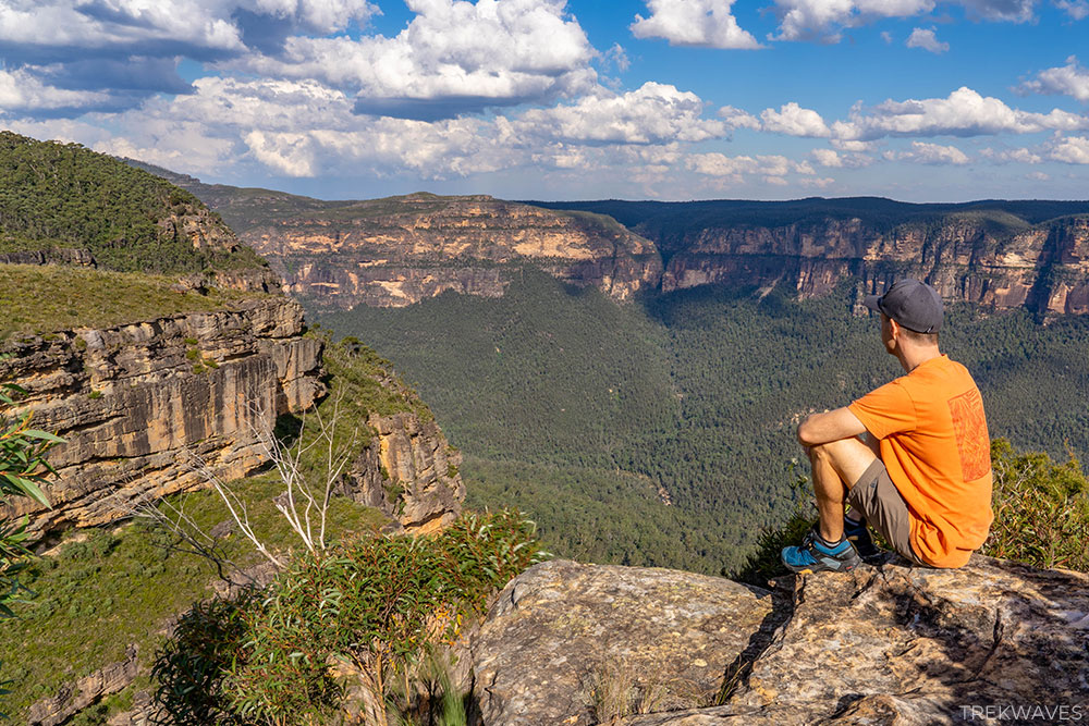
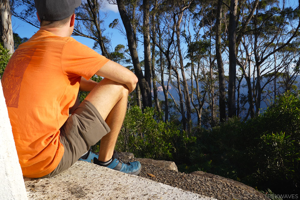
Since you’re now halfway through your trek, it’s an ideal moment to rest, have a snack, and relish the awe-inspiring views stretching before you.
Mount Banks Summit Walk
Once you’ve taken in the views from the Banks Walls, it’s time to tackle the last challenge of the trail: climbing to the top of Mount Banks.
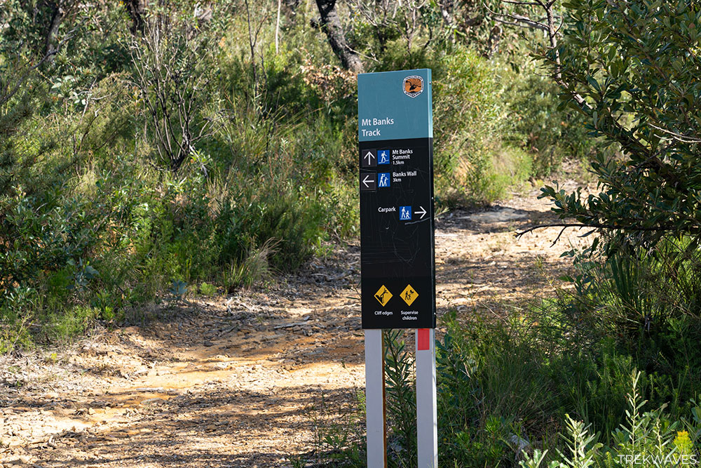
Walk back along the fire trail until you reach the junction with the Mount Banks Summit sign and turn left.
Prepare for a short yet steep climb spanning 1.5 kilometers, with an ascent of approximately 175 meters.
There’s nothing too challenging about it; the trail starts wide, resembling a fire trail for the first half of the climb, before transitioning into a narrower, slightly overgrown path.
Soon enough, you’ll come across the sign marking the summit of Mount Banks at 1062 meters.
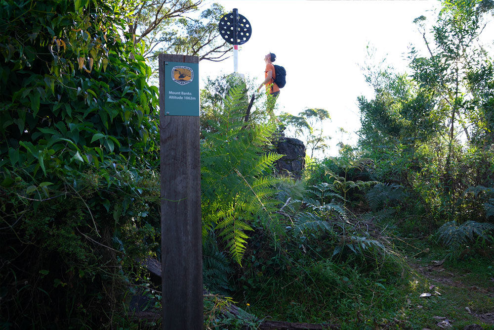
The summit’s views are obscured by trees, but if you continue a bit beyond the trig point and take a left onto a short side trail, you’ll come to a clearing after a couple of minutes.
However, considering you’ve already enjoyed much better views along the Banks Walls trail, you might prefer to simply rest and relax at the summit.
Mount Banks Summit Return
It’s time to complete the loop and head back to the car park. The trail on the descent is a bit more overgrown compared to the one you ascended earlier.
The scenery on the descent is spectacular, and I must say, it’s even more magical during the golden hour.
I purposefully designed this route to wrap up in the late evening, offering the chance to witness the sunset views in the area surrounding the base of Mount Banks.

Within easy reach of the car park, this entire area offers you the chance to get up really close to the cliff edge
If you’re short on time during your visit, don’t miss the chance to visit this spot and take in its dramatic views.
All in all, I found this entire 12.1km walk to be incredibly enjoyable, and for me, the Banks Walls Lookouts were definitely the highlight of the trail, closely followed by the stunning sunset experience at the base of Mount Banks.
Although the views from Mount Banks summit may not be spectacular, but reaching it is worth it just to say, “Hey, I’ve been there!” when you’re driving along the Bells Line of Road.
Found it Helpful? Pin it For Later!

Frequently Asked Questions (FAQs):
How long does the trail take?
- A half-day for the 12.4km circuit should be more than enough
What about signage and trail quality?
- There are plenty of signs and it is relatively easy to navigate it (except overgrown sections of the Mount Banks Summit trail)
How difficult are the trails?
- Easy on the fire trails and moderate on the way up to the Mount Banks summit
What essentials should I carry?
- Bring along water, sunscreen, a hat and snacks
Is the trail wheelchair accessible?
- No
When is the best time to visit?
- I would suggest to start early in the morning or late in the afternoon in the summer months
Is there phone service?
- Limited
Can I bring my dog?
- Pets and domestic animals (other than certified assistance animals) are not permitted


2 comments
Unbelievable amount of information, makes it easy to make my decisions regarding my next hike. Extremely grateful.
Thank you Peter, really happy that you found it helpful and enjoy your next hike!