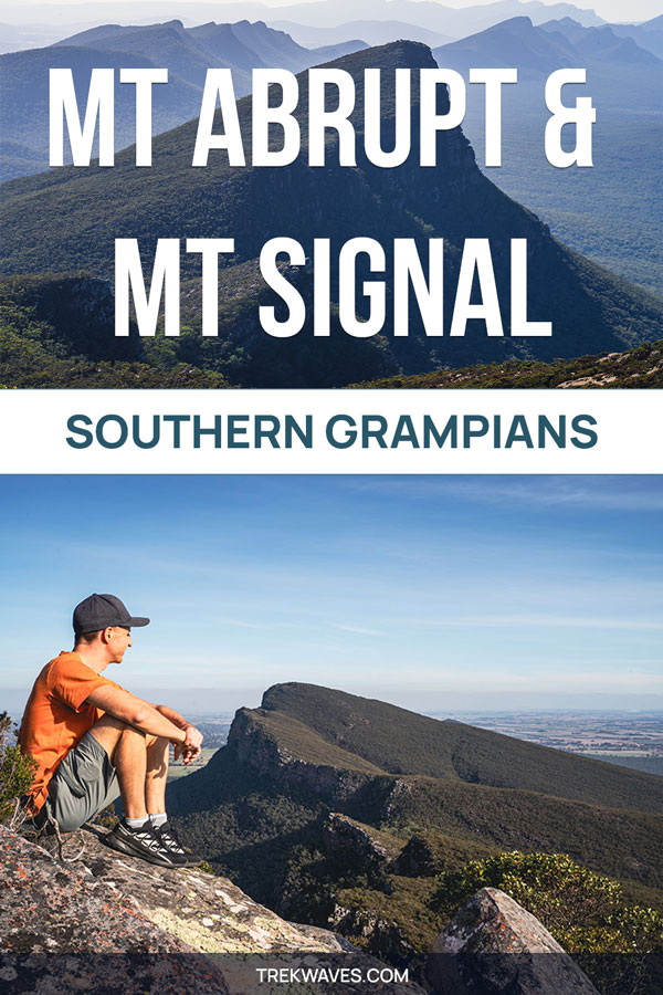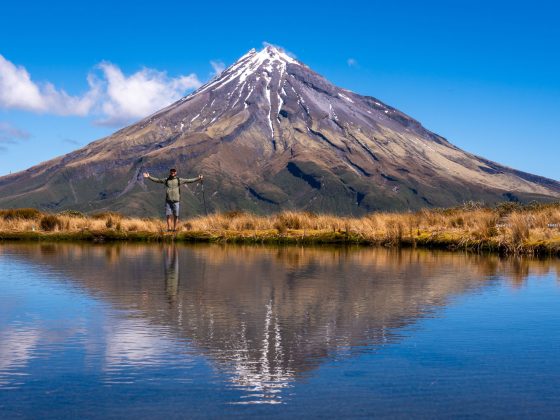
When I first started planning my trip to Grampians National Park, it was the stunning photos of Mount Abrupt’s summit that immediately caught my attention.
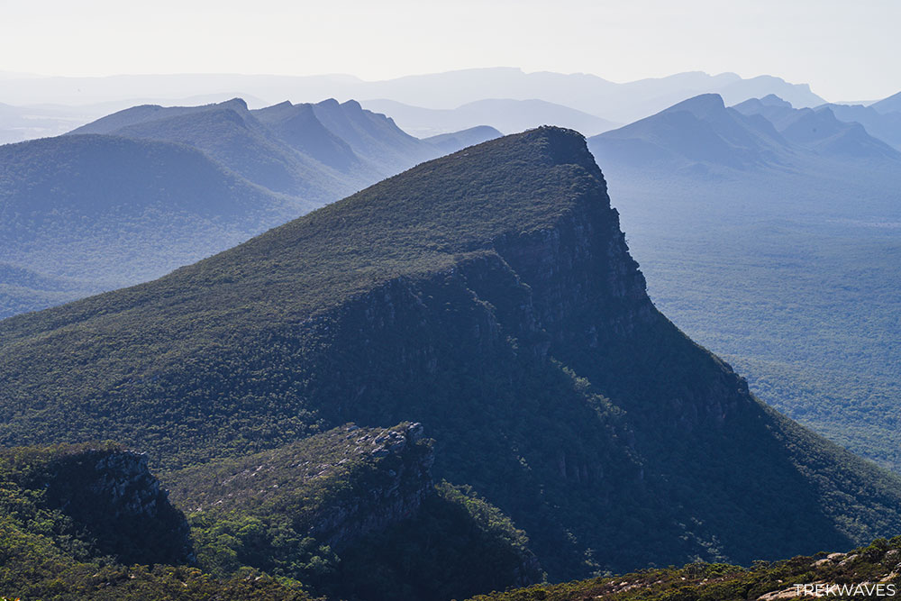
The jagged, saw-toothed peaks reminded me of the iconic Seceda range in the Dolomites, and I knew right away that I had to visit this part of the park.
While Mt Abrupt’s 827m and Mt Signal’s 780m heights can’t rival the soaring +2,500m of Seceda, the rugged beauty of these hikes made them a highlight of my trip.
This hike became one of the most memorable parts of my Grampians trip, and I’m excited to share why it’s one of the park’s must-do treks.
How To Get To Mt Abrupt & Mt Signal Trailhead
The car park for the trailhead is located approximately 7.7km north of Dunkeld along the Grampians Road. It’s well-marked and easy to find, with ample parking space.
If you’re driving from Halls Gap, the main hub of Grampians National Park, it’s a scenic 45-minute drive (53 km) south via Grampians Road.
Though the car park isn’t marked on Google Maps, this Google pin will help you set up your GPS correctly.
For those traveling from Melbourne, the drive is around 3h 15m (284 km) via the National Highway (M8) and through northern parts of Ballarat before reaching Dunkeld.
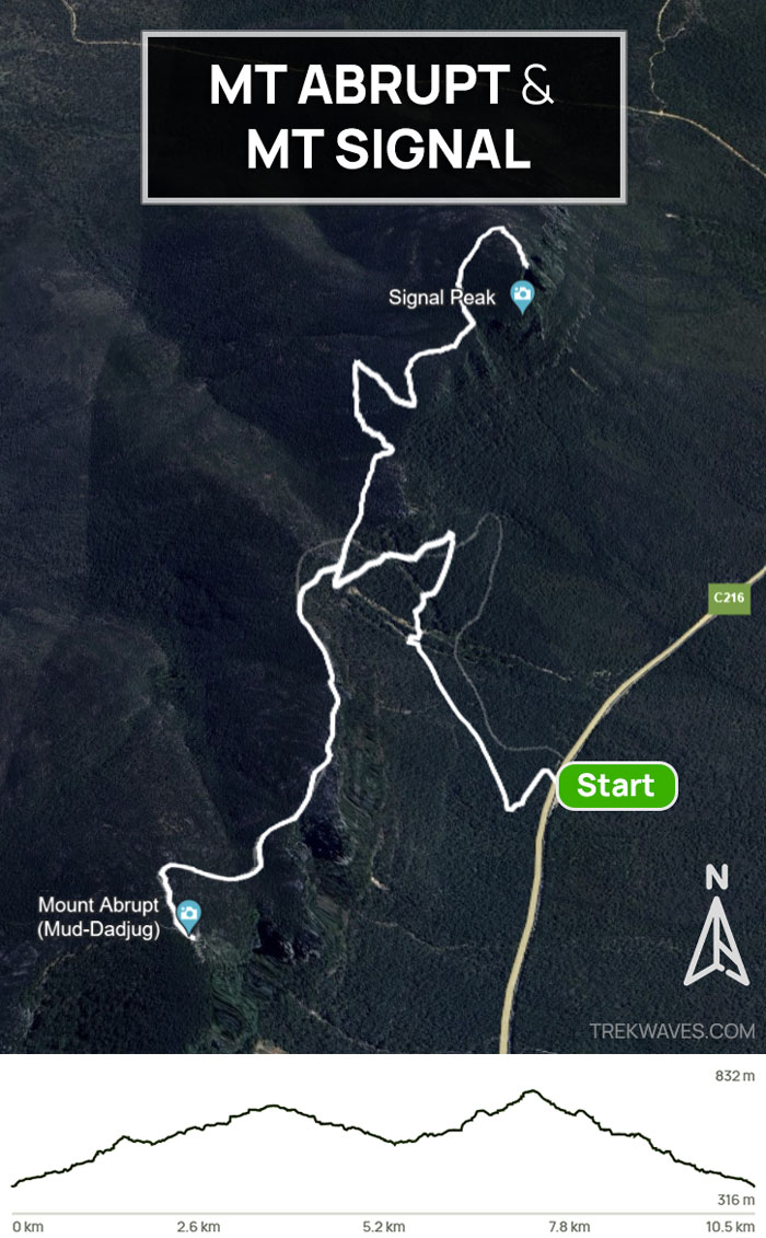
The hikes to Mount Abrupt and Mount Signal begin at the same trailhead.
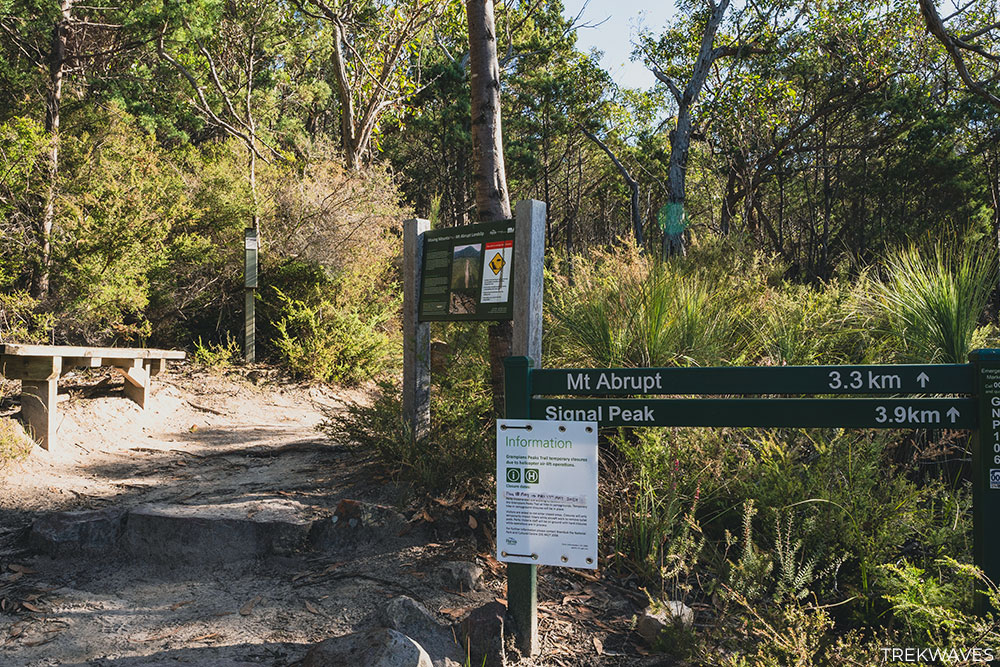
After a 1.6 km climb from the car park, you’ll reach a junction where you can either go left to Mount Abrupt or right to Mount Signal.
Mt Abrupt & Mt Signal Trail Overview
There are several ways to approach these hikes. Some people opt to hike Mount Abrupt alone, enjoying the steep climb and panoramic summit.
Others prefer the lesser-known Mount Signal, which offers a quieter, more tranquil experience.
However, if you’re up for a longer day, I highly recommend combining both hikes.
After conquering one summit, the hardest climb is behind you, making it the perfect chance to explore the second peak.
By summiting both peaks, you get a truly comprehensive perspective of the park’s unique topography, making it well worth the extra effort.
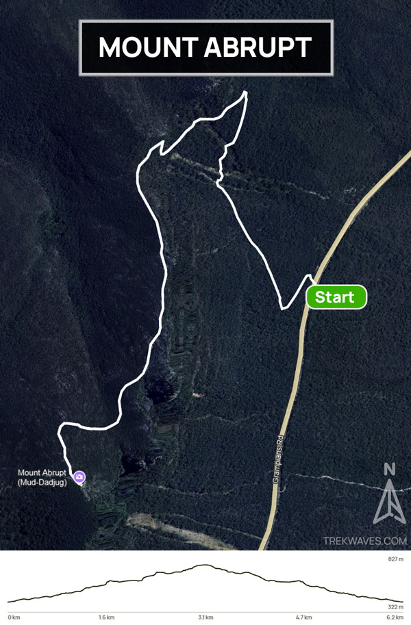
1. Mount Abrupt Hike: Trail Details
- Distance: 6.3 km return
- Elevation Gain: 457m
- Duration: 2.5-3 hours
- Difficulty: Moderate (steep sections)
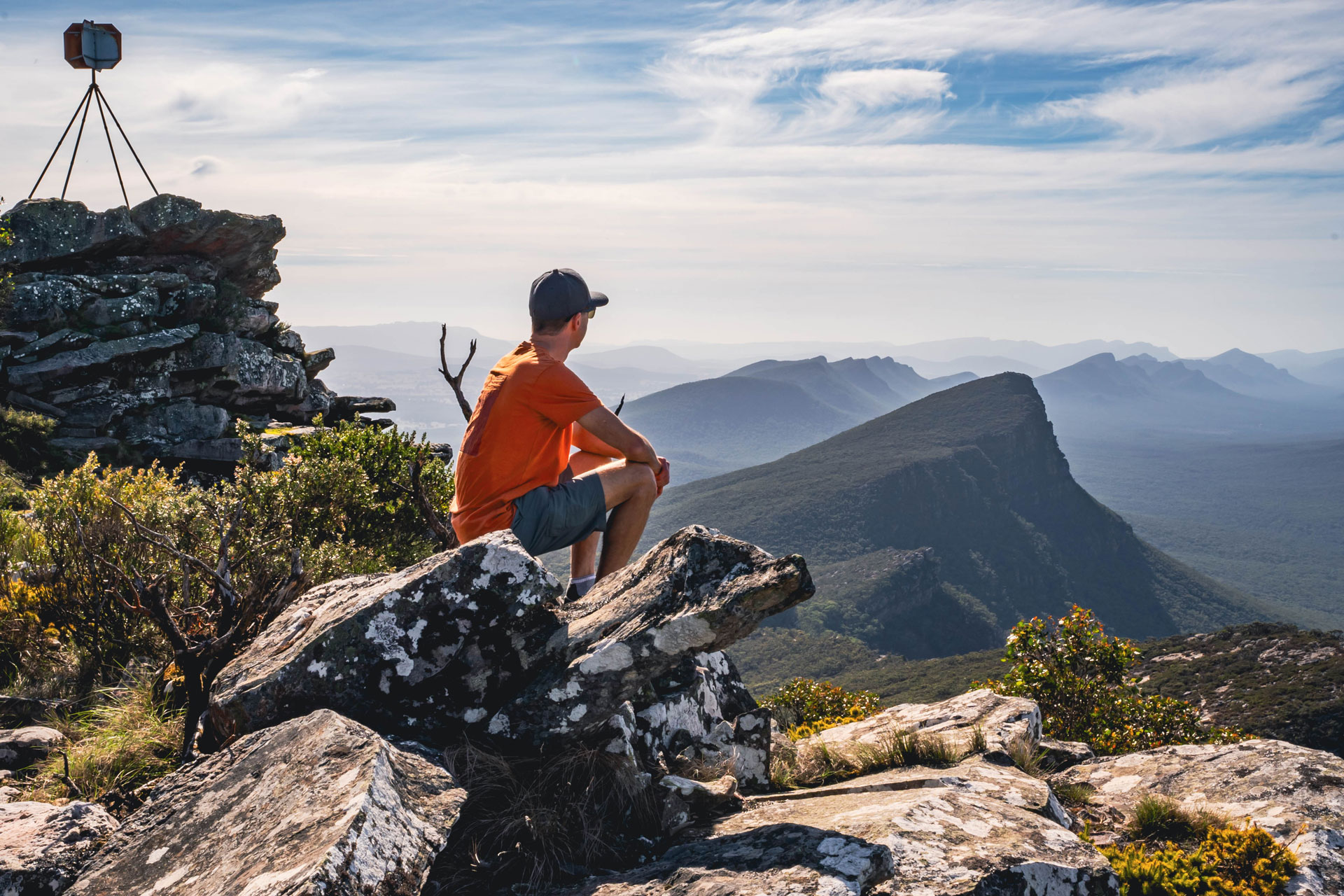
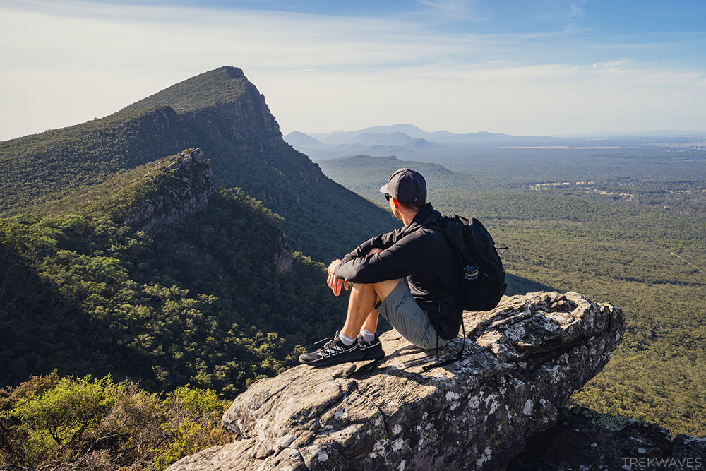
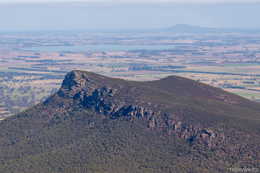
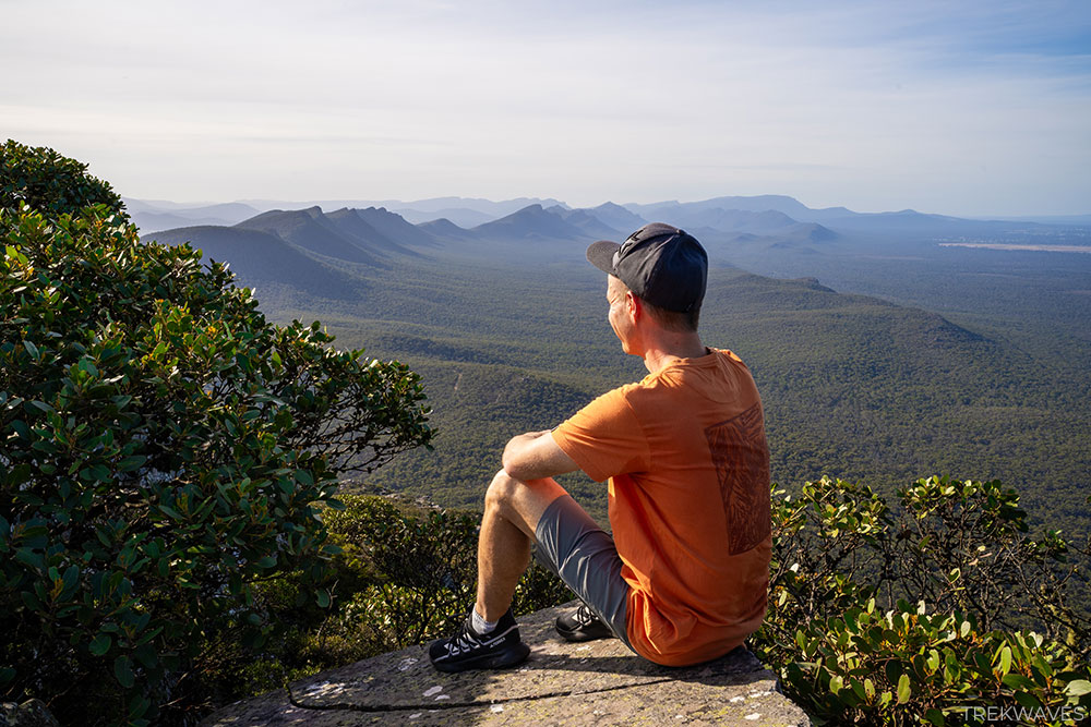
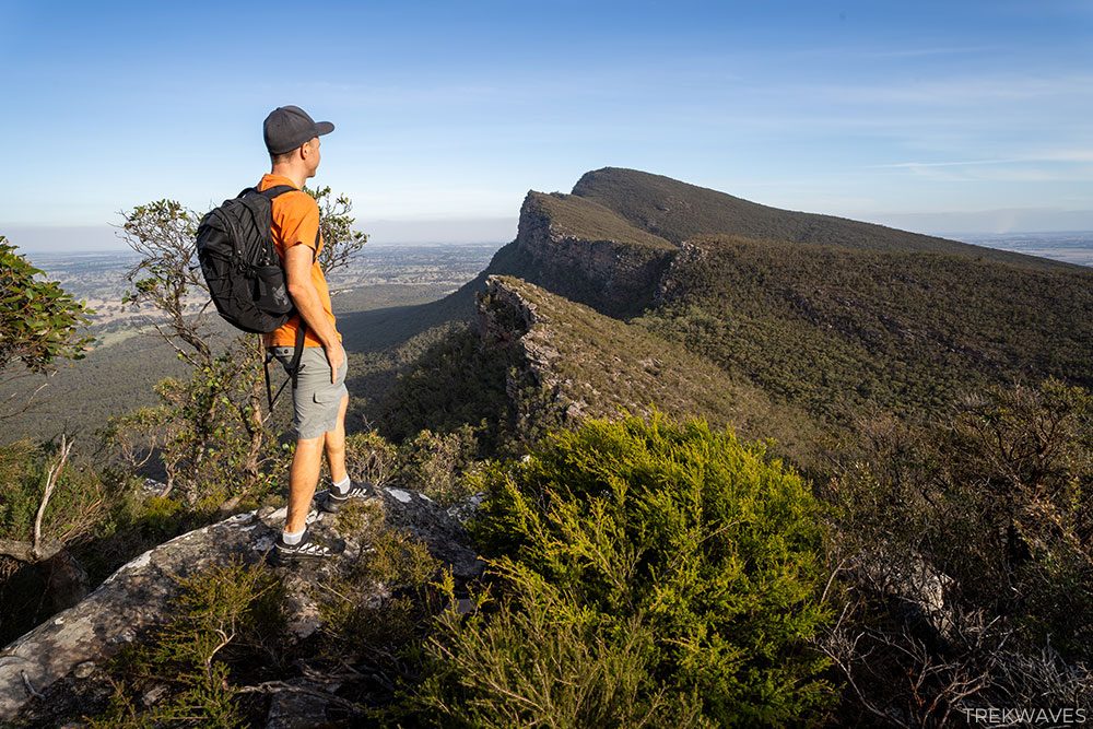
The Mount Abrupt hike is a favourite among visitors for its challenging ascent and rewarding views. The trail begins with a steep, rocky incline through eucalyptus forests before opening up to exposed ridges.
While the initial climb may test your endurance, the panoramic views at the summit make it all worthwhile.
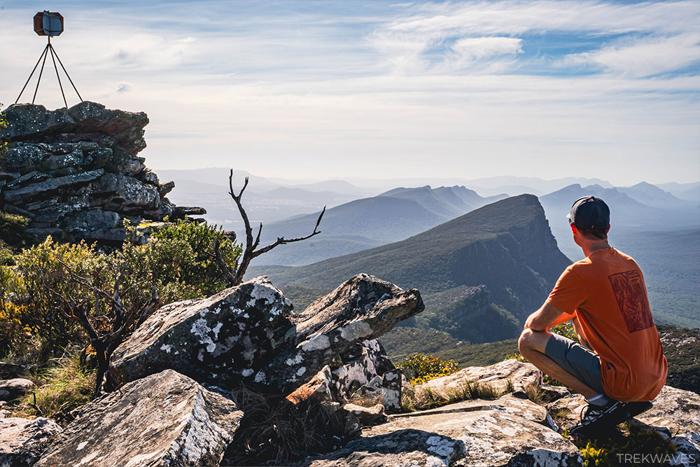
What You Can See From Mt Abrupt Summit
From the summit of Mount Abrupt, you’ll be treated to panoramic views that stretch across the Southern Grampians and beyond. Notable sights include:
- Mount Piccaninny: A small hill to the southwest.
- Mount Sturgeon: Located at the southernmost edge of the Grampians, Wurgarri (Mount Sturgeon) is one of two impressive peaks rising above Dunkeld.
- Dunkeld: A charming small town serving as the gateway to the Southern Grampians.
- On clear days, you can even see as far as the plains to the east, and the entire range of the southern Grampians stretches out before you.
2. Mount Signal Hike: Trail Details
- Distance: 7.5 km return
- Elevation Gain: 350 m
- Duration: 3-3.5 hours
- Difficulty: Moderate
Mount Signal is a less-frequented trail but equally rewarding. The path winds through the same initial forested area as Mount Abrupt before splitting off towards its own summit.
The elevation gain is more gradual compared to Mount Abrupt, making it a more relaxed hike.
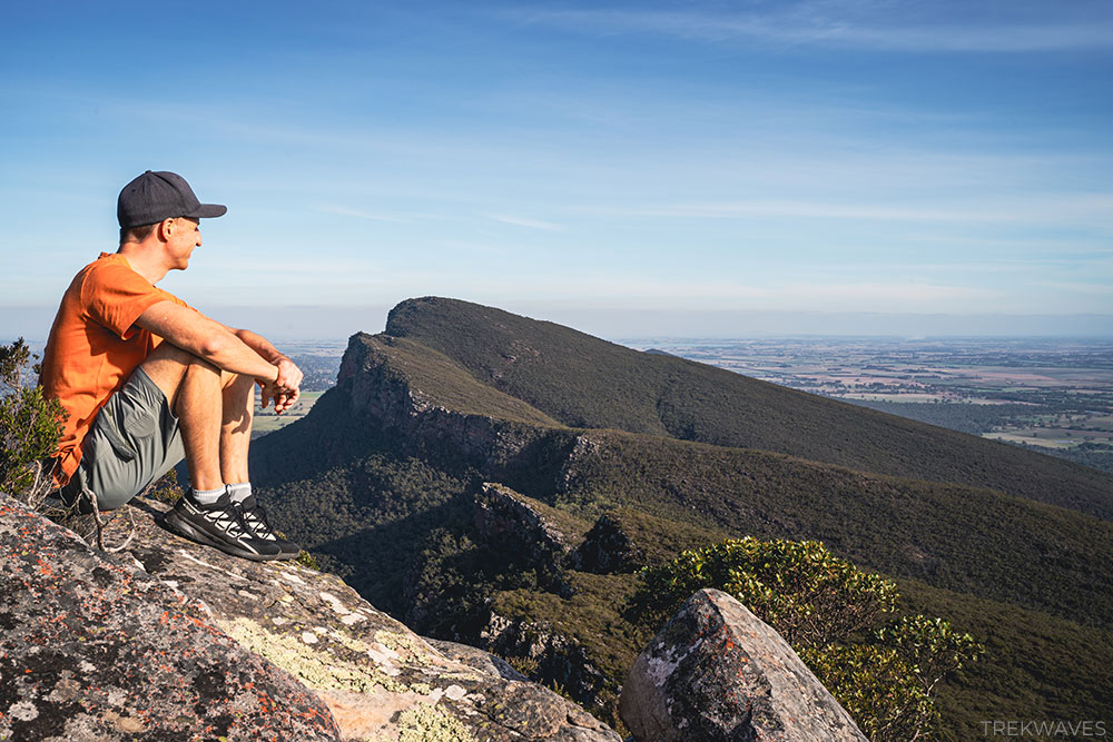
What You Can See From Mt Signal Summit
- Mount Abrupt: You’ll have a unique angle looking back at this towering peak.
- The rolling hills and farmlands of the surrounding countryside.
- Expansive views of the Southern Grampians.
3. Combined Stats for Mt Abrupt & Mt Signal Hike
If you’re up for a more ambitious adventure, combining the two hikes is a great option.
The shared trailhead makes it easy to tackle both peaks in one day, and since the hardest climbs are behind you once you’ve reached the first summit, extending your hike to the second peak is a natural choice.
- Start & finish: Mt Abrupt Car Park on Grampians Road
- Distance: 10.5km return
- Elevation gain: 653m
- Time: At least half day
- Difficulty: Medium / Hard
Conclusion
The Mount Abrupt and Mount Signal hikes are two of the most rewarding hikes in the Grampians National Park.
Whether you’re tackling one or combining both, the dramatic views, changing landscapes, and peaceful atmosphere make these trails a must for any hiker visiting the region.
Prepare for steep climbs and rugged terrain, but rest assured that the panoramic vistas at the summits make every step worth it.
Found it helpful? Pin it for later!