Did you know that within a short two-hour drive west from Sydney, situated on the Newnes Plateau, north of Lithgow, lies a very special place with unique rock formations called the Lost City?
While it may not rival the magnificence of the Lost City of the Incas (Machu Picchu), it offers a sight that’s certain to leave a lasting impression on you.
Here, within the Gardens of Stone State Conservation Area, nature has crafted a masterpiece over the ages, with layers of ironstone nestled between sandstone forming breathtaking geological structures.
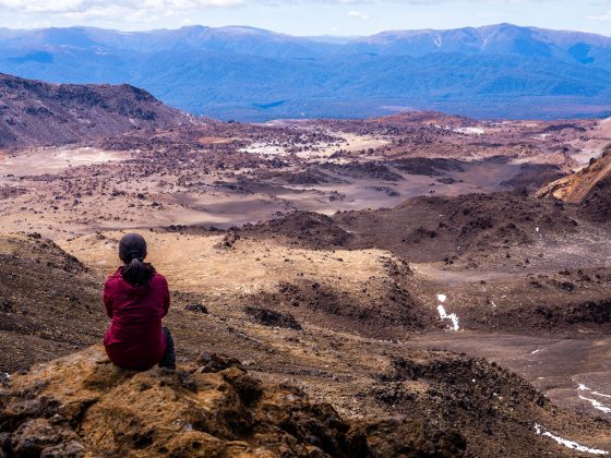
We stumbled upon this remarkable spot during our Easter break. Upon arrival, we found ourselves captivated, spending hours exploring these amazing rock formations and soaking in the stunning scenery.
It’s worth noting, some of these rocks are delicate, so let’s prioritise preserving the environment over seeking the perfect photo opportunity.
Feeling curious and eager to explore this incredible spot?
Well, stick around, because I’m about to share with you how to find the trail that’ll lead you there.
How To Get To Lost City Trail
Getting There By Car:
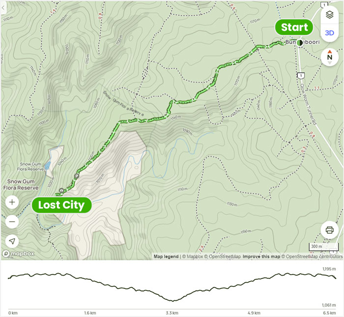
The trail to the Lost City begins at Bungleboori Camping Ground, found along Glow Worm Tunnel Road, north of Lithgow.
The road leading you there is a well-maintained fire trail, and I had no difficulty driving my 2WD car along it.
On the right-hand side of the road, you’ll find a spacious parking area where you can leave your vehicle if you’re planning to walk to the destination.
It’s worth mentioning that you can actually drive all the way to the Lost City viewpoint since it’s a regular fire trail. You might come across online info suggesting it’s only accessible with a 4WD.
However, as we walked along, I realised my 2WD would have probably handled it without any problems.
I heard from a friend of mine that they’re aiming to upgrade many roads in this part of Newnes Plateau to be accessible for 2WDs. So, I’m pretty sure that the road to Lost City has been already revamped.
Getting There by Public Transport:
I don’t think there’s any public transport to the Bungleboori Camping Ground, where the trail begins.
It’s a long 10.9km walk from Lithgow train station. So, your best bet to visit is by car or joining an organised tour.

Lost City Trail Overview
- Distance: 6.6 km return
- Time: 1.5-2 hours
- Total Ascent: 149m
- Difficulty: Easy
Whether you choose to walk or drive, remember to keep an eye out for road splits, as there are several junctions along the trail.
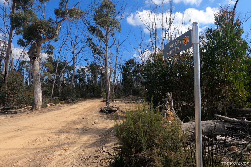
Walking Along Lost City North Trail
Your journey starts just across from the Bungleboori Campground area. Once you’ve parked your car, head to the other side of Glow Worm Tunnel Road. You’ll spot a V-shaped junction of two fire trails—take the left one (not the Old Bells Line Road).
Continue along the path for a few hundred meters until you reach the intersection with Powerlines-Track. Keep going straight and at the next intersection look out for the sign marking the Lost City North Trail.
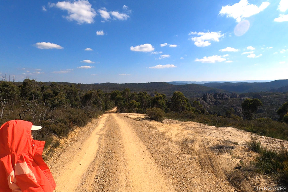
Continue moving forward, always opting for the path that heads southwest. This means you’ll go slightly left whenever the road splits for the remainder of the walk.
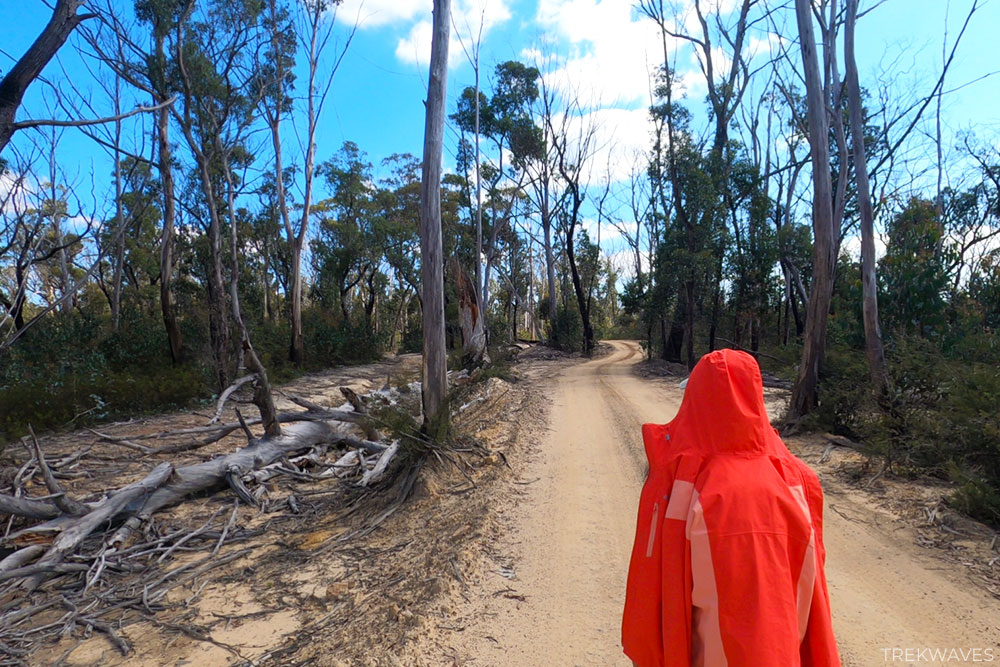
As you walk this trail, remember to watch out for passing vehicles. One of the major drawbacks of walking this trail is that every car that goes by stirs up large clouds of dust, which can be quite irritating.
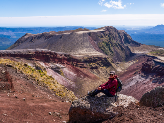
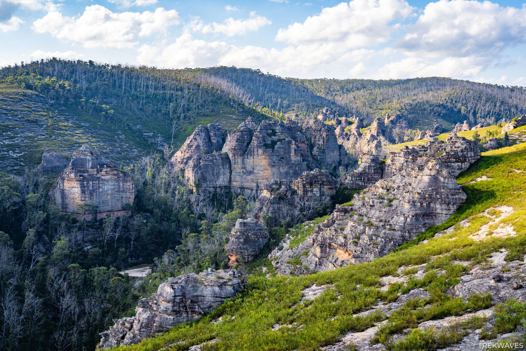
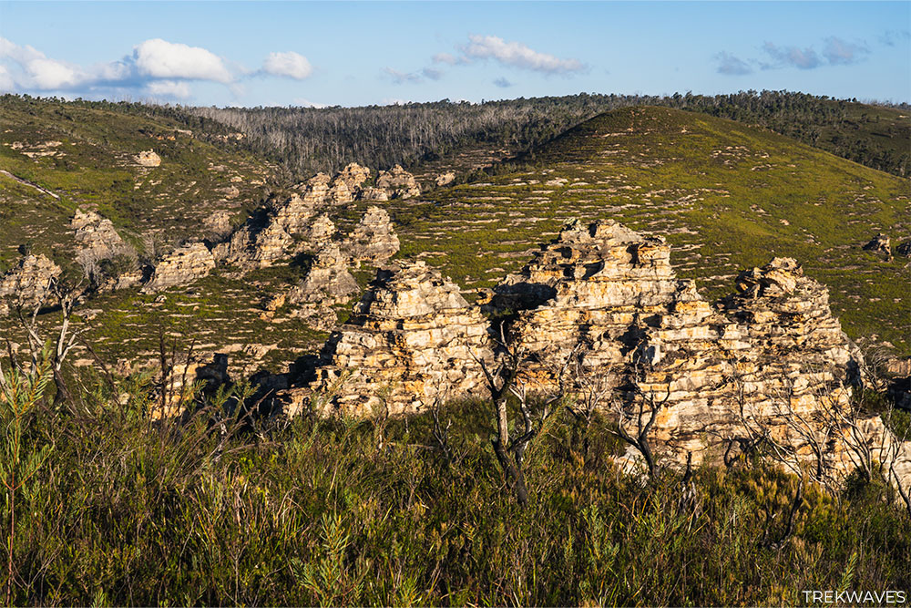
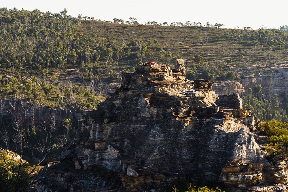
Eventually, the tree line on your right will begin to fade, revealing a view of the Snow Gum Flora Reserve and offering a first glimpse of the impressive Lost City pagoda rock formations.

Lost City Viewpoint
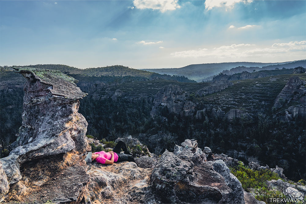
Once you’ve reached the Lost City Viewpoint, you’ll notice the last car park available. If you want to get up close to the beautiful pagodas ahead and take in the stunning view of the expansive valley, I recommend taking a leisurely walk down the trail, around 150-200 meters.
When you approach the pagodas closely enough to consider climbing them, you realise just how delicate they are. The ironstone layers that create their intricate decorations are unsupported and prone to breaking.
We took extra care with each movement, mindful not to dislodge any rocks as we made our ascent.
Once you’ve reached the last pagoda, you’ll find that there are no additional paths to follow.
However, you can certainly venture a bit farther down and lower to peer into the valley and catch a glimpse of Marrangaroo Creek.
Basking in the warm glow of the late evening sun, we had an incredible time admiring these ancient rocks and capturing countless stunning photos.
I urge you to visit this remarkable place at your earliest opportunity, before it succumbs to the pressures of mass tourism.
Geology of Lost City
Pagodas form over time as sandstone and ironstone layers weather gradually. Their Chinese pagoda-like appearance is due to ironstone’s slower erosion compared to the sandstone below.
Geologists estimate it takes a million years to shape an 8-meter pagoda.
There are 2 types of pagodas:
- Smooth pagodas that feature relatively uniform conical shapes without terraces.
- Platy pagodas, reminiscent of Asian pagodas, ziggurats, or step-pyramids, boast stepped and terraced cones.

The origin of the iron remains a topic of discussion among experts. Some geologists propose it originated from previously overlying basalt.
Evidence of Tertiary basalt caps on peaks such as Mt Wilson, Mt Irvine, Airly Turret, Mt Cameron, and many others indicates that some small and localised basalt flows occurred near the pagoda region.
Found it Helpful? Pin it For Later!

Frequently Asked Questions (FAQs):
How long does the trail take?
- 1.5-2 hours
What about signage and trail quality?
- There are limited signs along the way
How difficult is the trail?
- It is an easy walk along the fire trail
What should I wear?
- For those considering a wander around the rocky pagodas hiking shoes are the way to go
What essentials should I carry?
- Carry water, sunscreen, a hat, snacks, and insect repellent
Is it the trail child-friendly?
- Yes
Is the trail wheelchair accessible?
- Unfortunately, the trail is not wheelchair accessible
When is the best time to visit?
- Early in the morning or later in the evening as the final sections of the trail have no tree coverage.
Is there phone service?
- Very limited
Can I bring my dog?
- According to this website dogs are not allowed in the Gardens of Stone National Park.
However, it’s worth double-checking if that rule applies to the Gardens of Stone State Conservation Area, as I couldn’t find any information about it here.