If you’re after a relatively easy half-day walk, spanning around 11 kilometers, and you want to witness one of the most iconic and Instagram-worthy spots in the Blue Mountains, then you’ve got to check out the Burramoko Ridge Trail, also known as the Hanging Rock Trail.
Now, what’s so special about Hanging Rock?
Imagine a massive chunk of sandstone, over 100 meters tall, looming over the Grose Valley, disconnected from the main cliff, creating the unsettling feeling that it could collapse into the valley below.
It’s definitely worth checking out, especially if you’re not afraid of heights and open spaces—there are cliff edges everywhere, and no fences!
Now, don’t expect the trail itself to be mind-blowing – it’s pretty much your standard fire trail in the Blue Mountains.
But don’t worry, as you’ll still be treated to some scenic views and have the chance to immerse yourself in the beauty of local nature along the way.
If trekking along the fire trail isn’t your cup of tea, you’ve got another option: jump on your mountain bike and reach Baltzer Lookout in just 15-20 minutes.
So now that you have a rough idea if this trail appeals to you, let’s go over how to find a starting point.
How To Get To Hanging Rock Walk
Traveling by Car:
Situated in Blackheath, the trail is easily accessible by car. Simply follow Ridgewell Road (a decent quality fire road, no rough patches) for a few hundred meters until you arrive at the locked gate.
There, you’ll find a small carpark and the start of the Burramoko Fire Trail.

Using Public Transport
If you’re planning to use public transport, catching a train to Blackheath is your best option. Once you’re there, walk north along the Great Western Highway and turn right onto Ridgewell Road.
It’s approximately 1.4 kilometers walk from the train station to the beginning of the Burramoko Fire Trail (trailhead), so your total walking distance will be around 14 km.

Hanging Rock Trail Overview
- Distance: 11.2 km return
- Time: +3 hours
- Total Ascent: 285m
- Difficulty: The fire trail portion is relatively easy, but it becomes moderate to hard after the Baltzer Lookout due to a steep descent towards the Hanging Rock.
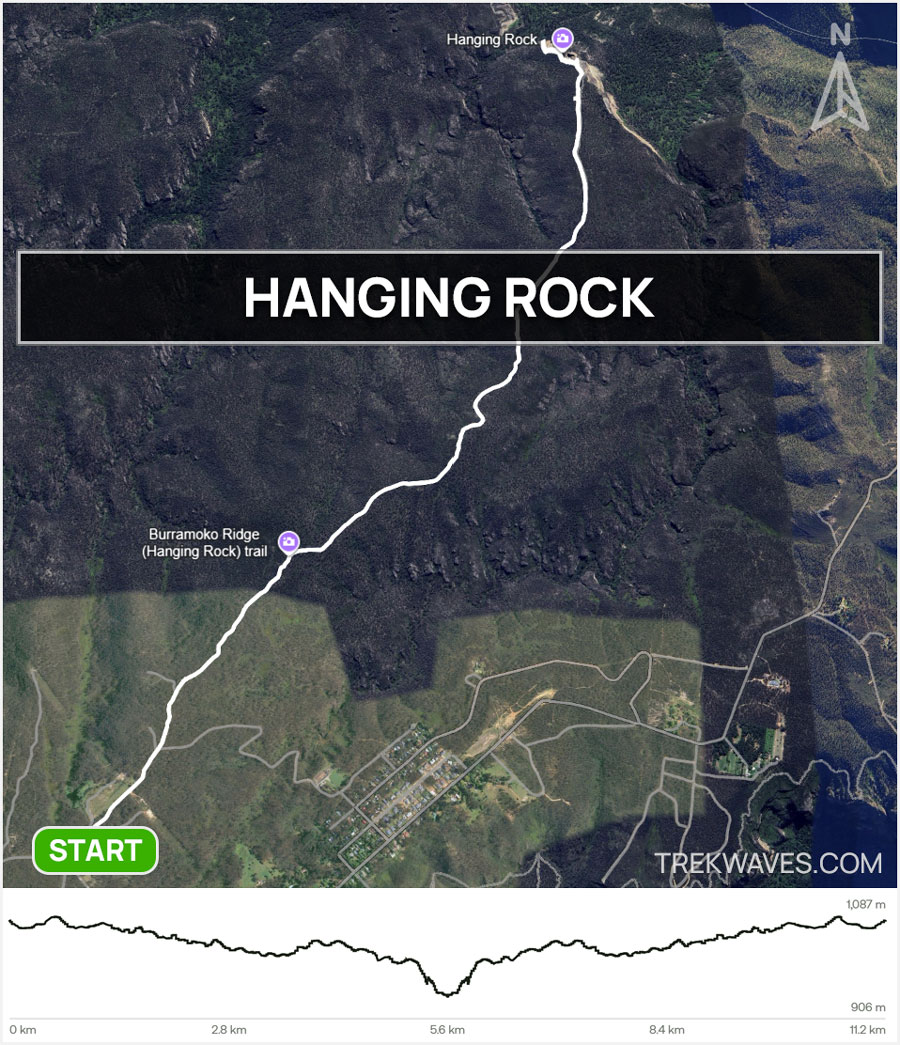
Now that you’ve got the trail specifics and know where to start, here’s a simple rule for this trek: stick to the Burramoko Fire Trail all the time.
Keeping on track with the Burramoko Trail is straightforward — just follow the path north and slightly east, watching for the tall yellow signs at each junction (there are a few to look out for in the beginning of the walk).

Burramoko Ridge Trail
Once you’ve parked your car and passed through the first gate, you’ll step onto the Burramoko Ridge Fire Trail, marking the start of your trek.
As you set off, the initial part of the trail is mostly flat, with a fenced-off grassy area on your left. Keep your eyes peeled for kangaroos — we spotted a couple here, so you might be lucky too!
About half a kilometer in, you’ll come across a junction with a path veering off to your right, leading to Hat Hill Creek. Stay on course by sticking to the Burramoko Fire Trail and continuing straight ahead.
Approximately a 1 km into the hike, you’ll reach another locked gate, marking the entrance to the Blue Mountains National Park.
Keep an eye out for the sign indicating ‘Hanging Rock, 8km return‘.

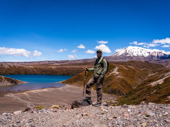
From this point onward, the trail becomes increasingly scenic and captivating, offering picturesque vistas and glimpses of the Grose Valley unfolding to your left.

During your walk along this trail, you’ll find plenty of shade from the surrounding trees, making for a comfortable journey even on sunny days.

Baltzer Lookout
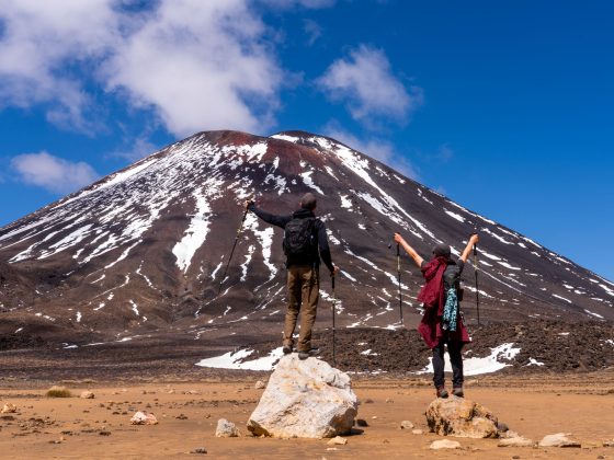
After walking for about an hour, you’ll begin to catch glimpses of what’s ahead as the landscape gradually unfolds, offering stunning vistas of rock formations overlooking the Grose Valley.
As you approach the signpost marking Baltzer Lookout & Hanging Rock, the path starts to narrow.
After roughly 100 meters, you’ll emerge into a wide-open area, where you’ll be greeted by breathtaking views stretching out before you.


Hanging Rock
Alright, we’re almost there!
Just keep heading towards the end of Balzer Lookout. Once you’re there, take a look to your left, and you’ll catch your first sight of the majestic Hanging Rock.
From here, the descent of several hundred meters begins.
This is also the most challenging part of this walk. While there are some well-built steps at the top of the descent, the majority of the path is covered in loose rocks, branches, and roots.

As you make your way down the final part of the trail, the vistas of Hanging Rock will become more spectacular, likely prompting you to pause at different spots to snap a few photos and soak in the beauty.


Dare to Jump the Gap onto Hanging Rock?
Here’s the last challenge awaiting you on the trail: leaping across a 1.5-meter gap to reach Hanging Rock.
You’ve likely come across those brave souls on social media, captured in photos as they perch on the edge of Hanging Rock.
Yet, despite its seemingly small size, the gap is big enough to make you think twice about jumping, especially when the wind starts to blow.

So, you might be wondering—did I take the leap? Well, I was all for it, but in the end, I decided against it.
The wind was really picking up that day, and I wasn’t wearing my trusty hiking shoes with good grip. The risk of slipping after the jump felt too real, and I didn’t want to take any chances
If you’re having doubts, I’d probably recommend playing it safe. But hey, it’s ultimately your call.
Whether you decide to jump or not, reaching this incredible spot and witnessing such a breathtaking sight is an achievement in itself, especially if it was your first time.

Found it Helpful? Pin it For Later!

Frequently Asked Questions (FAQs):
How long does the trail take?
- +3 hours
What about signage and trail quality?
- There are plenty of signs along the trail
How difficult is the trail?
- Moderate (easy firetrail and hard descent towards Hanging Rock)
What should I wear?
- Good hiking shoes or boots will be useful for the final part.
What essentials should I carry?
- Water, sunscreen, hat and some snacks.
Is the trail wheelchair accessible?
- The trail is not wheelchair accessible.
When is the best time to visit?
- We went during the sunset hours and views were amazing. Rumor has it, the early morning hours at sunrise are even more magical.
Is there phone service?
- Yes
Can I bring my dog?
- Unfortunately, dogs are not permitted on this trail.