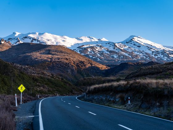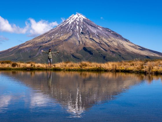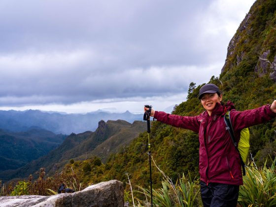
Tongariro National Park is home to some of the most spectacular hiking landscapes in New Zealand. While the famous Tongariro Alpine Crossing often steals the spotlight, there are many other incredible day hikes scattered across this volcanic landscape.
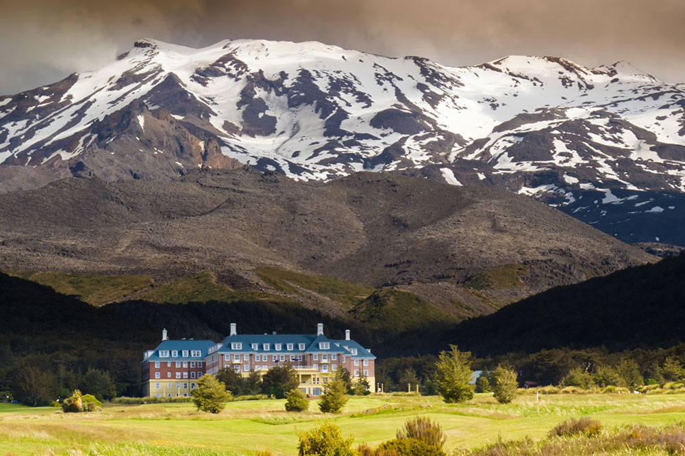
We spent four days based near Whakapapa Village exploring some of the park’s most popular tracks. Even with several days dedicated to hiking, we quickly realised just how many great trails Tongariro has to offer.
In this guide, I’ll share 7 of the best day hikes in Tongariro National Park that we explored during our stay.
And if you’re planning your own trip, make sure to check the final section of the article where I’ve included 3 additional trail suggestions — giving you 10 excellent hiking options to help build your perfect Tongariro itinerary.
Want to see what these hikes look like?
Jump to 26:54 in the video below for clips from the trails featured in this article.
Overview of the Best Day Hikes in Tongariro National Park
Before diving into the list, here’s a quick comparison of the trails featured in this guide — including distance, hiking time, and difficulty:
- Tongariro Alpine Crossing – 20.2 km | 6–8 hrs | Hard
Highlights: Emerald Lakes and iconic Mt Doom (Mt Ngauruhoe) views.
➡️ Read the full Tongariro Alpine Crossing trail guide - Tama Lakes via Taranaki Falls – 17.4 km | 5–6 hrs | Moderate
Highlights: Two alpine crater lakes with impressive views of Mt Ruapehu & Mt Doom.
➡️ Read the full Tama Lakes hiking guide - Silica Rapids Track – 6.8 km | 2–3 hrs | Easy / Moderate
Highlights: Colourful mineral streams and expansive volcanic scenery.
➡️ Read the full Silica Rapids trail guide - Waitonga Falls Track – 3.7 km | ~1.5–2 hrs | Easy / Moderate
Highlights: Tongariro’s tallest waterfall hidden among native forest.
➡️ Read the full Waitonga Falls trail guide - Meads Wall Walk – 1 km | ~20 mins | Easy
Highlights: One of Tongariro’s most famous Lord of the Rings filming locations.
➡️ Read the full Meads Wall trail guide - Tawhai Falls Walk – 800 m | ~15 mins | Easy
Highlights: The iconic “Gollum’s Pool” filming location.
➡️ Read the full Tawhai Falls trail guide - Mangawhero Falls Walk – 300 m | ~10 mins | Easy
Highlights: A dramatic waterfall with Mt Ruapehu rising behind it.
As shown on the map below, most of the best hikes in Tongariro National Park are located close to Whakapapa Village, which is the main reason we chose to stay there during our visit.
From this area you can easily access several of the park’s most popular trails within a short drive.
If you’re planning to stay in the area, you can watch this quick video tour showing the facilities at Whakapapa Holiday Park, where we stayed during our trip.
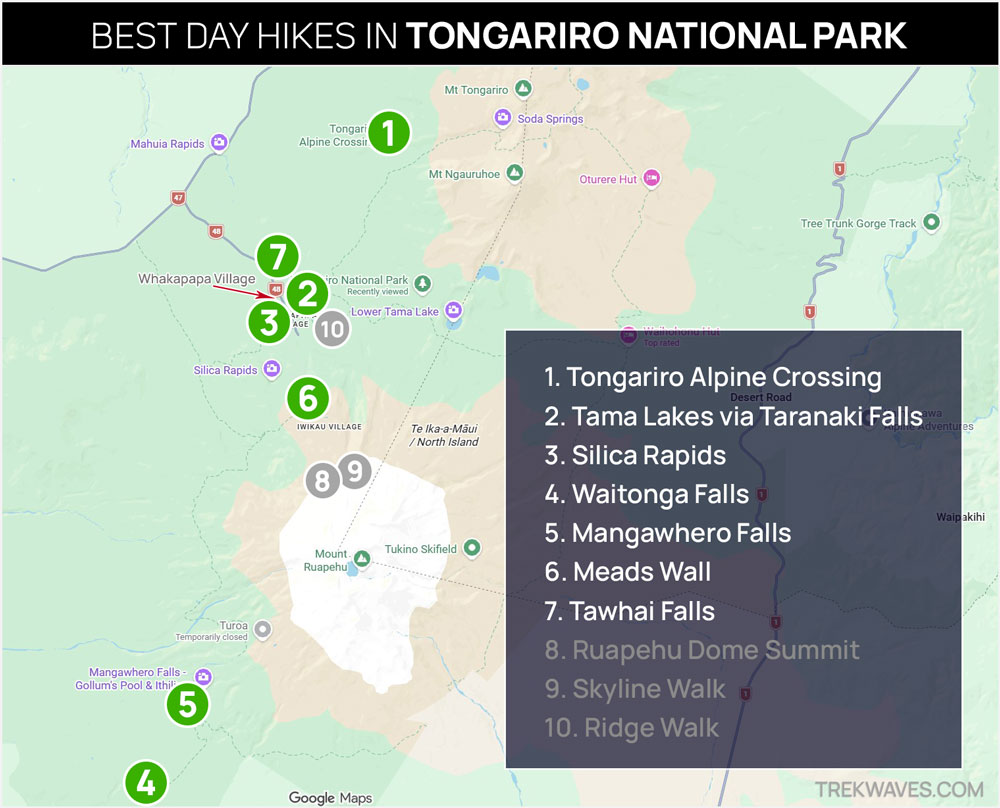
Unlike the other hikes on this list, Waitonga Falls (4) and Mangawhero Falls (5) are located on the southern side of Mt Ruapehu and are most conveniently accessed from Ohakune.
7. Tawhai Falls Walk
- Distance: 800 m return
- Time: ~15 minutes
- Difficulty: Easy
- Start: State Highway 48 (Tawhai Falls Carpark)
Tawhai Falls is one of the easiest walks in Tongariro National Park and a great quick stop while exploring the area around Whakapapa Village. A short path through native forest leads to a beautiful waterfall cascading over dark volcanic rock into a clear pool below.
Many visitors recognise this spot as Gollum’s Pool from The Lord of the Rings: The Two Towers, where Gollum was seen catching fish in the stream.
Even without the movie connection, the peaceful forest setting makes Tawhai Falls one of the most rewarding short stops in the park.
➡️ Read the full guide: Tawhai Falls Walk (Gollum’s Pool)
6. Meads Wall Walk
- Distance: 1 km return
- Time: 15-20 minutes
- Difficulty: Easy
- Start: Whakapapa Ski Area (behind Sky Waka Gondola)
Located in the Whakapapa Ski Area, the Meads Wall Walk is one of the quickest hikes you can do in Tongariro National Park. The short trail crosses an open volcanic landscape before reaching the impressive lava cliffs of Meads Wall.
From the lookout you’ll also get impressive views of Mt Ngauruhoe — famously known as Mount Doom in The Lord of the Rings.
This location was used to portray Emyn Muil in The Two Towers, the rugged terrain Frodo and Sam must cross to get to Mordor. Even without the film connection, the dramatic volcanic scenery makes Meads Wall one of the most memorable quick walks in the park.
➡️ Read the full guide: Meads Wall Walk
5. Mangawhero Falls Walk
- Distance: 300m return
- Time: 5-10min
- Difficulty: Easy
- Start & Finish: Ohakune Mountain Rd
The Mangawhero Falls Walk is a very short trail leading to one of the most photogenic waterfalls on the southern slopes of Mt Ruapehu.
Within a few minutes of leaving the car park, you’ll reach a viewing platform overlooking the waterfall cascading down a dark volcanic cliff.
Despite the very short walk, the combination of the dramatic waterfall and views toward Mt Ruapehu makes this one of the most rewarding quick stops in the park.
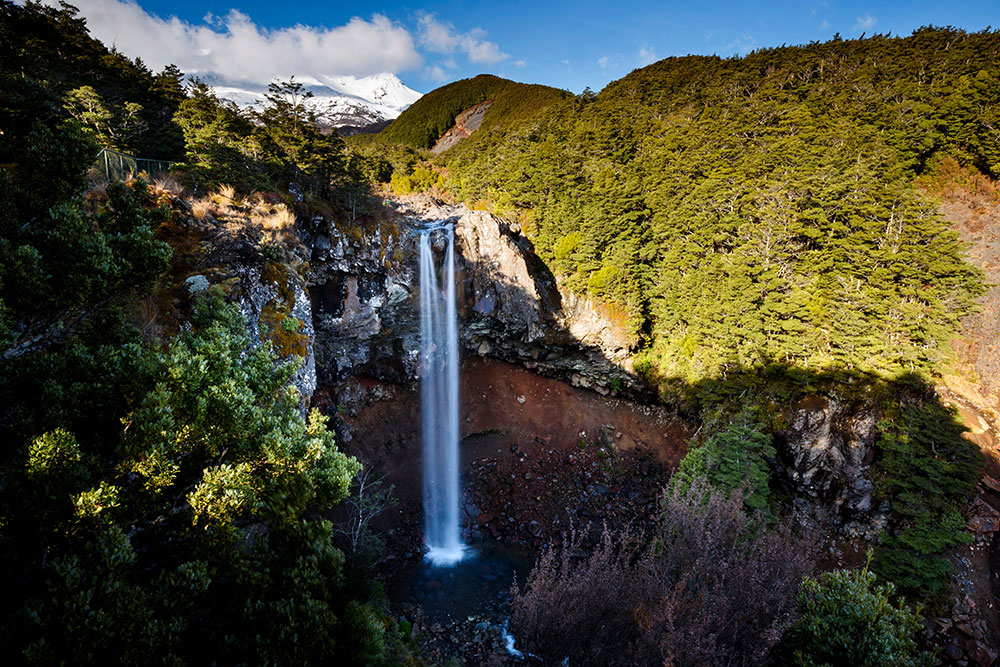
4. Waitonga Falls Walk
- Distance: 3.5km return
- Elevation Gain: 192m
- Time: ~2 hrs
- Difficulty: Moderate
- Start & Finish: Ohakune Mountain Rd
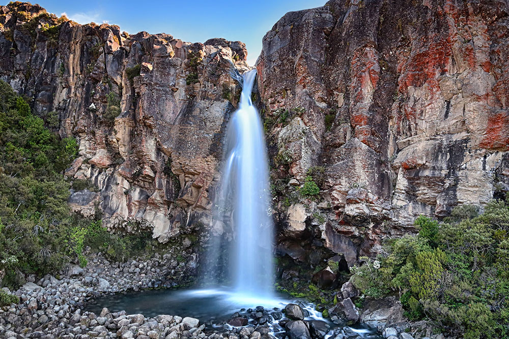
Hidden on the quieter Ohakune side of Tongariro National Park, the Waitonga Falls Track leads to the tallest waterfall in the park.
The trail begins along Ohakune Mountain Road and gradually climbs through native forest before reaching the Rotokawa Pools, where small ponds can sometimes reflect the slopes of Mt Ruapehu on calm days.
From there, the path continues toward a rocky stream bed where you can see Waitonga Falls plunging 39 metres into the gorge further upstream.
It’s also possible to make your way closer to the waterfall by following an unmarked route and scrambling across large boulders toward the base of the falls.
➡️ Read the full guide: Waitonga Falls Track
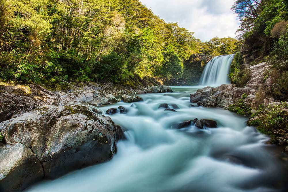
3. Silica Rapids Track
- Distance: 6.8 km loop
- Elevation Gain: 206 m
- Time: 2–2.5 hours
- Difficulty: Easy to moderate
- Start: Whakapapa Holiday Park
The Silica Rapids Track is a scenic loop located near Whakapapa Village and is often overlooked in favour of some of the park’s more famous hikes.
Along the trail you’ll get several excellent viewpoints toward Mt Ngauruhoe (Mount Doom) and Mt Ruapehu, two of the most recognisable volcanoes in Tongariro National Park.
One of the most interesting parts of the hike is the series of mineral-coloured streams along the valley.
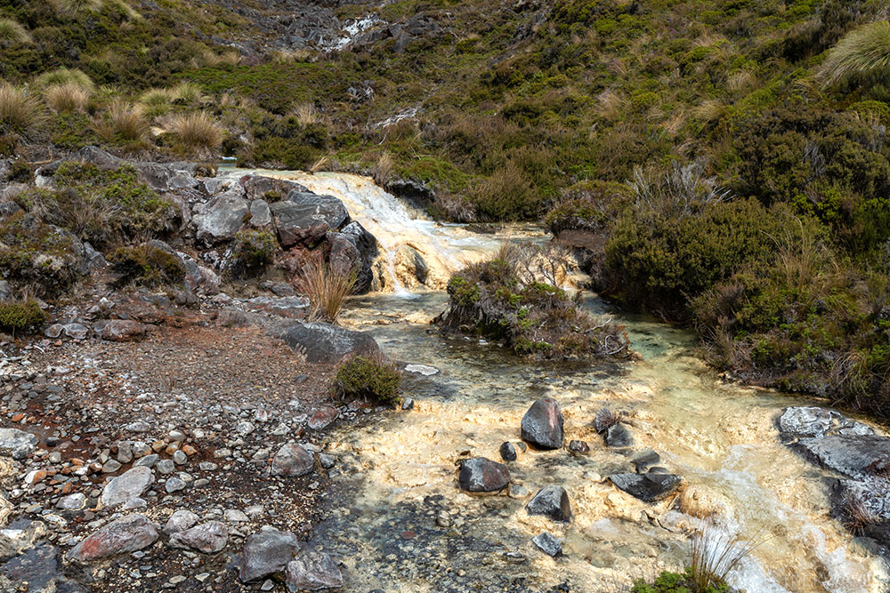
The trail first passes Golden Rapids, where mineral deposits give the water a warm golden tint, before continuing to Silica Rapids, where pale rock terraces and colourful streams create one of the most distinctive landscapes along the track.
➡️ Read the full guide: Silica Rapids Track Guide
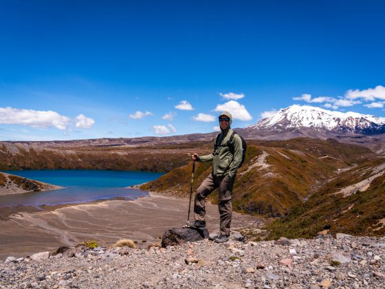
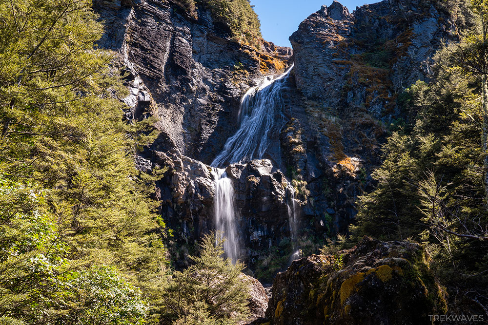
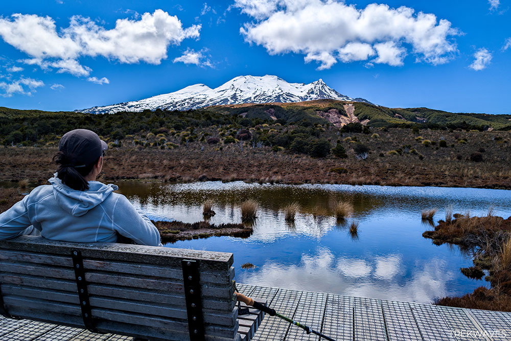
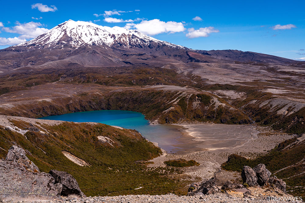
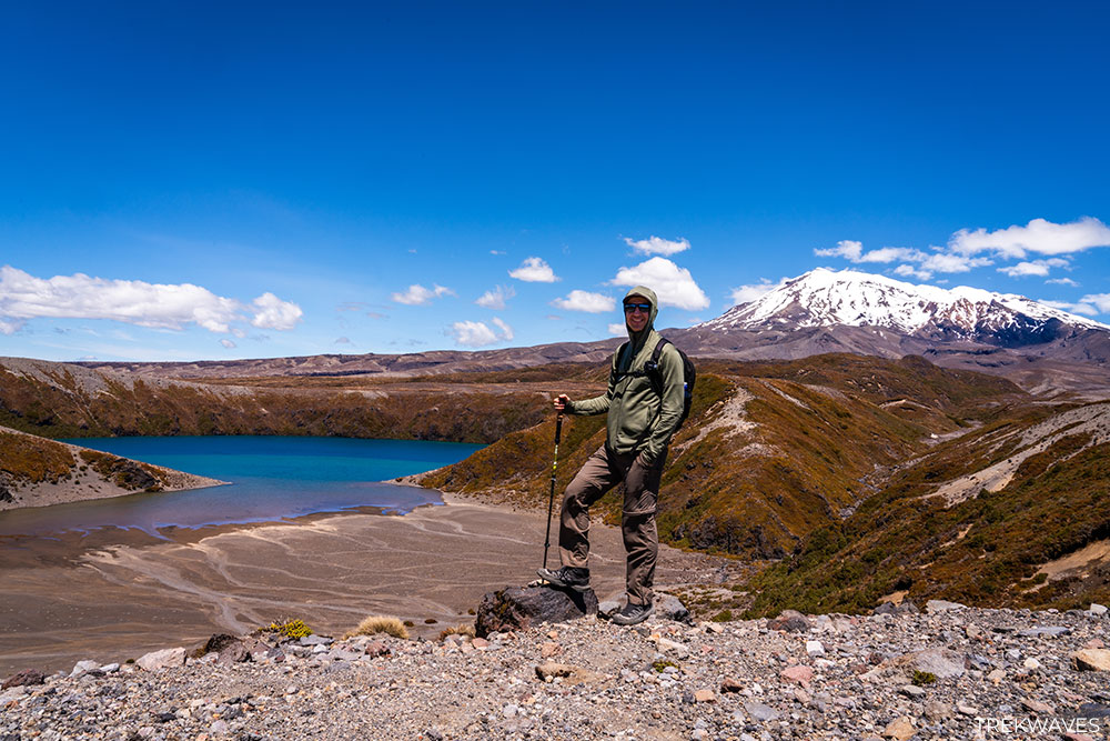
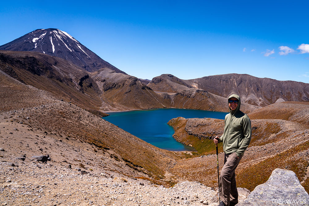
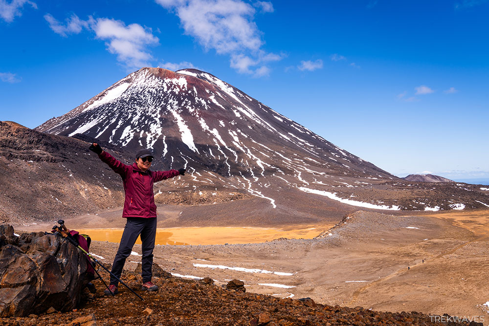
2. Tama Lakes via Taranaki Falls
- Distance: 17.4 km return
- Elevation Gain: 540m
- Time: 5–6 hrs
- Difficulty: Moderate
- Start: Whakapapa Village
The Tama Lakes Track is one of the most spectacular day hikes in Tongariro National Park and a fantastic alternative to the Alpine Crossing.
Starting near Whakapapa Village, the trail first passes the impressive Taranaki Falls, where water plunges over a lava cliff into a wide basin below.
Beyond the falls, the track continues across open volcanic terrain beneath the slopes of Mt Ruapehu, gradually climbing toward the dramatic crater lakes that give the hike its name.
The first viewpoint overlooks Lower Tama Lake, a deep volcanic basin surrounded by dark ridgelines.
For those willing to continue higher, the climb to Upper Tama Lake rewards the effort with sweeping views across the volcanic plateau and one of the most striking alpine landscapes in the park.
➡️ Read the full guide: Tama Lakes via Taranaki Falls
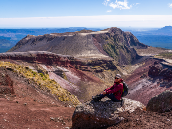
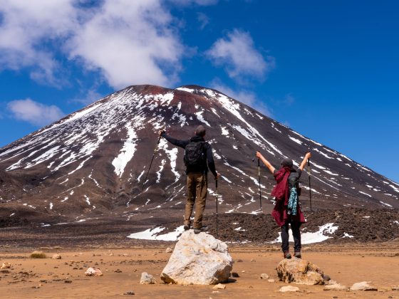
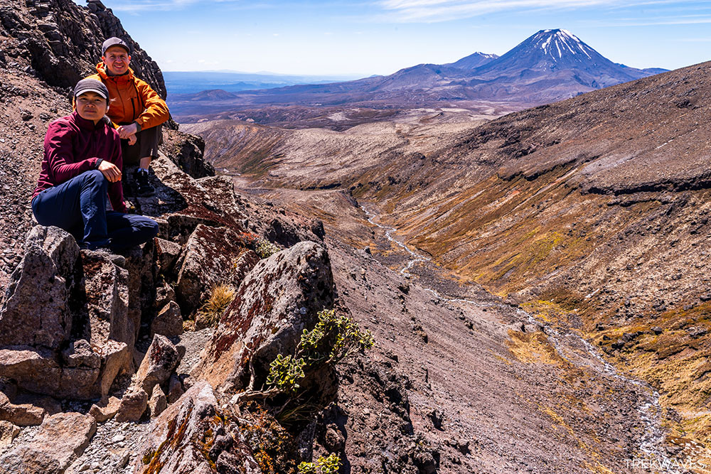
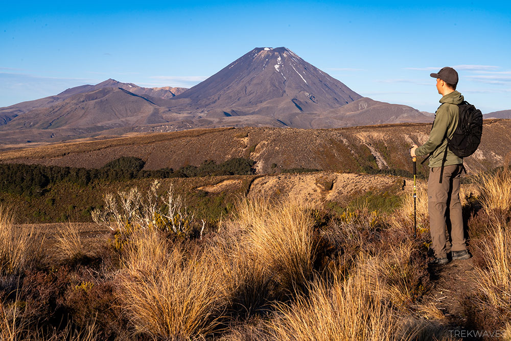
1. Tongariro Alpine Crossing
- Distance: 20.2 km (point-to-point, not a loop)
- Elevation gain: 853 m
- Duration: 6-8 hours in summer, 8-9 hours in winter
- Trail Start: Mangatepopo Carpark
- Trail End: Ketetahi Carpark
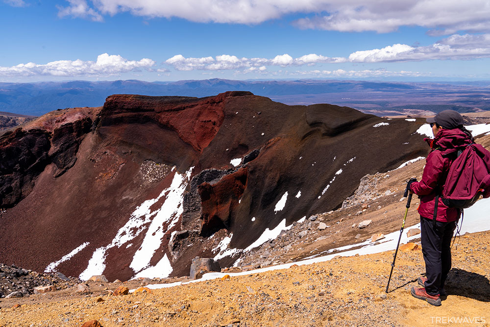
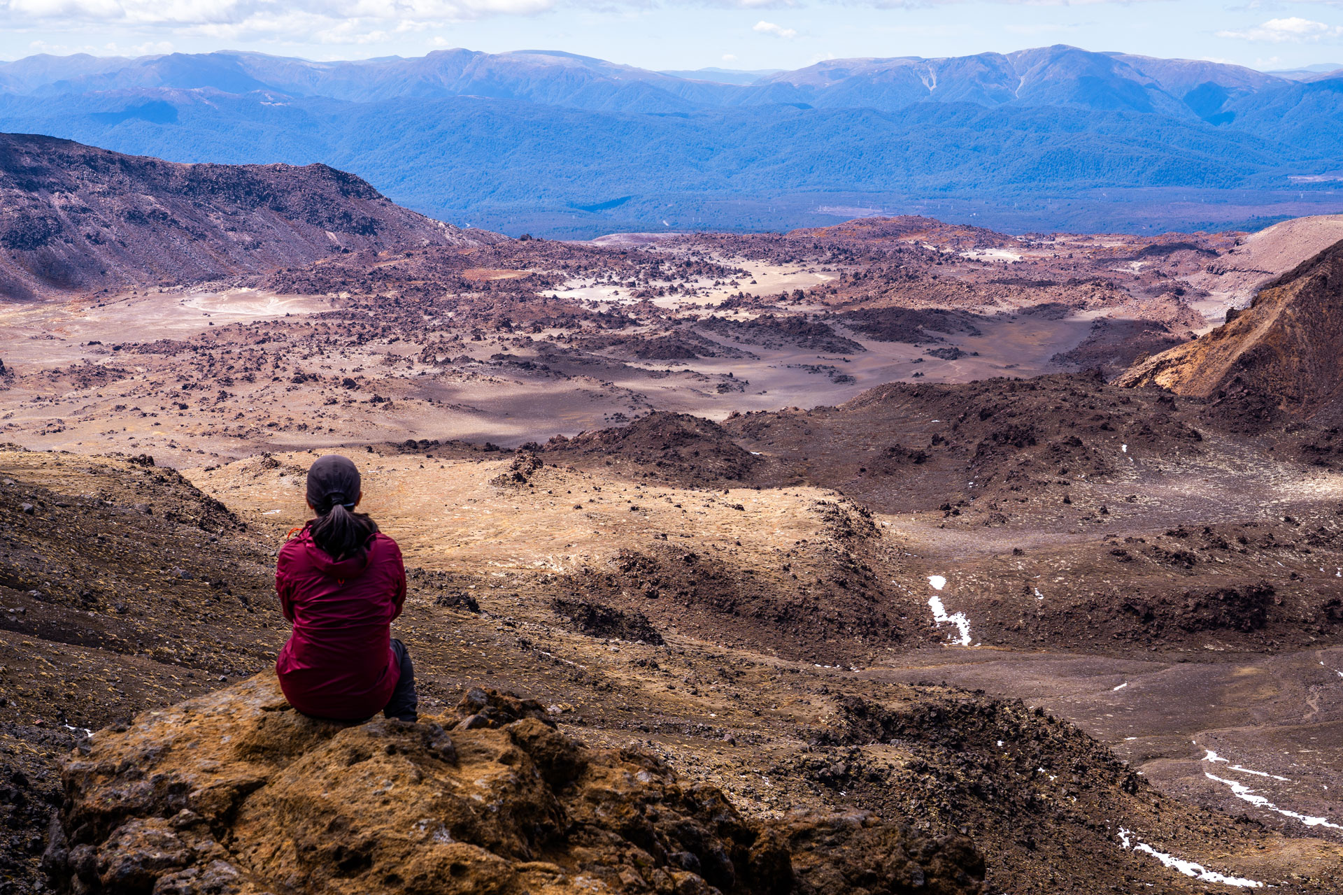
Often described as one of the best day hikes in the world, the Tongariro Alpine Crossing is the most famous trail in Tongariro National Park — and for good reason.
The trail traverses an otherworldly volcanic landscape filled with lava flows, steaming vents, and towering crater rims.
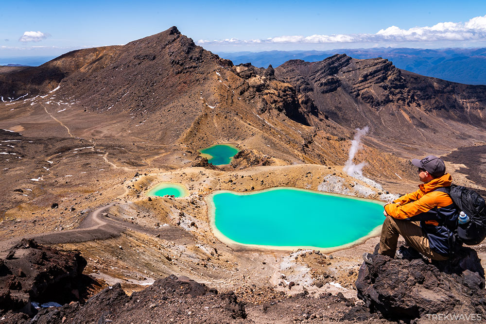
After climbing through South Crater, the route reaches Red Crater, the highest point of the crossing. From the rim, the view suddenly opens to reveal the surreal turquoise waters of the Emerald Lakes, glowing against the dark volcanic slopes below.
With constant views of Mt Ngauruhoe (Mount Doom) and sweeping alpine scenery in every direction, this hike delivers one of the most unforgettable landscapes anywhere in New Zealand.
➡️ Read the full guide: Tongariro Alpine Crossing
Three More Great Hikes Worth Adding to Your Itinerary
While the seven hikes above are some of the best day walks in Tongariro National Park, they’re far from the only ones worth exploring.
If you have a bit more time in the area, here are 3 additional hikes that are well worth adding to your itinerary.
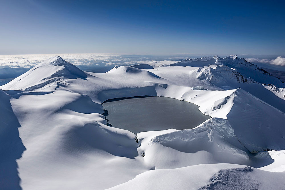
Bonus Trail #1 – Ruapehu Dome Summit
- Distance: ~6 km return (from Sky Waka upper station)
- Elevation Gain: 633 m
- Time: 3–4 hrs
- Difficulty: Hard (alpine conditions)
- Start: Sky Waka Gondola upper station or Iwikau Village
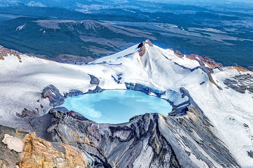
The climb to Ruapehu Dome (2,672 m) offers one of the most impressive high-alpine experiences in Tongariro National Park.
The easiest way to reach the start of the route is by taking the Sky Waka Gondola, which lifts you high onto the slopes of Mt Ruapehu and removes a huge amount of climbing from the day.
It’s technically possible to start the hike from Iwikau Village, but that approach involves more than 1,000 metres of elevation gain.
The reward for reaching the summit area is a view of Te Wai ā-moe (Ruapehu Crater Lake), a beautiful lake sitting inside the volcano’s active crater.
The lake is one of the most unique features of Mt Ruapehu and is constantly influenced by volcanic activity, with temperatures that can change dramatically due to geothermal heating.
We originally planned to do this hike and climb all the way to the summit, but when we visited in early November the upper slopes were still covered in snow.
Reaching the top safely required crampons and proper mountaineering gear, so we decided to give it a pass and save the final push for another visit.
Bonus Trail #2 – Skyline Walk
- Distance: 2.4 km return
- Elevation Gain: 261m
- Time: 1.5 – 2.5 hrs
- Difficulty: Moderate / Challenging
- Start: Whakapapa Village
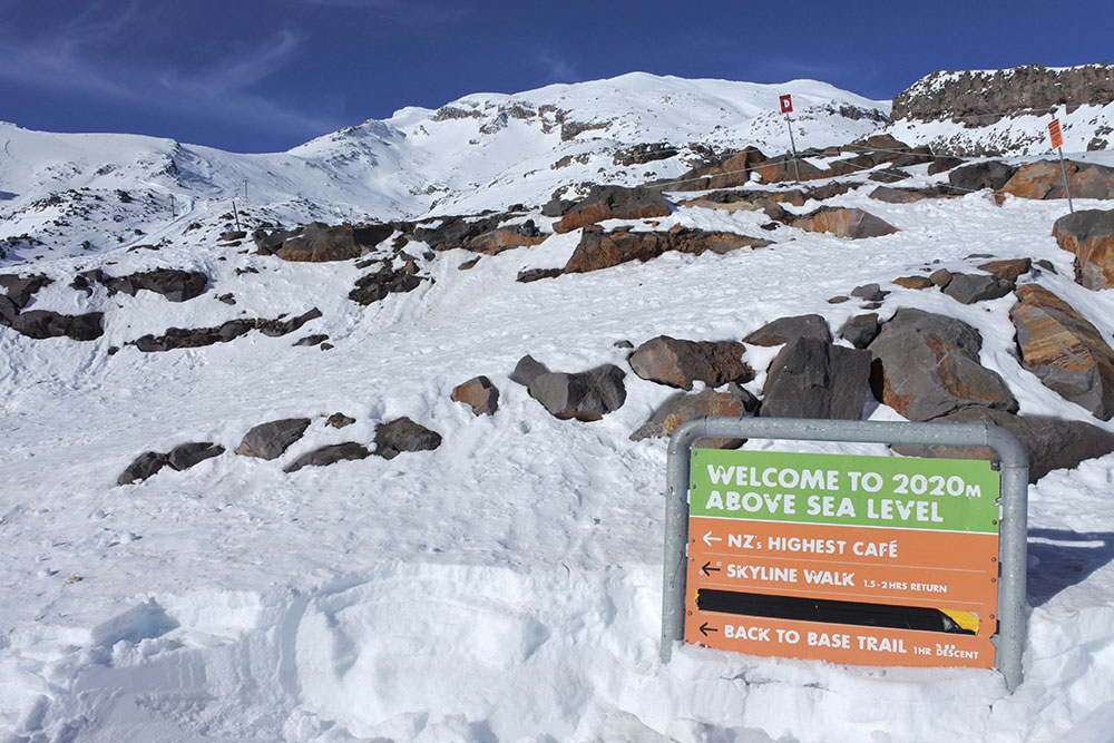
The Skyline Track is a short but steep alpine hike that begins at the top of the Sky Waka Gondola on Mt Ruapehu.
Taking the gondola removes a large amount of elevation gain and allows you to start the walk high on the mountain.
From the upper station, the trail climbs toward Skyline Ridge through exposed volcanic terrain made up of lava rock and scoria. Once on the ridge, the views open up across the Tongariro volcanic plateau and toward Mt Ngauruhoe.
➡️ For a detailed overview of the route, check out this excellent guide from Visit Ruapehu – Skyline Walk
Bonus Trail #3 – Ridge Walk
- Distance: 1.4 km return
- Elevation Gain: 61 m
- Time: 1 hr
- Difficulty: Easy / Moderate
- Start: Whakapapa Village
The Ridge Walk is a short but scenic trail located near Whakapapa Village. The path climbs gradually through forest before reaching a small ridge where the views open toward Mt Ngauruhoe and the surrounding volcanic landscape.
Because of its short distance and easy access, it’s a nice option if you’re looking for a quick viewpoint walk while visiting Tongariro National Park.
Final Thoughts
Out of all the places we visited while travelling around North New Zealand, Tongariro National Park easily became the most exciting part of our itinerary — and it definitely exceeded my expectations.
The variety of landscapes here is incredible. Within just a few days you can hike across dramatic volcanic terrain, stand beside powerful waterfalls, and reach alpine crater lakes surrounded by rugged mountain scenery.
If you’re planning to visit Tongariro, I strongly recommend spending at least 2–3 days in the area. That extra time allows you to experience several of the park’s incredible hikes and truly appreciate what makes this place so special.
And if you’re exploring more of the region, you can find additional trail ideas in my guide to the best hikes in North New Zealand.
Found it Helpful? Pin it for Later!