Planning a trip to the Blue Mountains and not sure where to hike?
With hundreds of trails winding through forested valleys and clifftop plateaus, it’s easy to feel lost in options. Some tracks are unforgettable — others, not so much.
I’ve spent the past decade hiking across the Blue Mountains National Park, covering everything from short walks near Katoomba and Leura to full-day adventures deep in the wilderness.
This list of the 20 Best Blue Mountains hikes is built from real experience — so you can skip the mediocre trails and head straight for the most rewarding walks.
Whether you want easy hikes with views, waterfalls near Wentworth Falls, or iconic tracks like the Grand Canyon Walk, you’ll find it all here.
How to Use This Guide
To help you plan more efficiently — especially if you’re visiting for just a few days — I’ve grouped the hikes loosely by region.
Within each region, you’ll find a variety of trails: clifftop lookouts, lush rainforest walks, waterfall circuits, and even a few longer routes that can double as overnighters.
In places where trailheads are close together, I’ve included nearby alternatives — so you can choose a hike based on difficulty, scenery, or even squeeze two great walks into a single day.
The 4 regions covered in this guide are:
- North-Western Blue Mountains – Remote, wild, and less crowded hikes along Bells Line of Road
- Lower Blue Mountains – Lush rainforest trails and waterfalls close to Lawson and Hazelbrook
- Central Blue Mountains – Iconic Katoomba, Leura, and Wentworth Falls tracks, great for first-timers
- Upper Blue Mountains – Epic lookouts and valley trails around Blackheath and Mount Victoria
This format makes it easier to explore efficiently — without missing the best trails in each area.

Best Hikes in North-Western Blue Mountains
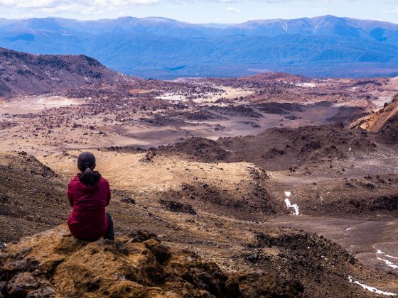
The north-western edge of the Blue Mountains, accessed via Bells Line of Road, feels a world away from the busier towns like Katoomba and Blackheath.
Here, you’ll find remote trails, volcanic peaks, and rugged wilderness that rarely make it onto first-timer itineraries — but absolutely should.
#20 Mount Banks Summit & Banks Walls Trail
- Start & Finish: Mount Banks Picnic Area
- Distance: 12.1 km return
- Elevation Gain: 511 m
- Time: Half day
- Difficulty: Medium
- Full Trail Guide: Mount Banks Summit & Banks Walls Trail
- Trail Video: Click here to watch on YouTube
If you’re after some of the most sweeping views of the Grose Valley, the Banks Walls Trail deserves a spot on your list — as long as you don’t mind a decent stretch of fire trail along the way.
If you’d rather keep it short, the 2.4 km return track to Mount Banks summit is a quick and easy option from the car park.
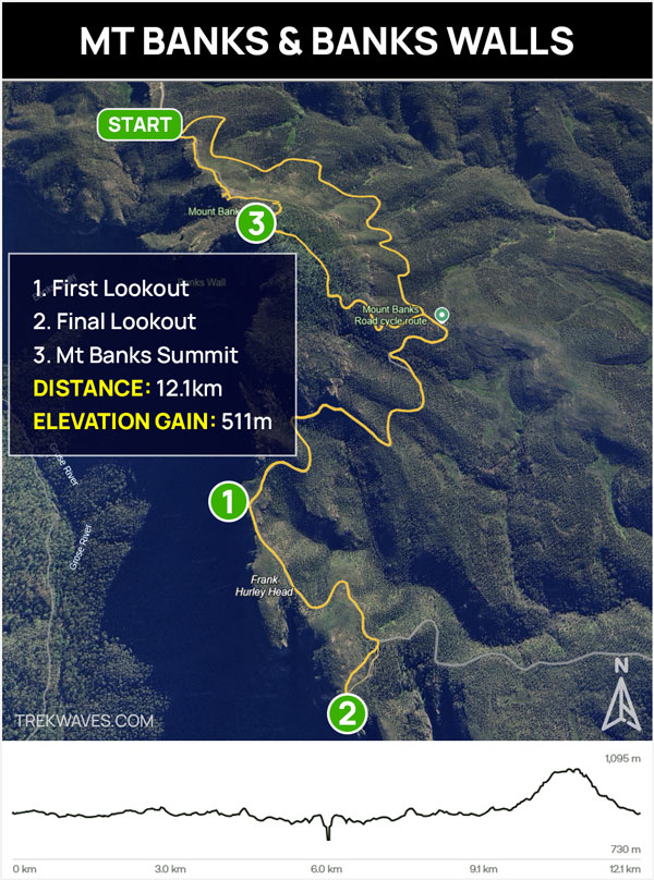
Though Mount Banks is one of the most visually prominent peaks in the area, its summit is mostly tree-covered and doesn’t deliver the best views.
To truly appreciate the surrounding landscape — including the Grose Valley, Butterbox Point and Lockleys Pylon — I strongly recommend doing the full trail to the final clifftop lookout.
#19 Pierces Pass to Blue Gum Forest
- Start & Finish: Pierces Pass Picnic Area
- Distance: 16.3 km return
- Elevation Gain: 818 m
- Time: 1 day or 2 days (overnight camping at Acacia Flat)
- Difficulty: Hard
- Full Trail Guide: Pierces Pass to Blue Gum Forest
- Trail Video: Click here to watch on YouTube
One of the most remote and rewarding day hikes in the Blue Mountains, this track plunges from Pierces Pass deep into the heart of Grose Valley.
It’s a demanding return hike best suited to experienced walkers — but those who make the effort are rewarded with rainforest scenery, river crossings, and a visit to the majestic Blue Gum Forest.
The track begins with a steep descent through mossy gullies and damp forest, eventually meeting the Grose River.
From there, it’s a short and scenic stretch to reach the Blue Gum Forest — home to some of the tallest eucalypts in the park.


For those considering an overnight experience, the nearby Acacia Flat Campground offers a serene setting under the stars.
Alternatively, the trail can be extended as a one-way hike by continuing to Perrys Lookdown, with a car shuttle or taxi arranged for return.
This hike is best suited for experienced bushwalkers equipped with proper navigation skills and gear, as the terrain is steep and remote.

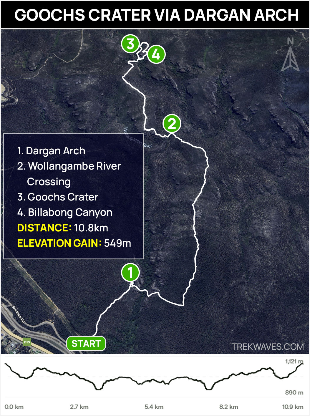
#18 Goochs Crater via Dargan Arch
- Start & Finish: Sandham Rd in Dargan
- Distance: 10.8km return
- Elevation Gain: 549 m
- Time: 4-6 hours
- Difficulty: Hard (unmarked trail)
- Full Trail Guide: Scenic Hike to Goochs Crater via Dargan Arch
- Trail Video: Click here to watch on YouTube
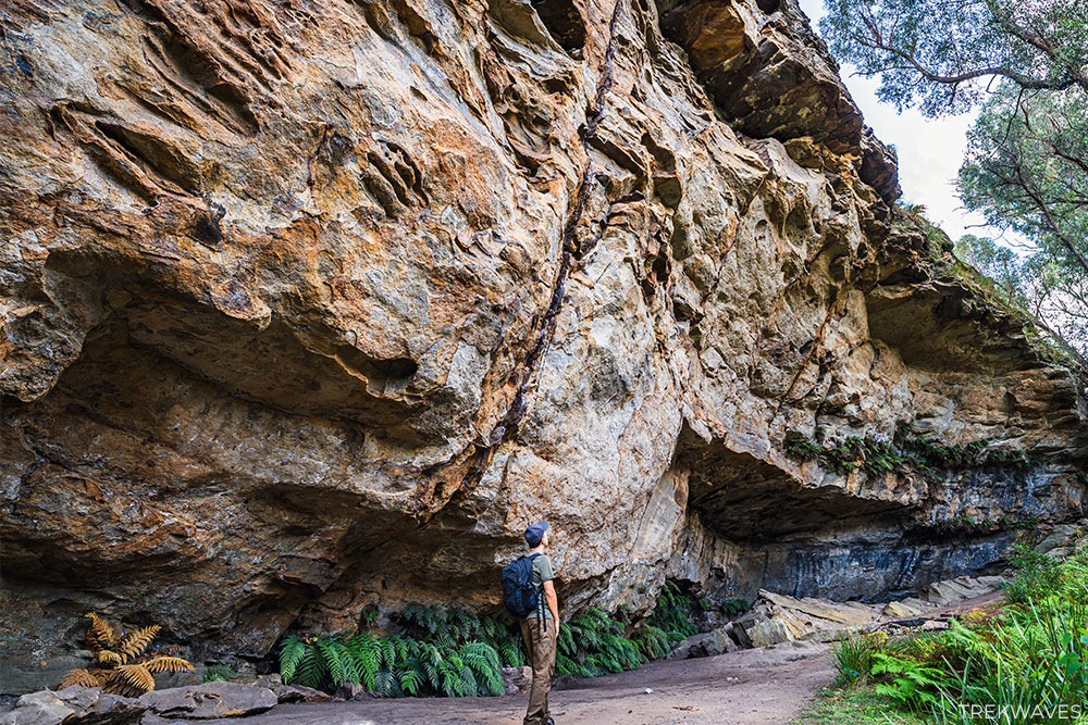
This adventurous hike leads you through some of the most unique geological formations in the Blue Mountains.
Starting near Dargan, the trail takes you past the impressive sandstone formation of Dargan Arch, descends into the Wollangambe River valley, and culminates at Goochs Crater—a serene hanging swamp encircled by towering pagoda rock formations.

The route is largely unmarked and requires navigation skills, as it involves off-track sections, river crossings, and steep scrambles.
Along the way, you’ll encounter diverse landscapes, including dense bushland, open ridgelines with panoramic views, and a notable Camping Cave adorned with Aboriginal hand stencils.
The final descent into the crater reveals a lush, grassy basin that transforms into a reflective lake after heavy rains.

Best Hikes in Lower Blue Mountains
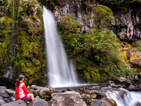
While often overlooked in favour of the higher cliffs around Katoomba and Blackheath, the Lower Blue Mountains are home to some of the region’s most enchanting rainforest trails and secluded waterfalls.
Centered around Lawson, Hazelbrook, and Woodford, this area offers quieter, less touristy hikes that weave through fern-filled gullies, mossy cascades, and cool temperate forest.
Many of the trails here are short, scenic loops or link-ups that can easily be done in half a day — perfect for those looking for a gentle introduction to the Blue Mountains.
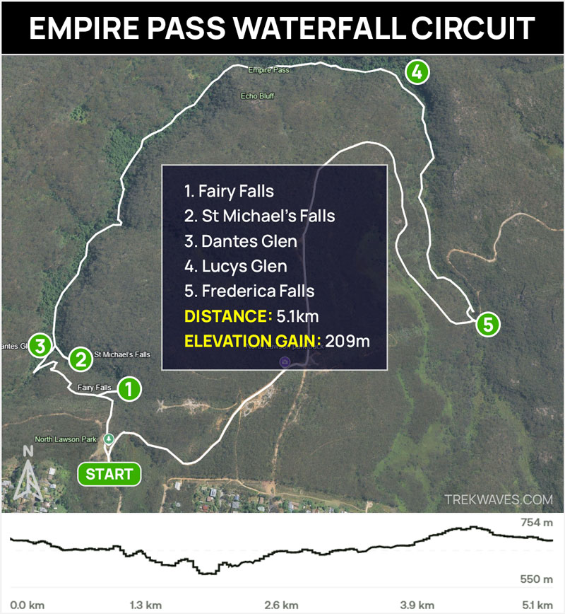
#17 Empire Pass Trail (North Lawson Waterfall Circuit)
- Start & Finish: North Lawson Park
- Distance: 5.1 km circuit
- Elevation Gain: 209 m
- Time: 2-3 hours
- Difficulty: Medium
- Full Trail Guide: Empire Pass Walking Track: North Lawson
- Trail Video: Click here to watch on YouTube
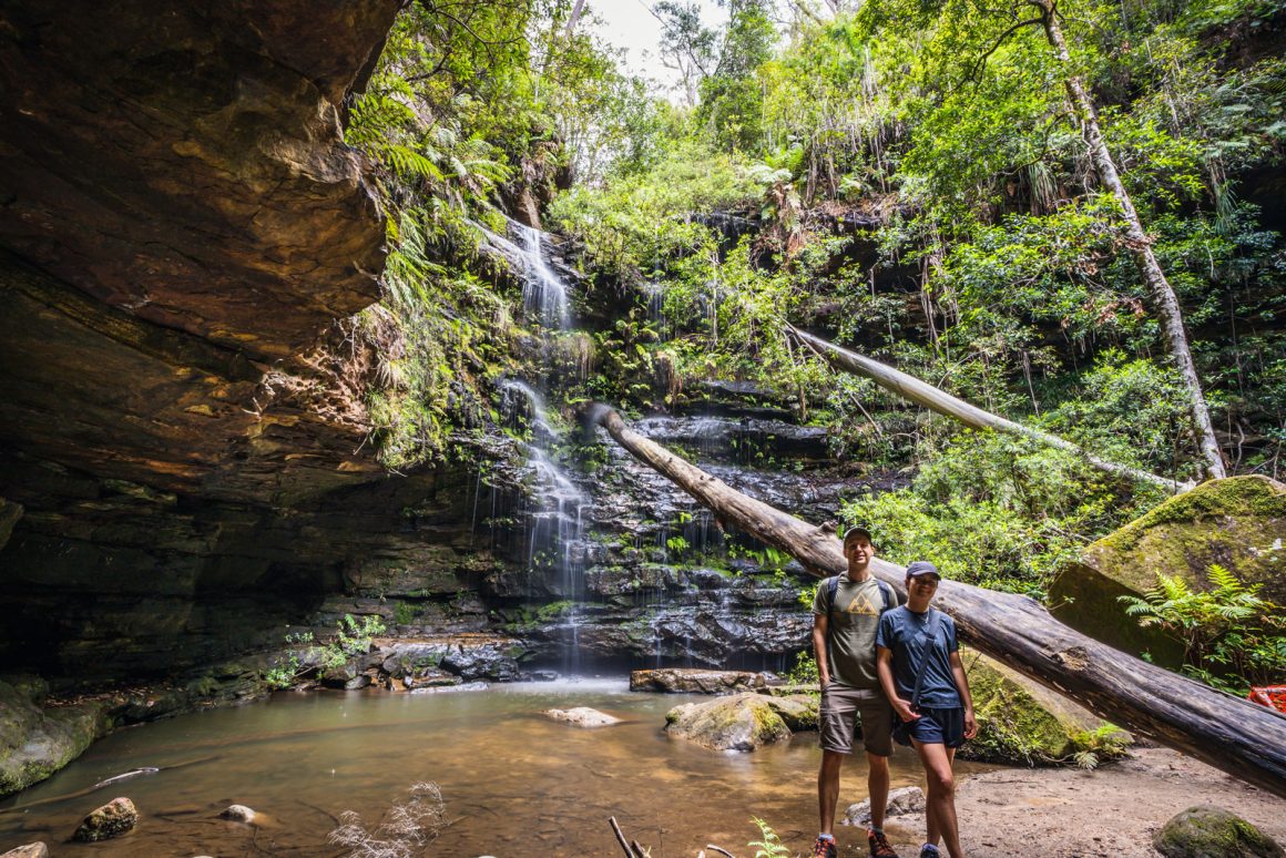
The Empire Pass Walking Track, also known as the North Lawson Waterfall Circuit, offers a delightful 5.1 km loop through lush rainforest, showcasing a series of picturesque waterfalls.
Starting from North Lawson Park, the trail leads you to Fairy Falls, Dantes Glen, St Michael’s Falls, and Frederica Falls, each with its unique charm.

The path meanders alongside creeks, over stepping stones, and through fern-filled gullies, providing a serene and immersive bushwalking experience.
While the track includes some steep sections and uneven surfaces, recent upgrades have improved its accessibility, making it suitable for moderately fit hikers.
#16 South Lawson 5 Waterfall Circuit
- Start & Finish: North or South Honour Avenue Car Park
- Distance: 3.1km circuit
- Elevation Gain: 117 m
- Time: 1-2 hours
- Difficulty: Medium
- Full Trail Guide: South Lawson 5 Waterfall Circuit Walk
- Trail Video: Click here to watch on YouTube
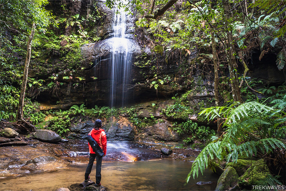
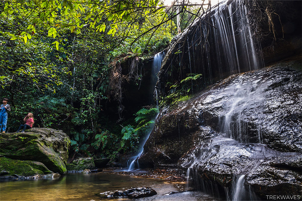
If you’re after a relaxing walk filled with natural beauty but away from the crowds, the South Lawson 5 Waterfall Circuit is a perfect pick.
This 3.1 km loop walk winds through beautiful forest and creek gullies, passing by 5 lovely waterfalls: Upper Cataract, Cataract, Federal, Junction, and Adelina Falls.
Most are just a short distance apart, offering a constant sense of reward as you move through the trail.
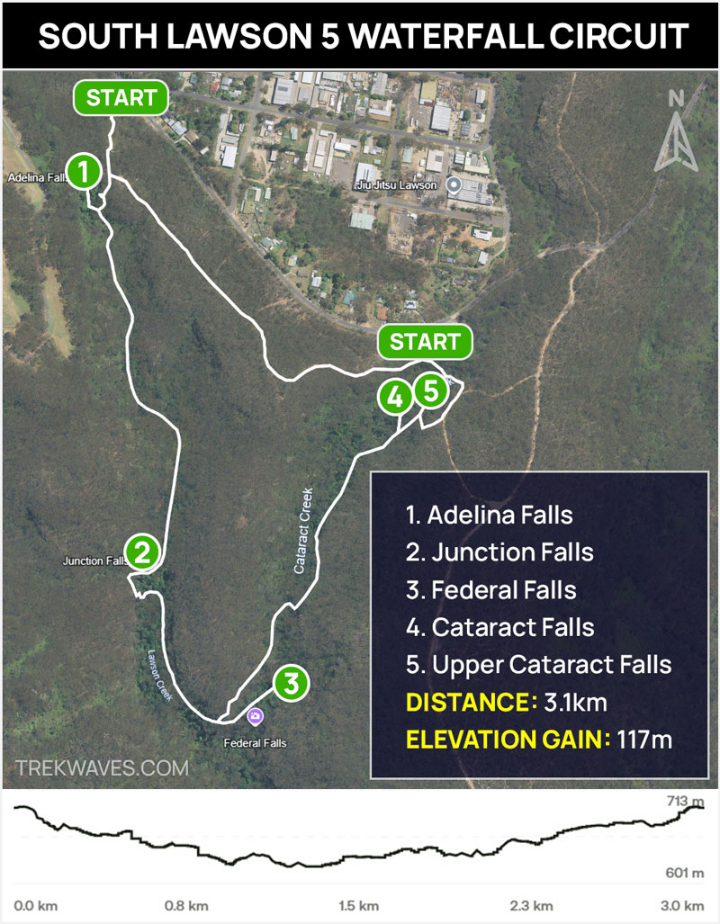
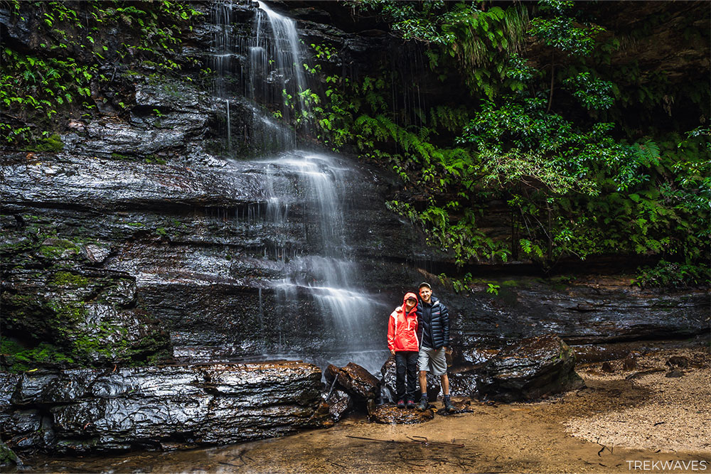
It’s one of the few dog-friendly bushwalks in the Blue Mountains, and with a relatively gentle grade, it’s a great choice for walkers of all ages.
After rain, the waterfalls truly come alive, and the entire trail feels like a rainforest retreat. Peaceful, scenic, and easy to access — this local favourite is ideal for a quick nature escape.
#15 Terrace Falls Circuit
- Start & Finish: The end of Lake Road
- Distance: 5km circuit
- Elevation Gain: 186 m
- Time: 2-3 hours
- Difficulty: Medium
- Trail Video: Click here to watch on YouTube
The Terrace Falls Circuit is hands down my favourite waterfall hike around the Lawson area. While other tracks may be better known, this one offers the most beautiful waterfalls and the strongest sense of remoteness — making it feel like a true hidden gem of the Blue Mountains.
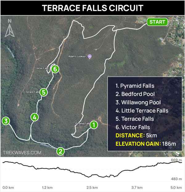
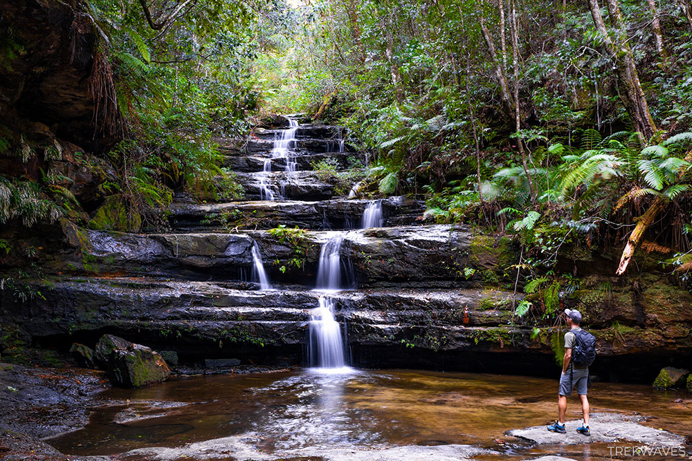
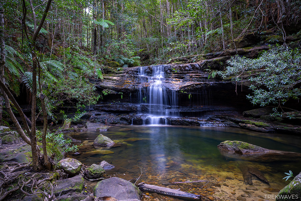
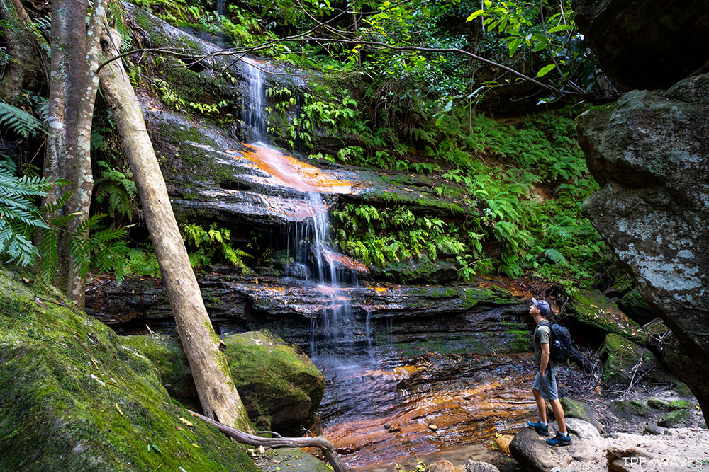
This moderate 5km circuit takes you deep into the forest, winding past a series of stunning cascades including Pyramid Falls, Terrace Falls and Victor Falls.
After decent rain, the waterfalls come to life, tumbling over mossy rock ledges and pooling into tranquil, fern-lined creeks.
The trail itself feels far removed from civilization — quiet, peaceful, and surrounded by towering eucalypts and rainforest undergrowth.
Central Blue Mountains
The Central Blue Mountains are home to the region’s most iconic and accessible hikes, making them an ideal starting point for first-time visitors.
Centered around the popular towns of Katoomba, Leura, and Wentworth Falls, this area offers a stunning introduction to the dramatic cliffs, lush valleys, and world-class waterfalls that define the Blue Mountains experience.
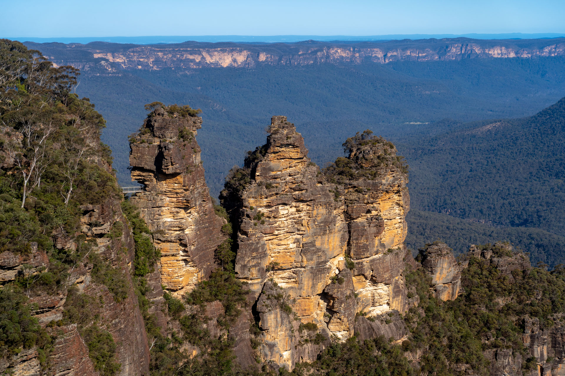
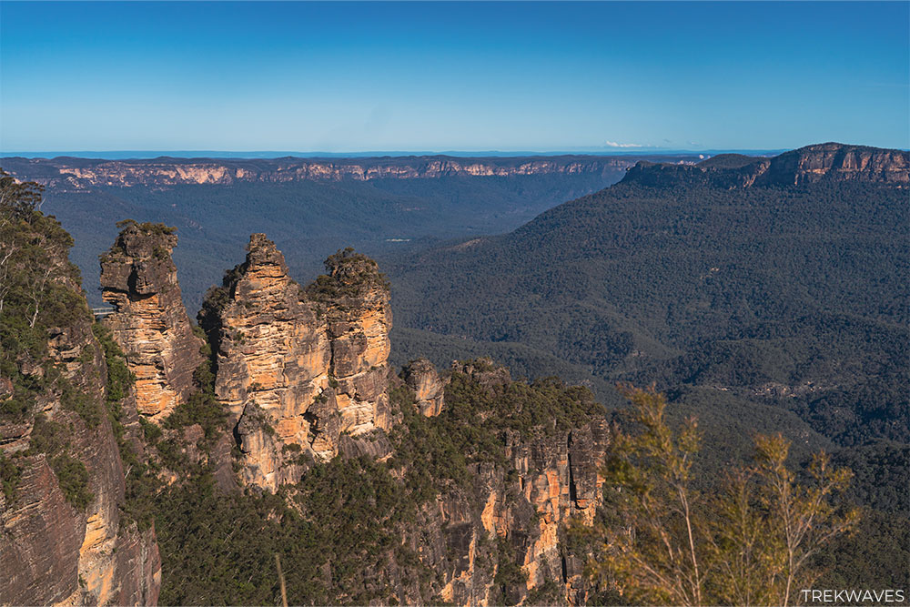
If you’re visiting the Blue Mountains for just a day or two, you’ll likely head straight to Echo Point Lookout for its panoramic views of the Three Sisters and the vast Jamison Valley. It’s the perfect intro to the region’s dramatic landscapes.
Nearby, Scenic World offers a fun way to explore the rainforest below, with its iconic skyway, boardwalk, and the world’s steepest railway overlooking Katoomba Falls.
#14 Minnehaha Falls
- Start & Finish: Minnehaha Reserve Carpark
- Distance: 2.3km return
- Elevation Gain: 72 m
- Time: 1 hour
- Difficulty: Easy / Medium (steep section towards the end of the trail)
- Full Trail Guide: Minnehaha Falls: Best Swimming Spot in Blue Mountains?
- Trail Video: Click here to watch on YouTube
If you’re craving a refreshing dip beneath a gorgeous waterfall without having to trek for hours, Minnehaha Falls, located north of Katoomba, is a perfect choice.
This short 2.3 km return walk takes you through classic Blue Mountains bushland before dropping into a hidden gorge, where a stunning 20-meter cascade plunges into a deep swimming hole.
It’s hands-down one of the best spots to cool off in summer — and it still feels like a bit of a local secret.
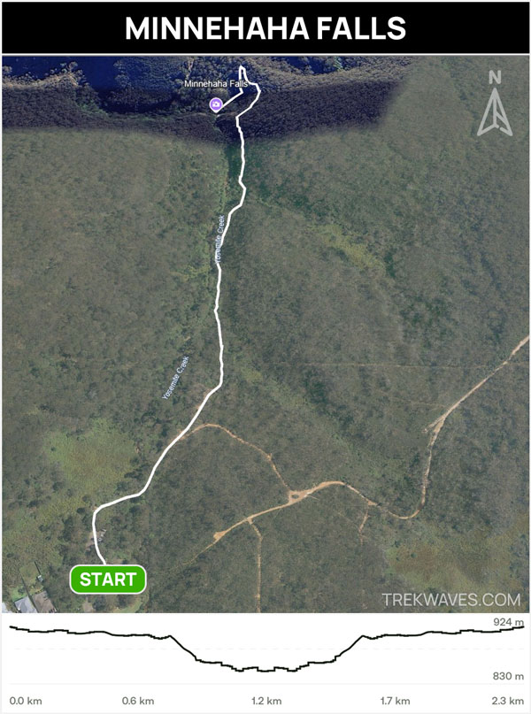

The track starts from Minnehaha Reserve and is relatively easy-going at first, but expect a bit of a steep descent near the end with stairs leading you down to the base of the falls.
Just take your time and wear sturdy shoes — especially if it’s been raining, as it can get muddy and slippery.
The scenery down at the falls makes it all worth it. Whether you’re after a swim or just want to relax on the rocks and enjoy the peaceful atmosphere, this is one of the most rewarding short walks in the area.

#13 Dardanelles Pass Circuit
- Start & Finish: Echo Tree Lookout along Cliff Dr
- Distance: 6.2km circuit
- Elevation Gain: 450 m
- Time: 3-4 hours
- Difficulty: Medium / Hard (lots of steps)
The Dardanelles Pass Circuit is a stunning rainforest trail best accessed from the small car park near Echo Tree Lookout along Cliff Drive.
While starting from Echo Point is an option — and offers iconic views of the Three Sisters and Jamison Valley — just know that it comes with a price tag due to expensive timed parking.
Beginning at Echo Tree Lookout gives you almost the same access, minus the stress and cost.
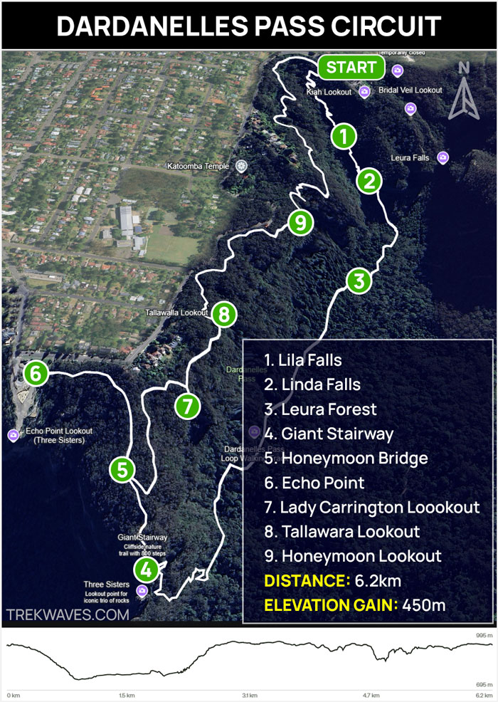
Right from the start, you’re surrounded by nature and within minutes begin your descent into the lush Leura Forest.
The path follows the scenic Dardanelles Pass, leading you past charming spots like Marguerite Cascades and Linda Falls. There’s a peacefulness here that’s hard to find near the busier sections of the Blue Mountains
After following the Dardanelles Pass beneath the towering cliffs, prepare for a challenge: the steep ascent up the Giant Stairway. This climb features 998 narrow sandstone steps so prepare for a good workout!
Once you reach Echo Point, take a moment to soak in the iconic panorama before continuing your journey along the Prince Henry Cliff Walk. This clifftop path guides you past a string of breathtaking lookouts offering sweeping views over the Jamison Valley.
#12 Katoomba Falls Round Walk
- Start & Finish: Scenic World
- Distance: 2-3km circuit
- Elevation Gain: 160 m
- Time: 1.5-2.5 hours
- Difficulty: Easy / Medium (steep descent)
- Full Trail Guide: Katoomba Falls Round Walk – Blue Mountains
- Trail Video: Click here to watch on YouTube
If you’re after a short but stunning walk near Katoomba, the Katoomba Falls Round Walk is one of the best options.
Starting from Scenic World’s car park, the track winds through cliffside lookouts, forested trails, and offers multiple angles of the Katoomba Falls and Three Sisters.

You’ll catch the waterfall from a few different spots, but Juliet’s Balcony is the real standout — giving you a front-row seat to the cascading water as it drops into the gorge below.
There are also some hidden gems along the way, like Witches Leap — with mossy boulders and trickling water giving the place a bit of a fairytale vibe.
Even though it’s so close to Scenic World, parts of the trail feel surprisingly quiet — especially down in the ferny gullies beneath the cliffs.
It’s perfect if you’re short on time but still want that full Blue Mountains experience — waterfalls, clifftop views, and peaceful bushland, all in one easy loop.

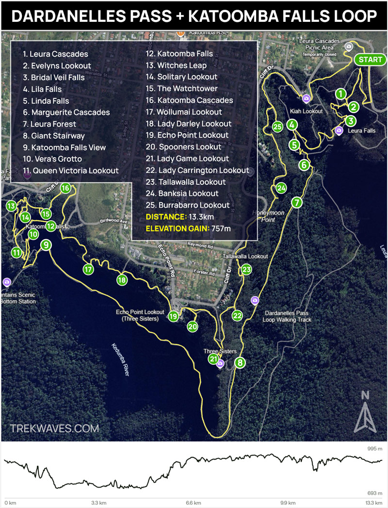
BONUS HIKE: Dardanelles Pass + Katoomba Falls Round Walk
If you’re after a longer and more rewarding hike, you can combine #13 Dardanelles Pass Circuit and #12 Katoomba Falls Round Walk into one full-day loop that links two of the most scenic areas in the Blue Mountains.
Start at Leura Cascades and follow the Amphitheatre Track downhill — along the way, you’ll pass the beautiful Bridal Veil Falls, a great early highlight.
Then continue onto Dardanelles Pass, a quieter section of trail that runs below the cliffs of the Three Sisters.
Instead of climbing back up the Giant Stairway, stay on the Federal Pass and follow it west toward Katoomba Falls.
This part of the track offers impressive cliff views and connects directly with the Katoomba Falls Round Walk, where you can enjoy even more lookouts and rainforest scenery.
#11 Mt Solitary via Ruined Castle
- Start & Finish: Glenraphael Drive (Golden Stairs trailhead)
- Distance: 15.4km return
- Elevation Gain: 972 m
- Time: 1 full day or 2 days (overnight hike)
- Difficulty: Hard
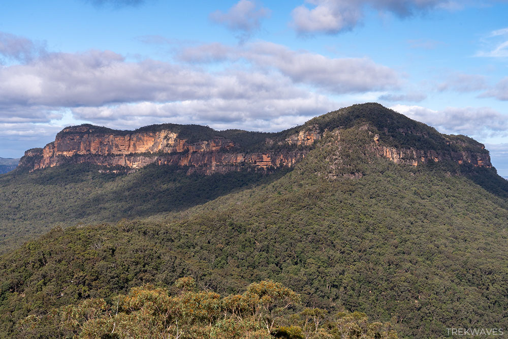
Mount Solitary via the Golden Stairs and Ruined Castle is a serious hike in the Blue Mountains.
While it’s possible to do the full hike to Mount Solitary and back in a day, it’s a big effort. A more manageable option is to hike only as far as Ruined Castle—still a rewarding day walk with excellent views—or to turn it into an overnight trip by camping atop Mount Solitary.
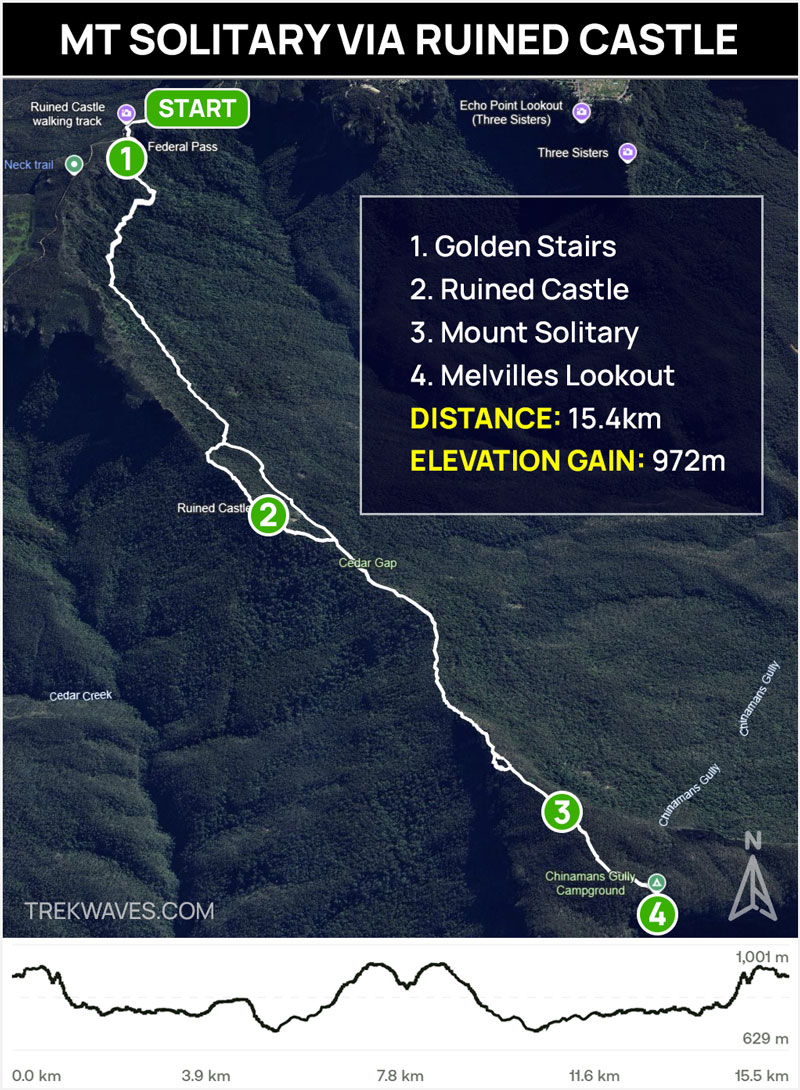
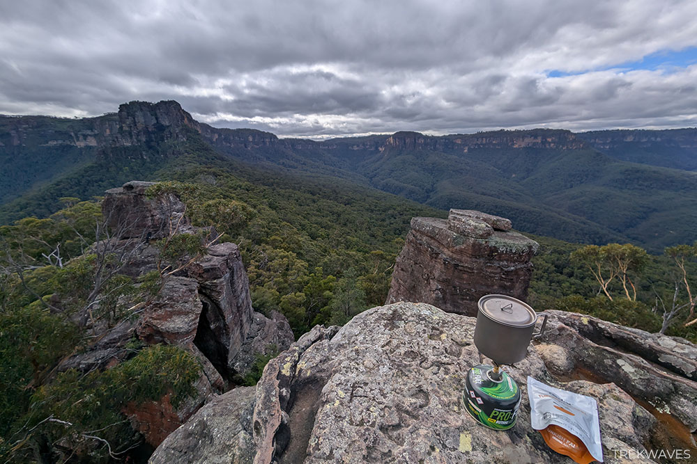
The trail drops steeply into the Jamison Valley via the Golden Stairs, winds through lush forest along the Federal Pass, and then climbs up to the dramatic outcrop of Ruined Castle.
If you continue on, the path becomes rougher as it ascends the narrow Korowal Knife Edge ridge to reach Mount Solitary’s summit.
This is easily among the most challenging and isolated hikes around, so don’t underestimate it. If you’re keen on a tougher, less-traveled trail, Mount Solitary is well worth it.
I did it in one day, but next time I’d turn it into an overnighter to make the experience a bit more relaxed and enjoyable.
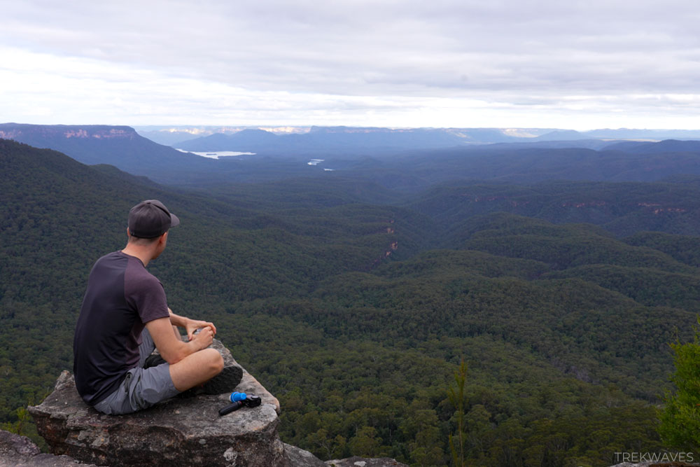
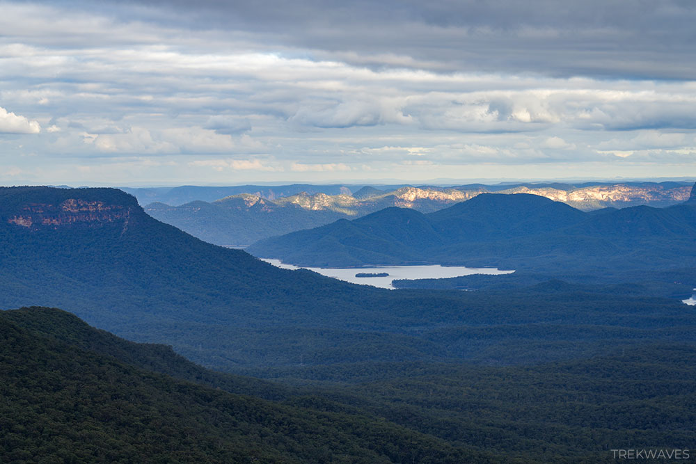
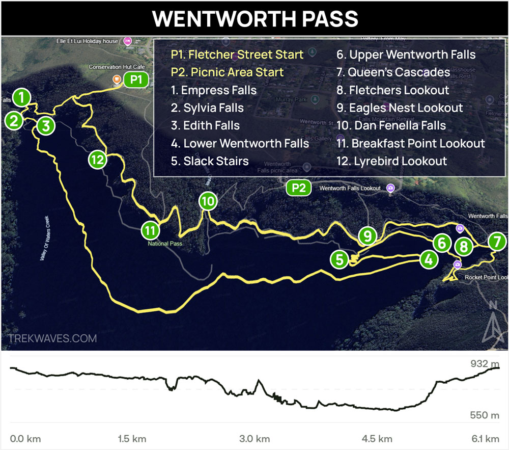
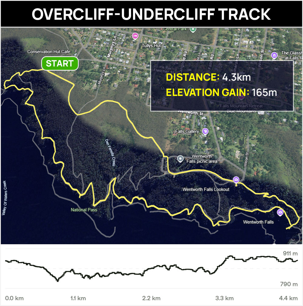
#10 Wentworth Pass
- Start & Finish: Fletcher Street or Wentworth Falls Picnic Area Car Park
- Distance: 6.1km circuit
- Elevation Gain: 515 m
- Time: 3-4 hours
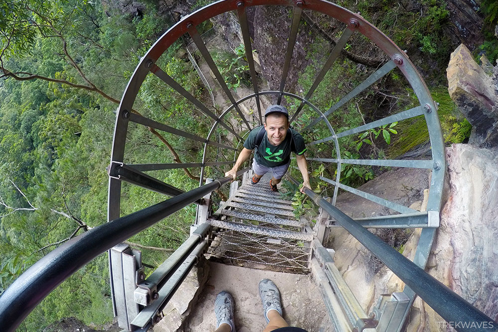
- Difficulty: Medium / Hard (steep stairs)
Wentworth Pass in Wentworth Falls has long been one of my favourite day hikes in the Blue Mountains—packed with adventure, waterfalls, ladders, and rainforest sections that feel truly wild.
I’ve done this one multiple times in the past, and it absolutely deserves to be considered one of the best circuits in the region.
Sadly, much like my second favourite, the National Pass—which runs parallel to Wentworth Pass—this trail has been closed for several years due to landslide damage and safety concerns, which is why it no longer ranks at the top of my list.
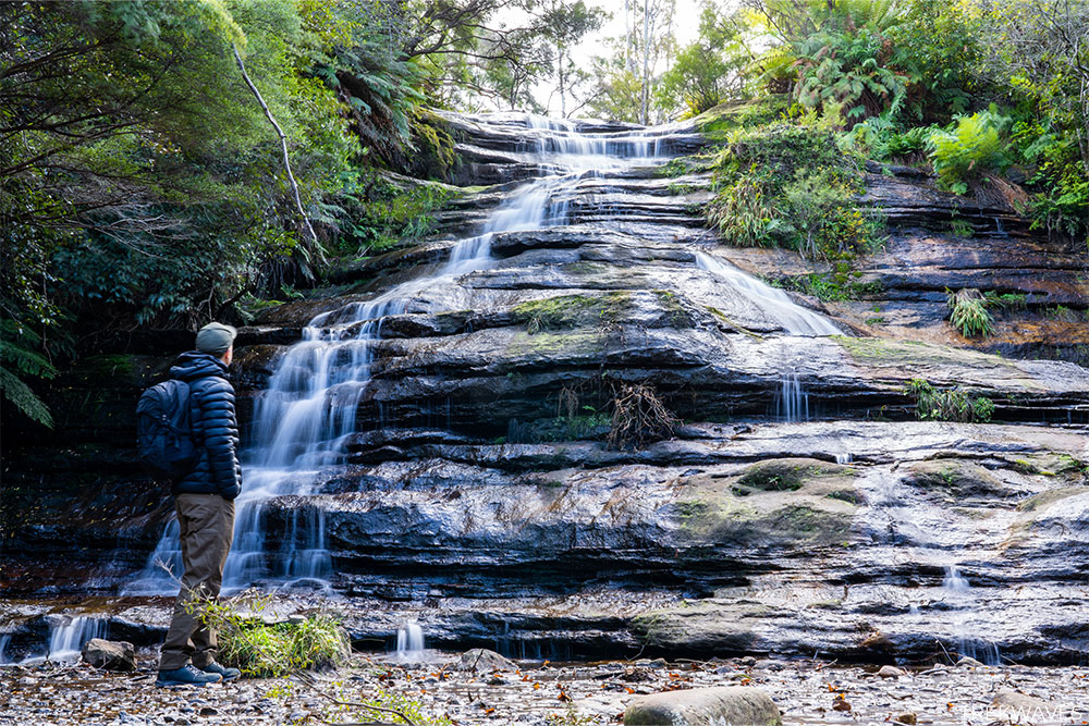
Still, the area has plenty to offer. If the main pass is closed, I suggest parking at Fletcher Street car park and heading down to Empress Falls—a short but scenic hike with several waterfalls along the way.
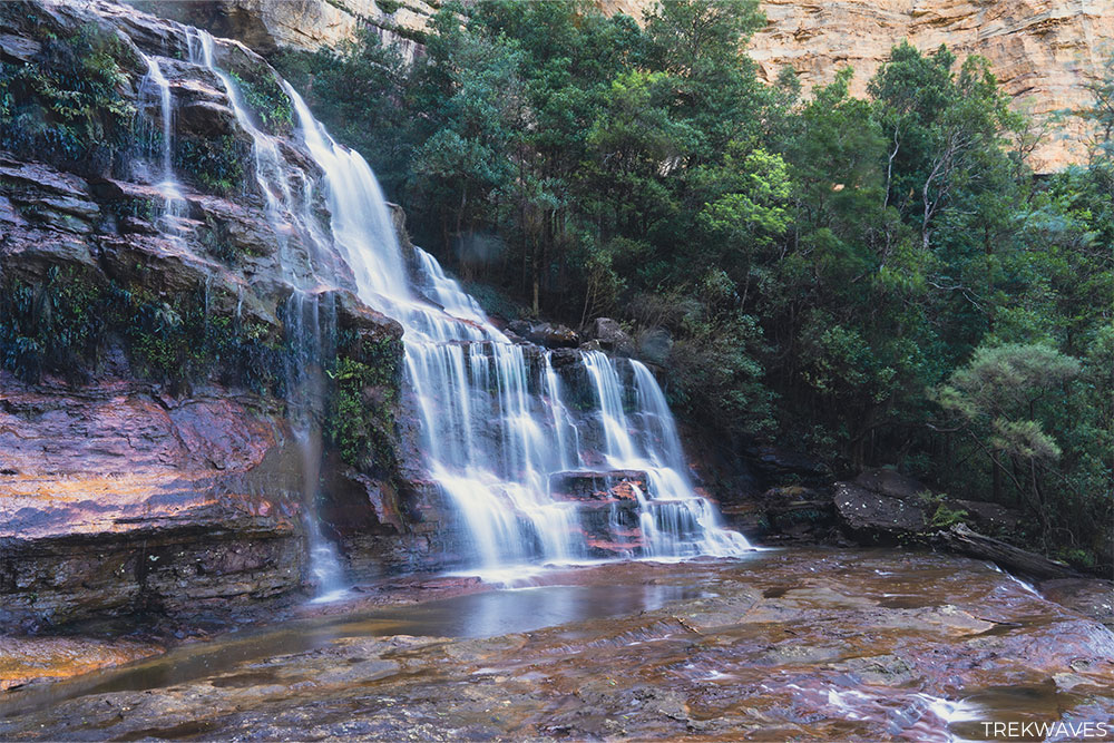
From there, you can either continue along the Overcliff Track for some amazing clifftop views, or drive to the main Wentworth Falls Picnic Area and follow the steps down to Upper Wentworth Falls, which is another iconic viewpoint that never disappoints.
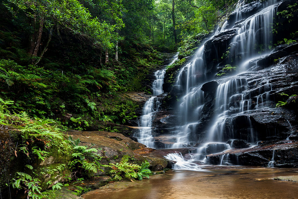
For those wanting a less strenuous option, the Overcliff-Undercliff Track offers a scenic and easier alternative without dropping into the Valley of the Waters.
But if you’re up for the steps, it’s absolutely worth the effort. The waterfalls down there are among the most beautiful in the entire Blue Mountains, and being able to stand right beside them makes for a far more immersive experience than simply viewing them from above.
Upper Blue Mountains
If you’re after raw scenery and a quieter, more immersive bushwalking experience, head straight to the Upper Blue Mountains.
The Blackheath and Mount Victoria area sits at the highest elevation in the region, giving you access to some of the most striking clifftop lookouts, deep valleys, and beautiful rock features.
Trails here feel more remote and less trafficked than those closer to Katoomba, and the cooler mountain air makes hiking even more enjoyable.
It’s no surprise that many of my top Blue Mountains walks are based up here—this area simply delivers on all fronts when it comes to natural beauty and sense of escape.
#9 Asgard Swamp & Thor Head Trail
- Start & Finish: Victoria Falls Road
- Distance: 8.7km return
- Elevation Gain: 288 m
- Time: Half day
- Difficulty: Medium
- Full Trail Guide: Asgard Swamp & Thor Head Trail With Epic Views
- Trail Video: Click here to watch on YouTube
The trail to Asgard Swamp and Thor Head is a hidden gem on the northern edge of the Blue Mountains, starting just off Victoria Falls Road near Mount Victoria.
Located near Mount Victoria, this moderately challenging walk takes you along the Asgard Swamp Fire Trail, with detours to Asgard Swamp, Thor Head, Asgard Mine and Asgard Head.

One of the standout features is Thor Head, a rocky outcrop that provides panoramic views over the Grose Valley. Reaching this vantage point involves a short, unmarked side trail, but the effort is rewarded with some of the most breathtaking scenery in the region.
Another point of interest is the historic Asgard Mine and Kiln, remnants of a 19th-century coal mining operation. The mine entrance extends approximately 30 meters into the hillside, so bringing a torch is advisable if you wish to explore inside.
But the real highlight here is Asgard Head — one of my absolute favourite lookouts in the Blue Mountains. Towering above the Grose Valley, this remote cliff edge offers expansive views all the way to the massive cascade of Victoria Falls.
It’s high, wild, and far less trafficked than most other viewpoints in the region, which adds to the feeling of discovery.


#8 Victoria Falls Trail
- Start & Finish: Victoria Falls Road
- Distance: 4.4km return
- Elevation Gain: 400 m
- Time: 2-3 hours (or half day to fully enjoy the falls)
- Difficulty: Medium / Hard (very steep stairs)
- Full Trail Guide: Victoria Falls Walking Track
- Trail Video: Click here to watch on YouTube
If you’re looking for a remote waterfall adventure without the crowds, Victoria Falls Walking Track near Mount Victoria is a great pick — and easily one of my favourite less-travelled hikes in the Blue Mountains.
The walk starts with a scenic lookout over the Grose Valley before plunging into a quiet forest where you’ll follow the path of Victoria Creek all the way to the base of the falls.
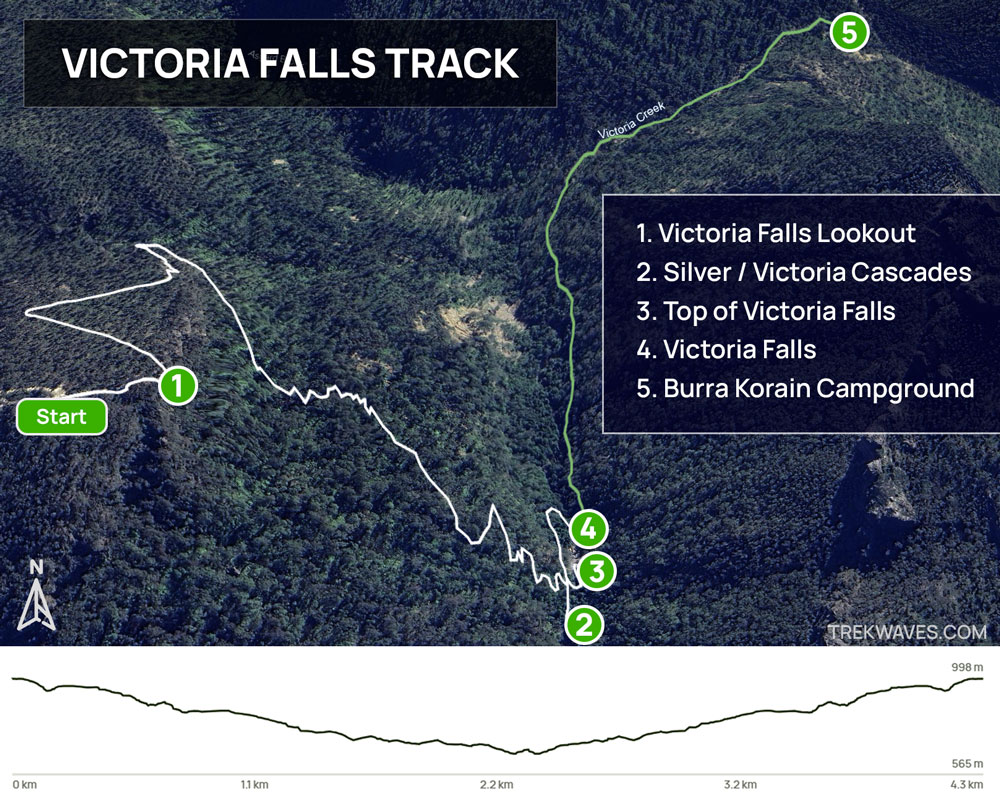
One of my favourite stops along the way is the Victoria Creek Cascades — a quiet, fern-lined area with a small waterfall and inviting pools that are great for a refreshing dip.
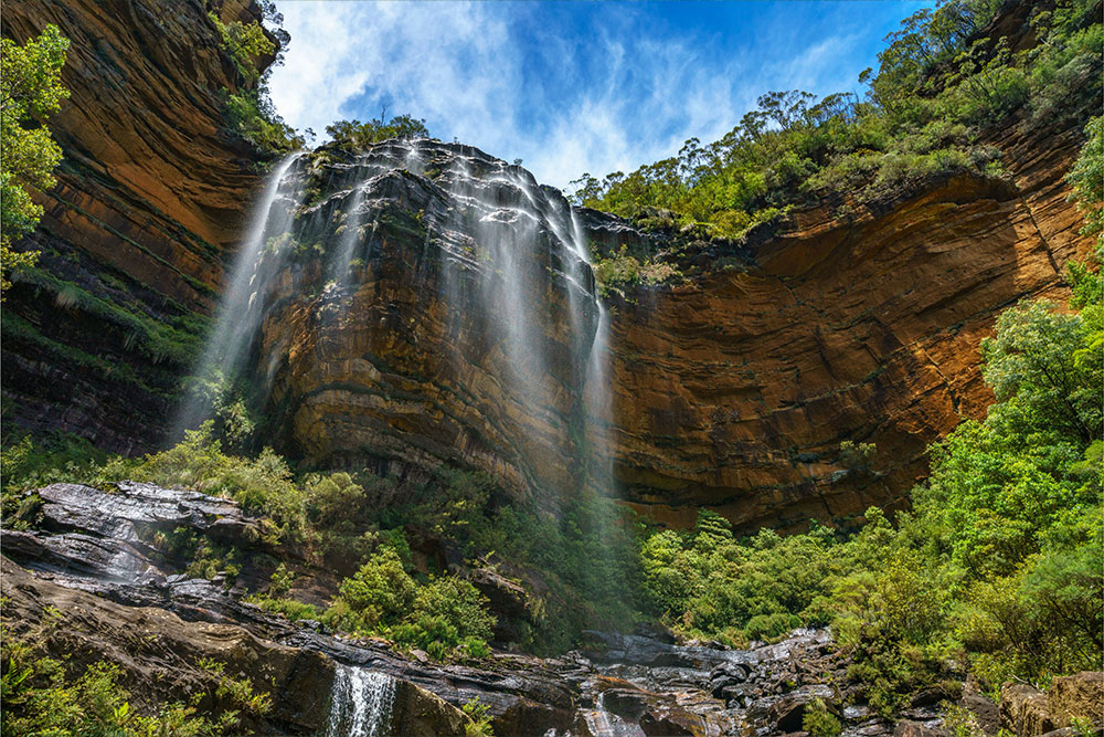
The highlight, of course, is Victoria Falls itself. The waterfall drops dramatically over a sandstone ledge into a crystal-clear pool surrounded by towering cliffs.
I found the view from below absolutely stunning — standing there listening to the rush of water was one of the most peaceful moments I’ve had in the mountains.
Just keep in mind that the return walk is a steep climb, so come prepared with water and decent fitness.
For those wanting to extend the adventure, this track links into longer routes like the Blue Gum Forest Track, but it’s best done as a full-day or overnight mission.
If you’re not quite ready to tackle the full journey but still want to venture further, a great option is to follow the creek downstream to Burra Korain Campground.
#7 Butterbox Point & Mt Hay Summit
- Start & Finish: Mount Hay & Butterbox Point Carpark
- Distance: 5.5 km return (Butterbox Point + Mt Hay summit)
- Elevation Gain: 252 m
- Time: 2-3 hours
- Difficulty: Medium
- Full Trail Guide: Butterbox Point Trail Guide
- Trail Video: Click here to watch on YouTube
Butterbox Point is one of those short Blue Mountains walks that feels far more adventurous than you’d expect.
Located at the end of Mount Hay Road, this 3 km return trail quickly immerses you in the dramatic landscapes of the Grose Valley.
Despite the relatively short distance, it’s packed with excitement—there are narrow sections with sheer drops, crumbling cliff edges, and some of the most expansive views in the region.


Early in the trail, you’ll pass through rare hanging swamp—something most people don’t expect to find out here. Then the landscape changes fast, with ironstone formations and narrow cliffside paths adding a touch of adrenaline.
The final viewpoint at Butterbox Point is simply stunning. On a clear day, you’ll see Lockleys Pylon and Mount Banks towering in the distance, the vertical drop of Walford Wall, and endless layers of wilderness.
If you want even more, you can pair this with the nearby Mount Hay summit track. But even on its own, Butterbox Point is a standout experience.


#6 Lockleys Pylon Track
- Start & Finish: Lockleys Pylon Car Park, Mt Hay Road
- Distance: 7.1 km return
- Elevation Gain: 184 m
- Time: 2-3 hours
- Difficulty: Medium
- Full Trail Guide: Lockleys Pylon Walking Track: Comprehensive Guide
- Trail Video: Click here to watch on YouTube
If you’re looking for a trail with sweeping Grose Valley views and a bit more distance than Butterbox Point, Lockleys Pylon is a perfect choice.
Located along Mount Hay Road, this rewarding 7 km return walk offers a gentle climb through heathland before opening up to some of the most panoramic views in the Blue Mountains.
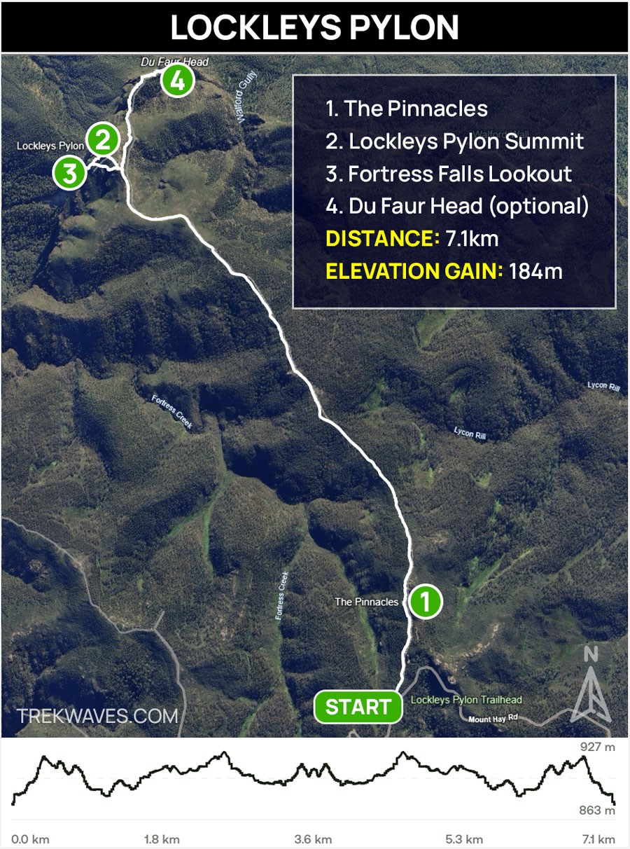
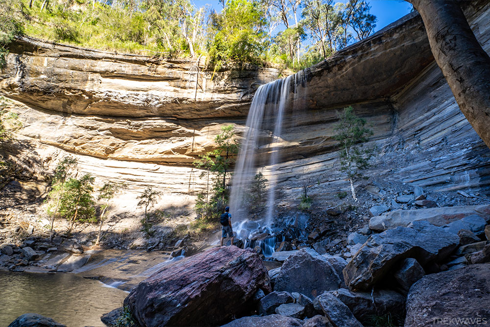
From the summit of Lockleys Pylon, you’ll be treated to a jaw-dropping vista across the Grose Valley, with Mount Banks and Mount Hay rising prominently on the horizon.
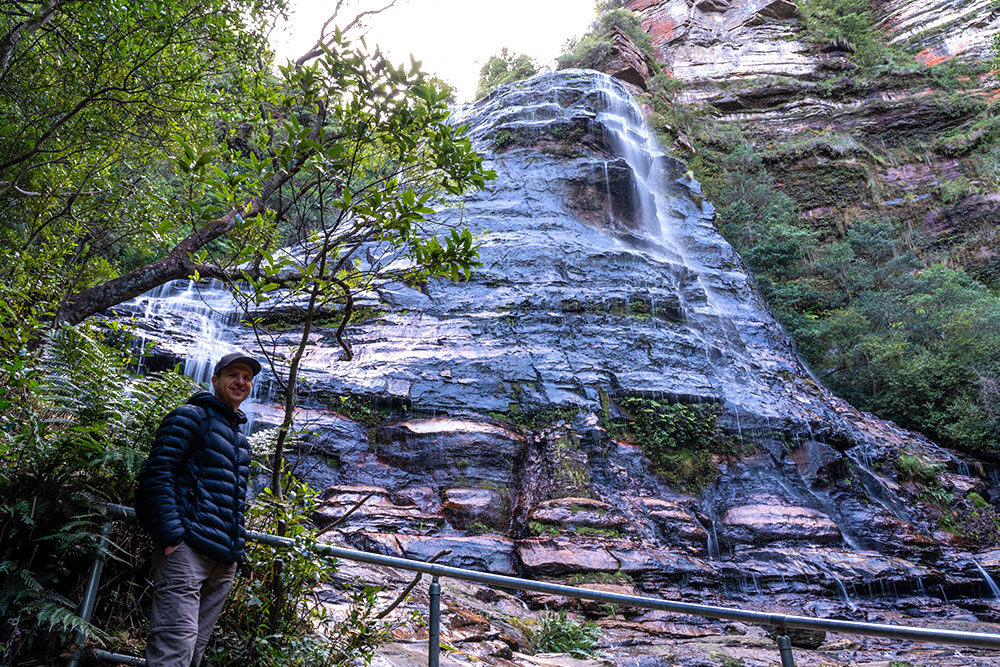
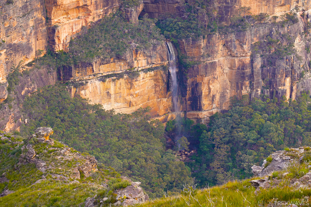
One of the highlights from this vantage point is the full view of Fortress Falls cascading down the far cliff wall — a spectacular sight that often catches people by surprise.
If you’re keen to take the experience further, you can continue along Shortridge Pass towards Du Faur Head for even more breathtaking perspectives of the valley.
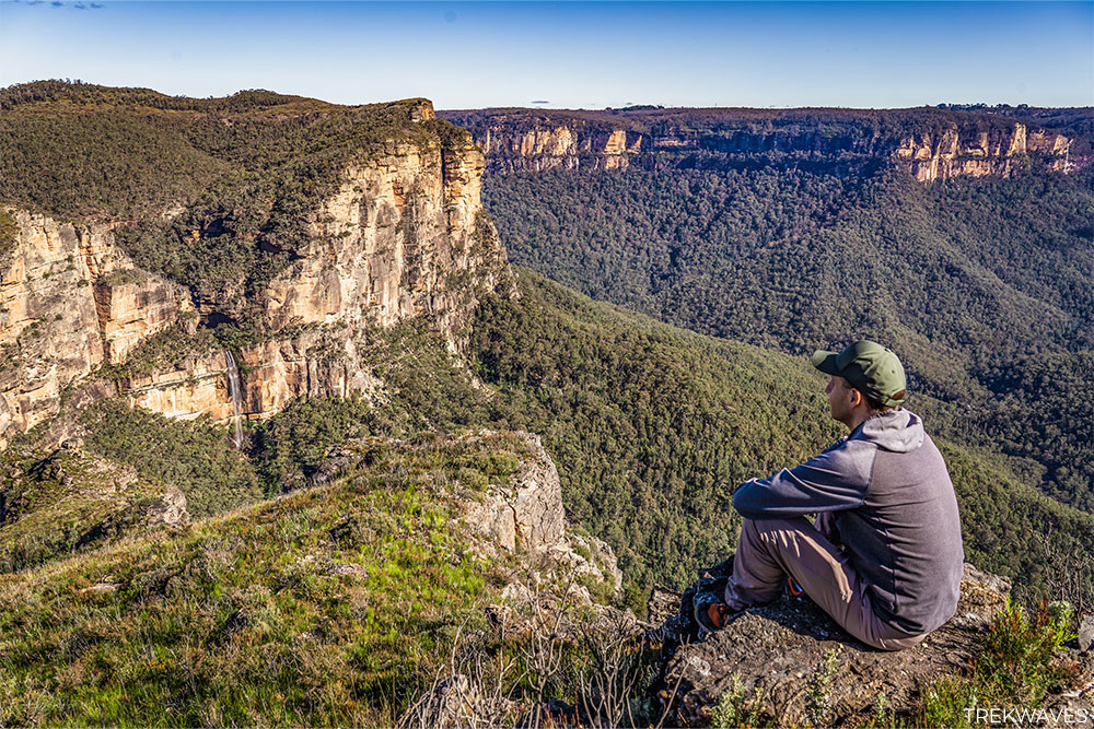
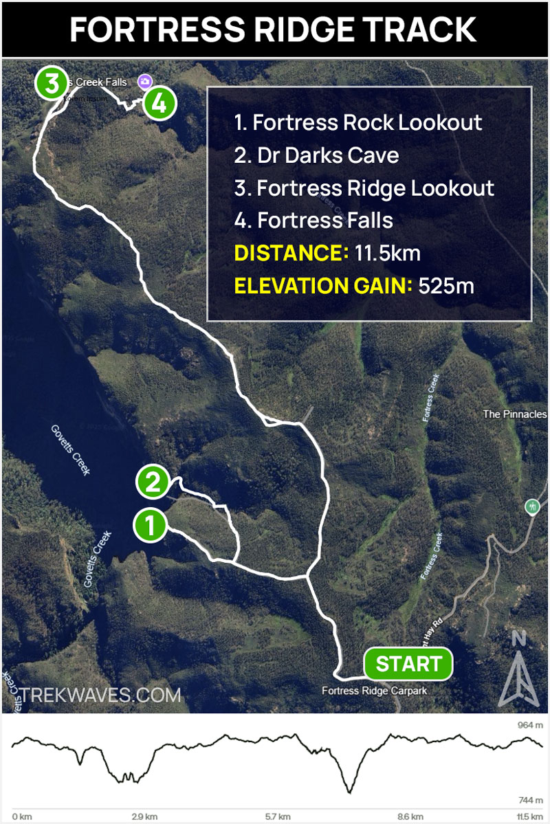
#5 Fortress Ridge & Fortress Falls
- Start & Finish: Fortress Ridge Car Park, Mt Hay Road
- Distance: 11.5 km return
- Elevation Gain: 525 m
- Time: At least half day
- Difficulty: Hard
- Trail Video: Click here to watch on YouTube
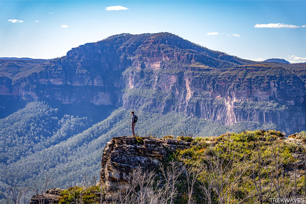
This is hands down my favourite trail along Mount Hay Road — and for good reason. Fortress Ridge offers a combination of jaw-dropping lookouts, exciting off-track detours, and a sense of remote adventure that’s hard to beat in the Blue Mountains.
I’m showing you the full trail map with optional detours to Fortress Rock Lookout, Dr Darks Cave, and Fortress Falls.
You don’t have to do it all — if you’re after a more relaxed day, you can simply head straight out to Fortress Ridge Lookout and return the same way.

However, if you’re up for more adventure, the side tracks offer incredible payoffs — just be prepared. The descents to both Dr Darks Cave and Fortress Falls are steep and shouldn’t be underestimated. A bit of scrambling is required, and care is essential.
But for those willing to make the effort, few spots rival the serene beauty of Fortress Falls or the hidden wonder of Dr Darks Cave.
This trail truly delivers on every level — sweeping views, hidden gems, and that thrilling sense of discovery that makes hiking in the Upper Blue Mountains so special.
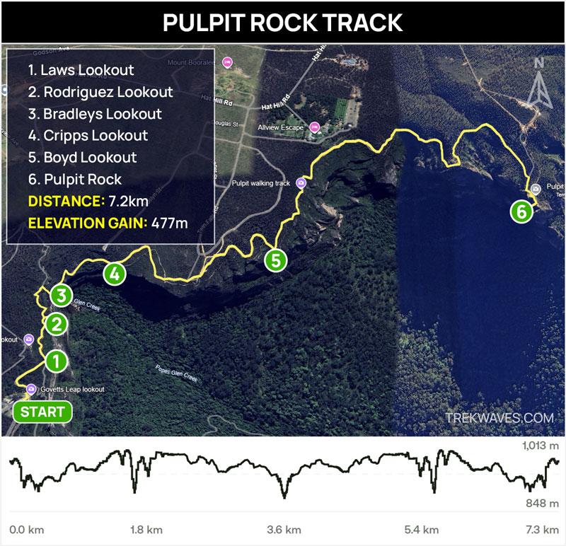
#4 Pulpit Rock
- Start & Finish: Govetts Leap
- Distance: 7.2km return
- Elevation Gain: 477 m
- Time: 4 hours
- Difficulty: Medium
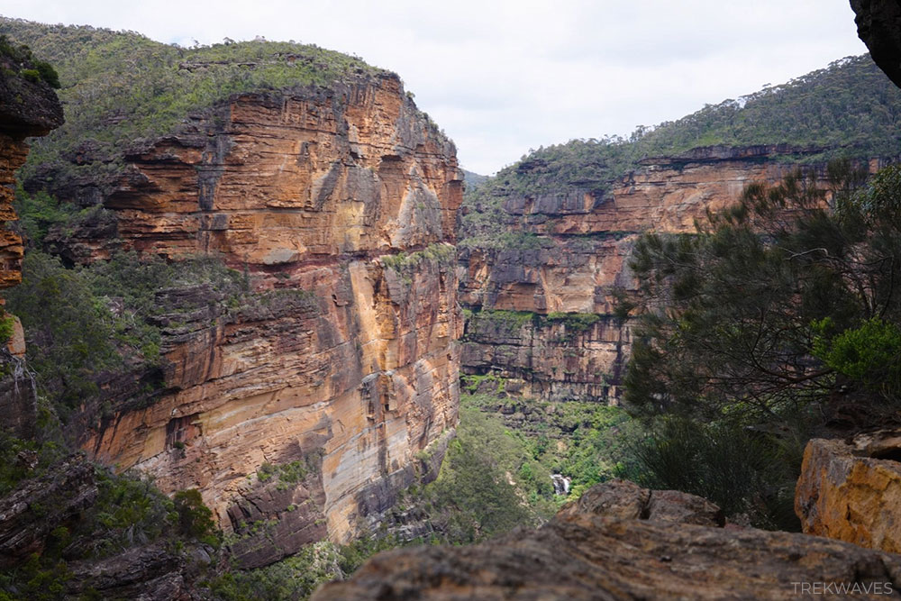
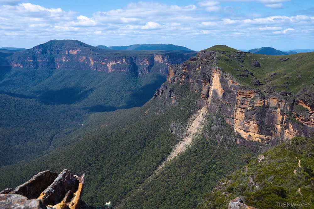
The walk from Govetts Leap to Pulpit Rock is a stunning clifftop trail in the Upper Blue Mountains, featuring some of the most dramatic views over the Grose Valley.
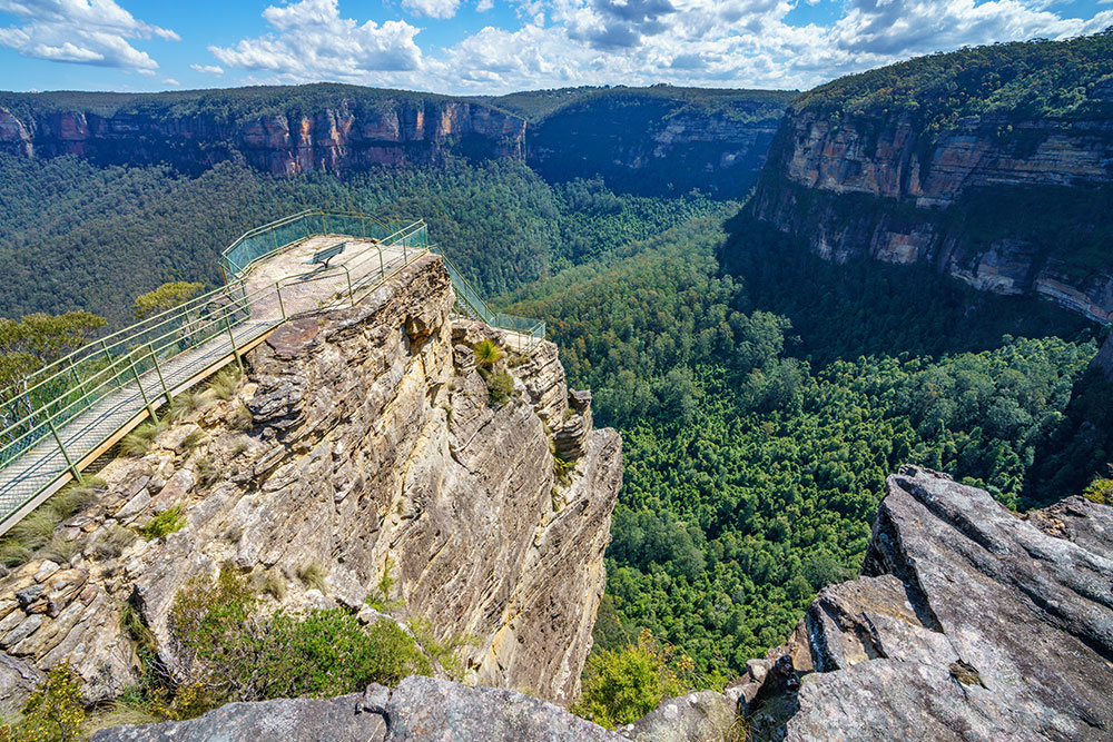
You’ll pass a series of scenic lookouts—Laws, Cripps, and Boyd—before reaching Pulpit Rock, which happens to be one of my absolute favourite viewpoints in the region.
The multi-tiered lookout offers sweeping, uninterrupted views over the valley and back toward the cliffs of Govetts Leap.
That said, it’s important to note that this track, including Pulpit Rock Lookout itself, has been closed for quite some time due to safety concerns following landslides and infrastructure damage.
While parts of the trail may still be accessible, I highly recommend checking the latest track status before planning your visit.
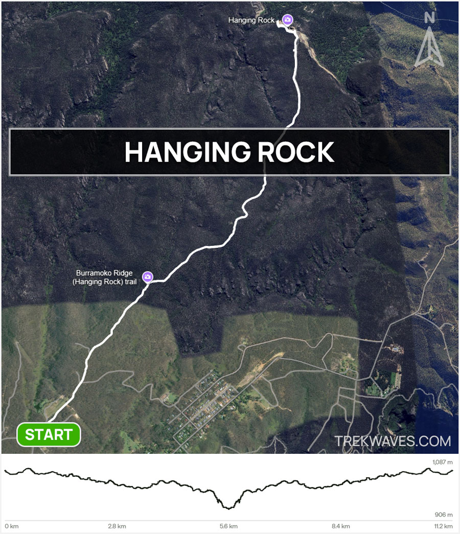
#3 Hanging Rock
- Start & Finish: Ridgewell Road, Blackheath
- Distance: 11.2 km return
- Elevation Gain: 285 m
- Time: +3 hours
- Difficulty: Medium
- Full Trail Guide: How To Find Hanging Rock in Blue Mountains
- Trail Video: Click here to watch on YouTube
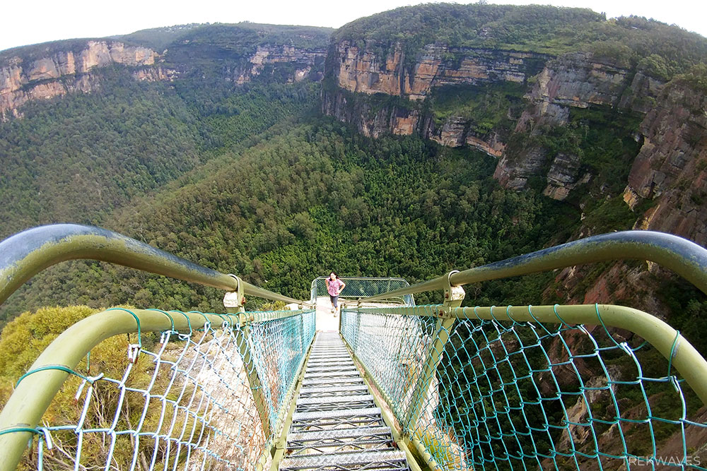
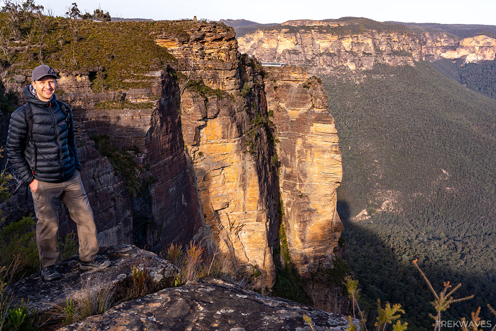
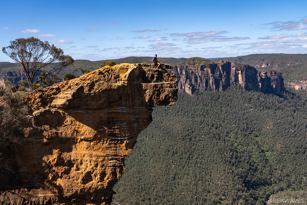
At first glance, the track out to Hanging Rock might not seem like much — most of the trail is a straightforward fire road through typical bushland. But don’t let that fool you. This is one of those hikes where the payoff comes in full force at the end.
Baltzer Lookout delivers sweeping, uninterrupted views over the Grose Valley, and just a few steps further is the dramatic Hanging Rock — a narrow sliver of sandstone split from the main cliff.

I’ve been out here several times, and it never gets old. On my most recent visit, I finally decided to make the leap across the gap and stand on Hanging Rock itself.
It’s not a move for the faint of heart — the drop on either side is sheer — but the thrill and views from the top are unforgettable!
Even if you don’t make the jump, just standing near the edge and taking in the grandeur of the Grose Valley is worth every step. It’s a short, accessible trail with a huge scenic payoff, and one I keep coming back to.

#2 Porters Pass & Colliers Causeway
- Start & Finish: End of the Burton Road
- Distance: 4.5 km circuit
- Elevation Gain: 301 m
- Time: +3 hours
- Difficulty: Medium / Hard
- Full Trail Guide: Porters Pass & Colliers Causeway Circuit
- Trail Video: Click here to watch on YouTube
Located on the western side of Blackheath, the Porters Pass Circuit via Colliers Causeway is one of the most underrated trails in the Blue Mountains — and easily one of my personal favourites.
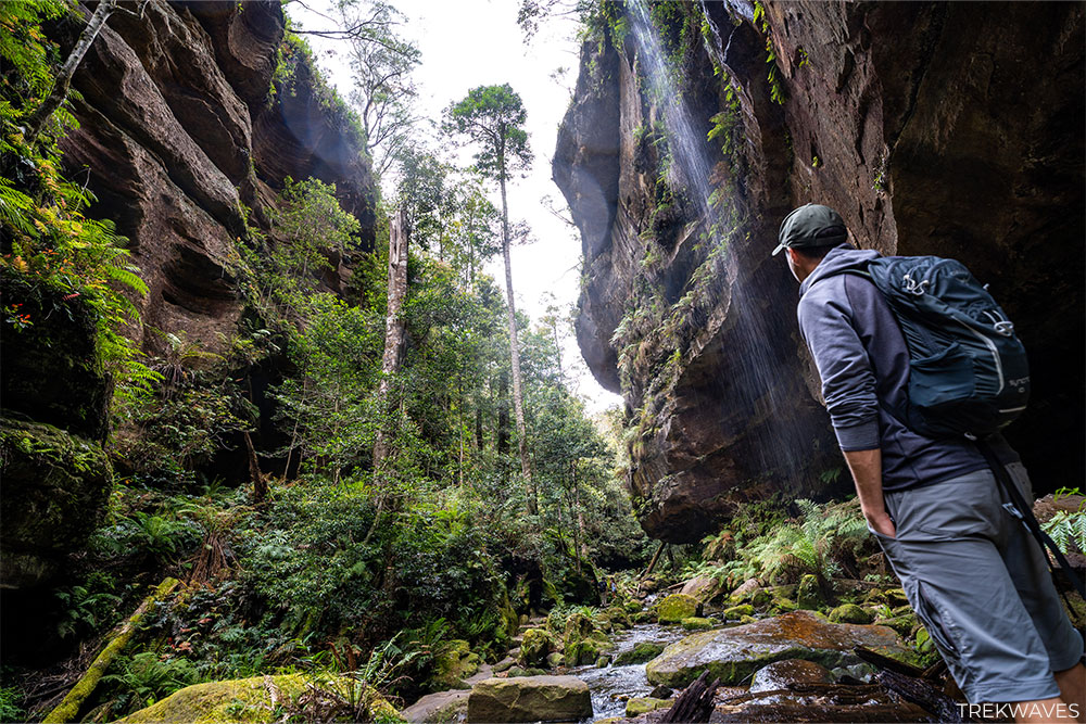
It’s got everything: narrow canyons, shaded rainforest gullies, mossy overhangs, towering cliffs, and sections that feel truly remote.
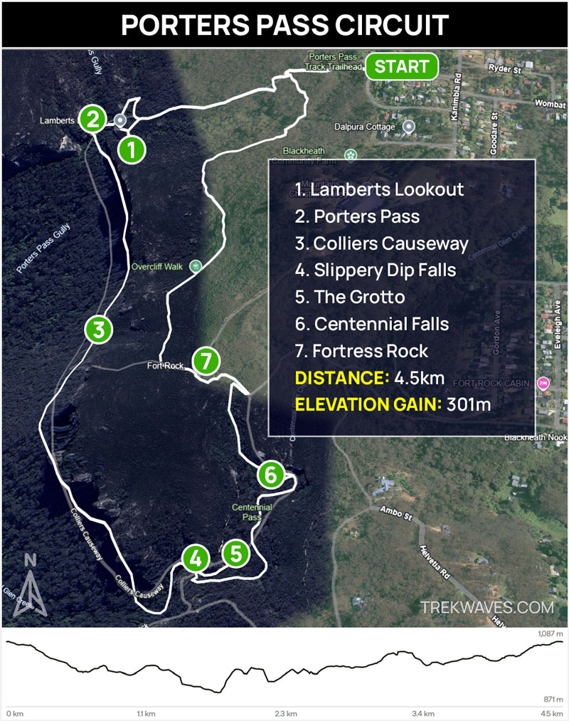
Kicking off from Burton Road, this loop takes you down into the cool, fern-filled world of Porters Pass before connecting to the narrow, scenic ledge of Colliers Causeway.
This is where the scale of the Blue Mountains really hits you — vertical walls rising dramatically above, often streaked with black water stains and lined with ferns.
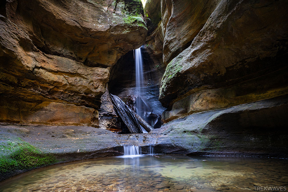
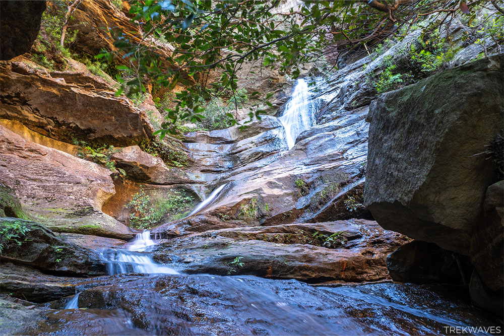
As you continue along the Causeway, you’ll pass through a few tighter sections before arriving at Slippery Dip Falls near the end. Just beyond that is The Grotto Canyon — my personal favourite part of the hike — with steep canyon walls, ferns and a real sense of being hidden away from the rest of the world.
From there, you’ll climb steadily out through Centennial Glen, where the bush opens up to panoramic views across the Kanimbla Valley at the Fort Rock. This upper section features crags popular with climbers and more cliff-hugging paths before leading back toward Blackheath.
It’s a solid half-day hike with variety, scenery and a quieter feel than many of the other well-known tracks in the area.

#1 Grand Canyon
- Start & Finish: Neates Glen or Evans Lookout Car Park
- Distance: 5.8 km circuit
- Elevation Gain: 301 m
- Time: +3 hours
- Difficulty: Medium
- Full Trail Guide: Grand Canyon Walk Blue Mountains: Comprehensive Guide
- Trail Video: Click here to watch on YouTube
The Grand Canyon Walk in Blackheath is one of the most spectacular short loops in the Blue Mountains — a true classic that offers a complete change of scenery as you descend into a lush, narrow sandstone gorge.
Starting from either Evans Lookout or Neates Glen, the trail descends deep into a dramatic canyon filled with dripping rock walls, dense tree ferns, and narrow winding paths carved beside Greaves Creek.


Once you’re below the escarpment, the track winds beside Greaves Creek, where ferns cling to the rocks, waterfalls trickle through the overhangs, and the towering canyon walls close in around you. It’s quiet, cool, and incredibly immersive — one of those rare trails that feels hidden in plain sight.
The loop has a completely different feel from the more exposed clifftop walks — it’s shady, cool, and rich with atmosphere. As you follow the creek through the gorge, the scenery is nothing short of magical, especially after recent rain when the waterfalls are flowing and the mossy walls glisten in the filtered light.
Although many quick-stop visitors to the Blue Mountains, especially tourists, tend to focus on the main lookouts, the real soul of the Blue Mountains lies in its intricate canyon systems, and this walk takes you straight to the heart of one of the most beautiful ones.
It’s not a tough walk, but it’s easily one of the most rewarding — and a strong reminder that the best views aren’t always the highest ones.
Found it Helpful? Pin it For Later!