Taking on the hike to Victoria Falls, hands down one of the most spectacular waterfalls in the Blue Mountains, involves tackling a short yet very steep 4.4 km return trail, which can be quite challenging, especially on the way back.
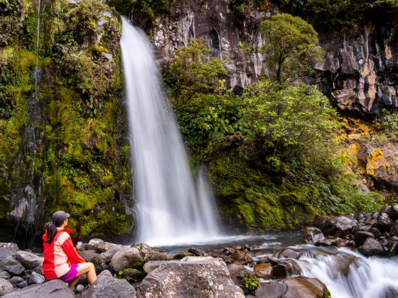
When you reach the bottom of the valley, you’re greeted by not one, but two gorgeous waterfalls, Victoria Cascades (also know as Silver Cascades) and Victoria Falls, with water so clear you’ll want to jump right in.
And as if that wasn’t enough, the path through the rainforest along the Victoria Creek leading to Burra Korain Campground is like something straight out of a fairy tale.
If this sounds like an adventure you’re excited to take on, then keep reading because I’m about to give you all the information you need to prep for this hike.
How To Get To Victoria Falls Trail
The Victoria Falls trail starts northeast of Mount Victoria town. It is roughly under a 2-hour drive from Sydney, covering a distance of around 125 kilometres
To get there, exit the Great Western Highway (A32) and follow the unsealed Victoria Falls Road for 5 kilometres. The road is mostly in good condition and can be driven with a 2WD vehicle despite a few potholes.
When you’re ready to head out, set your GPS coordinates to Victoria Falls Walking Track.
Victoria Falls Parking
The car park at Victoria Falls is free and offers about 15 spaces, along with a few picnic tables scattered around the area, and a small toilet.
Victoria Falls Trail Overview
Once you’ve parked your car and are ready to start walking, you’ll notice an information board with a map of the area at the trailhead.
This board provides good walking ideas for those interested in venturing further into the Blue Gum Forest and exploring the trails past the Burra Korain Campground.
Don’t be misled into thinking it will take 7-8 hours one way to reach the base of Victoria Falls just because of the main heading on the board.
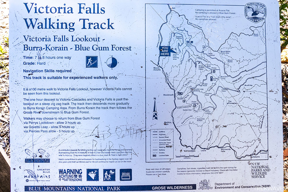
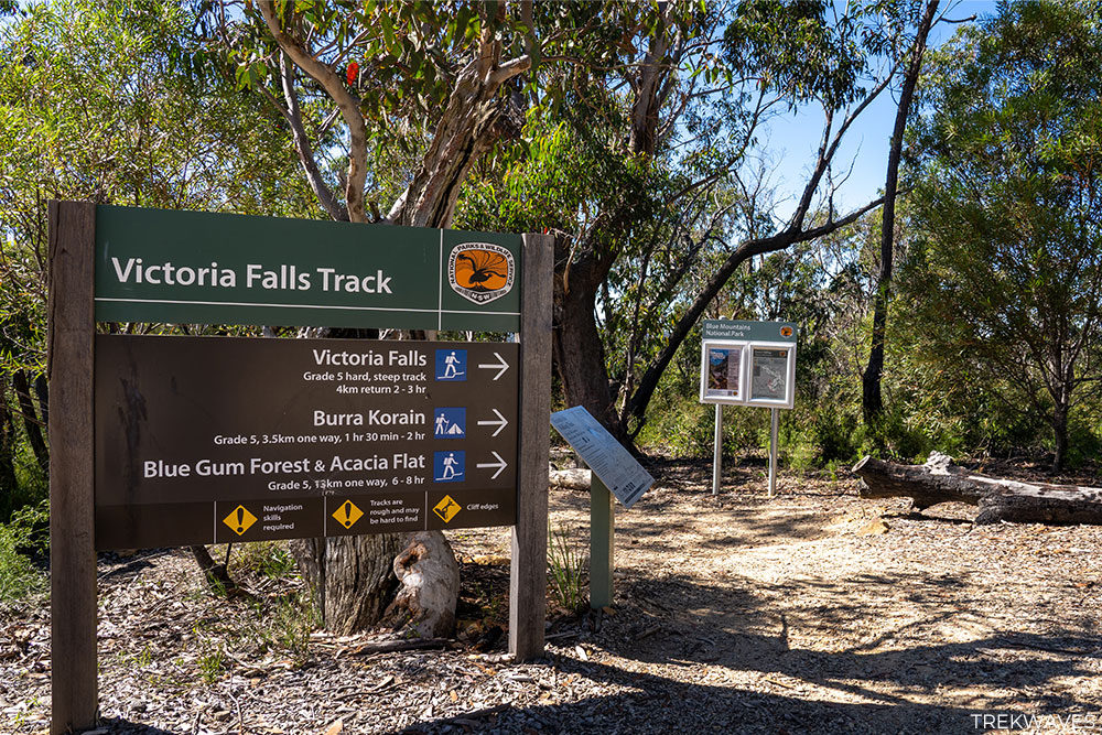
Here are the actual Victoria Falls Walking Track details:
- Distance: 4.4 km return
- Time: 2-3 hours (or half day to fully enjoy the falls)
- Elevation Gain: 400m
- Difficulty: Hard (steep climb on the way back)
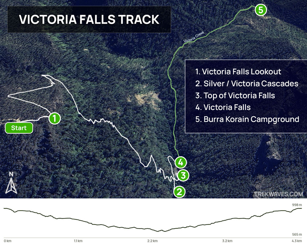
I made the decision to venture a bit farther from Victoria Falls along Victoria Creek towards Burra Korain Campground, and I found it to be very enjoyable.
During my hike, I made the decision to venture a bit farther from Victoria Falls along Victoria Creek towards Burra Korain Campground, and I found it to be very enjoyable.
This additional trek would add around 4 km to the overall walk and is marked as an optional route on the map below (green trail).
Trail to Victoria Falls Lookout
From the car park, you’ll start walking down a series of steps, and after about 150 meters, you’ll arrive at the Victoria Falls Lookout.
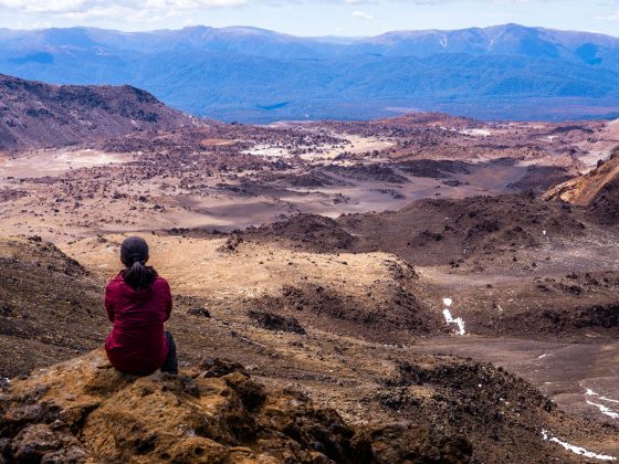
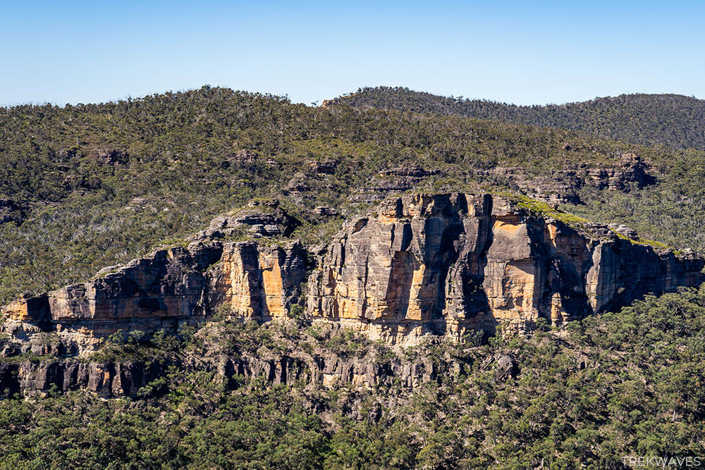
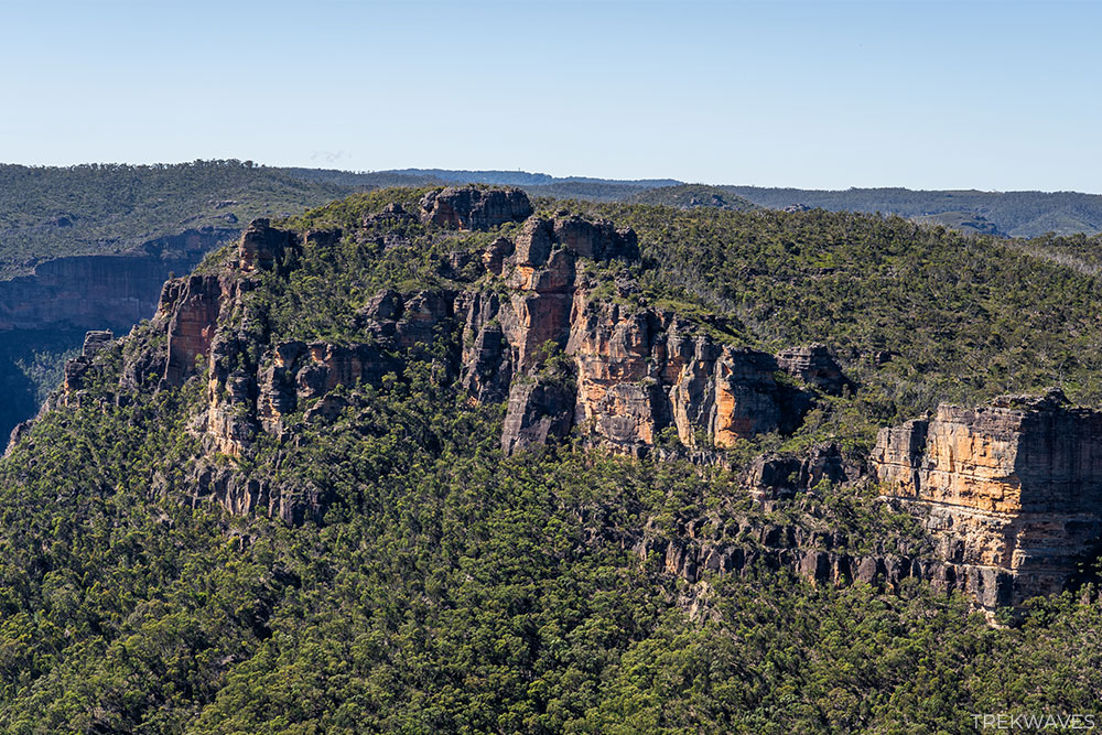
Even though the falls can’t be seen from this spot, the view over the Grose Valley is really nice, with the spectacular cliff walls of Burra Korain Head directly in front of you.
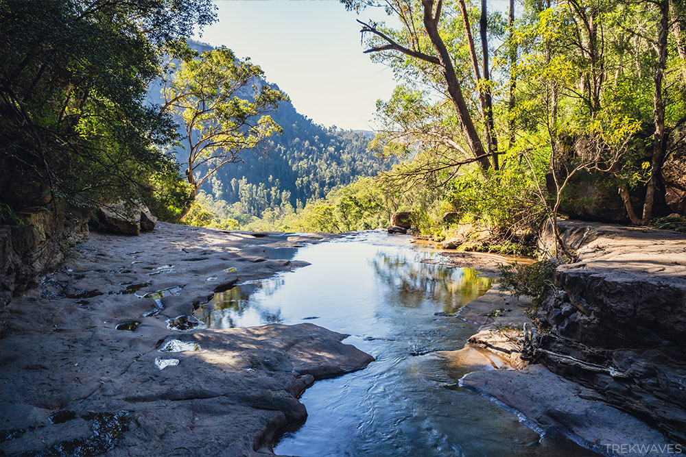
Trail to Victoria Cascades / Silver Cascades
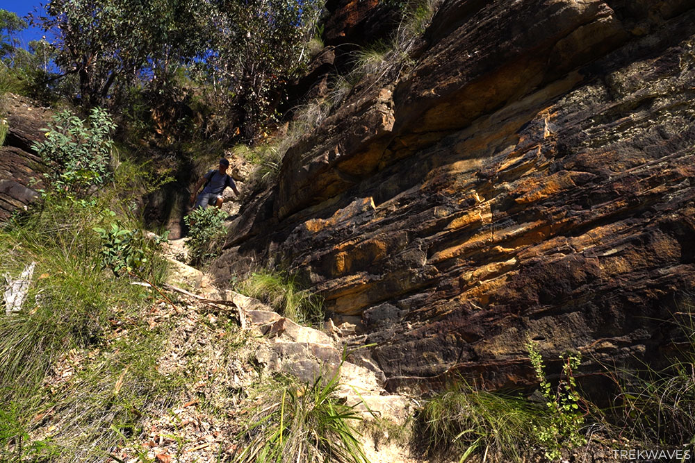
This is the longest part of the trail, where you’ll descend a path with many steep steps, including a few rocky sections.
However, there is nothing technical here; the trail is well signposted, and there is no rock scrambling required.
The path is narrow at times but generally very safe, even along the slightly more exposed sections.
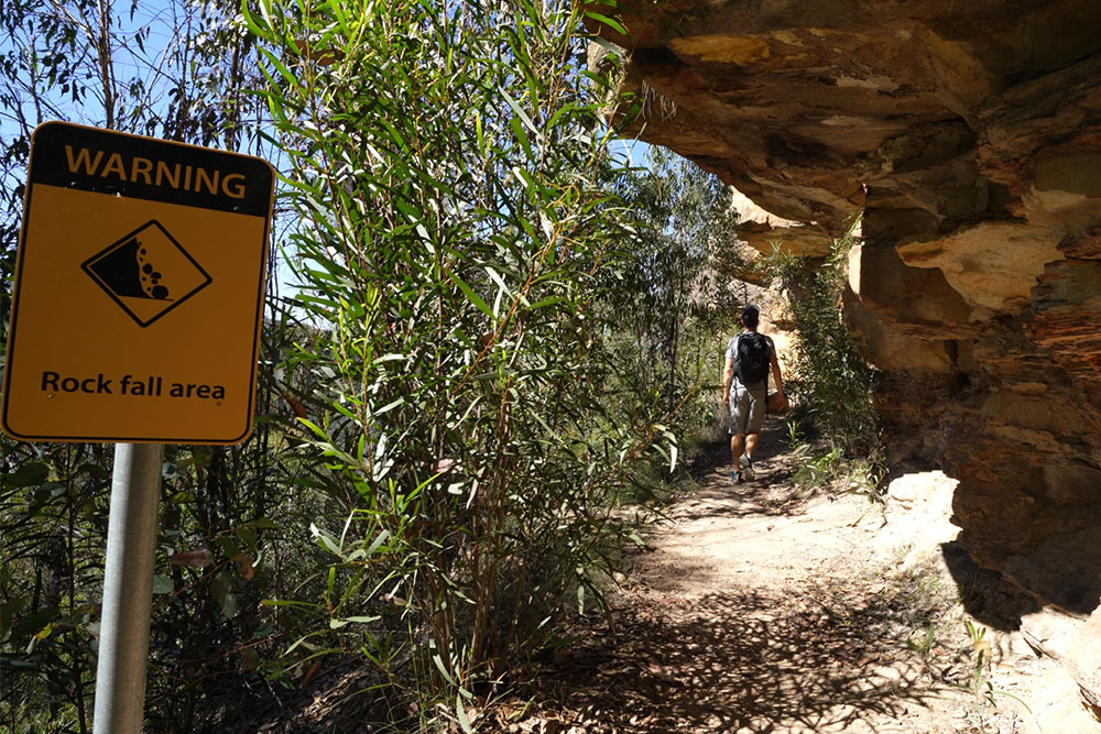
Towards the beginning of your descent, you’ll be walking under a rocky overhang with a yellow ‘Rock Fall Area’ warning sign.
Whenever you see these signs along the trail, including few more on the way to Burra Korain, it’s recommended not to stop and to keep moving.
After passing through these rocky overhangs, you’ll come to the steepest part of the descent, but don’t worry—it’s nothing technical. Just take your time as you make your way down.
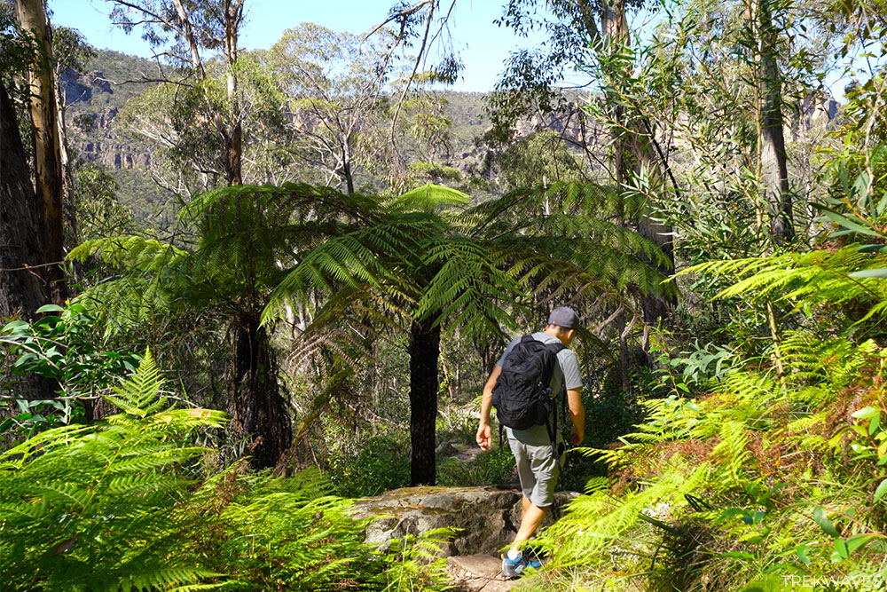
Following this, you’ll enter a lush green segment of the trail, with fields of verdant ferns stretching out in all directions around you.
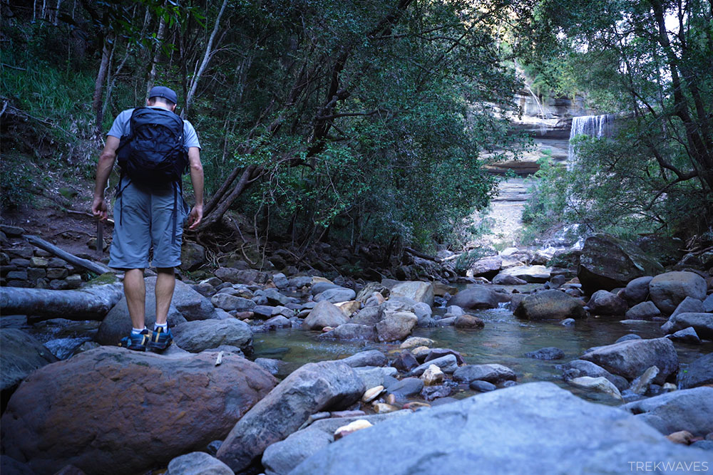
Once you’ve descended 1 km, the path begins to zig zag gradually, and the sound of the falls becomes more audible.
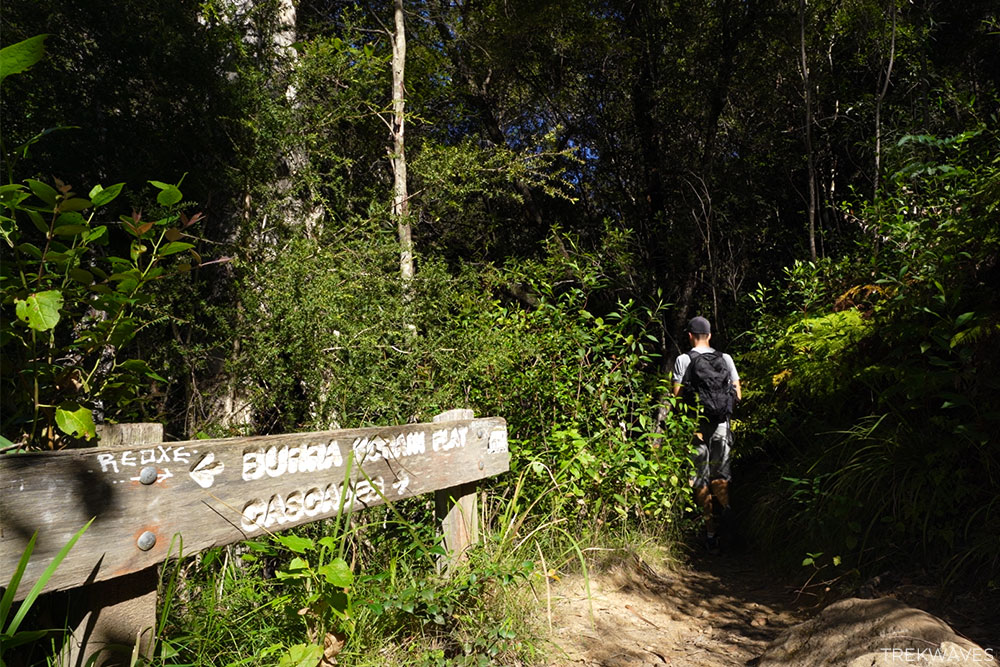
Finally, you’ll come to a junction with a wooden sign, where you’ll want to take the path marked as ‘Cascades’.
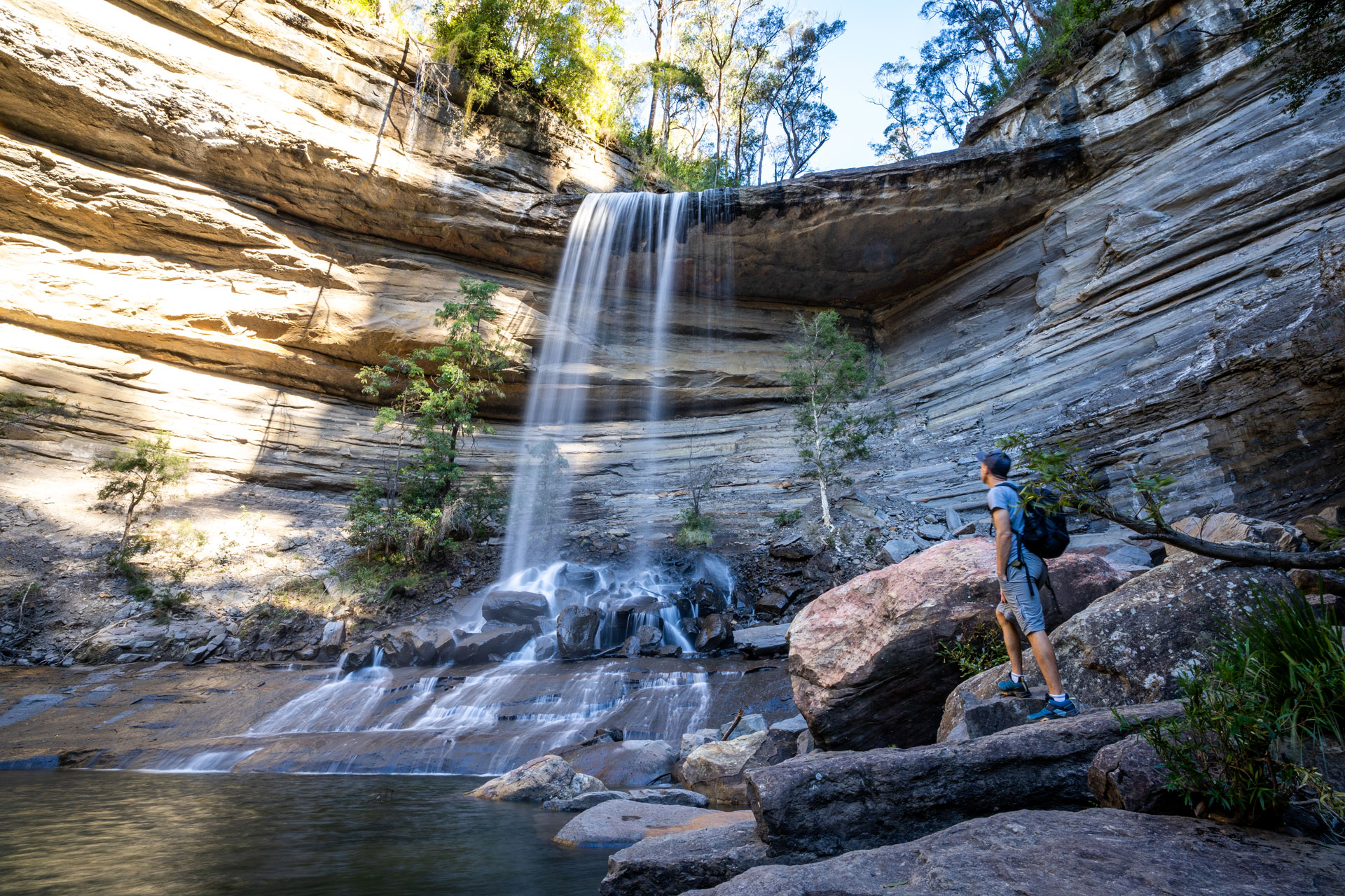
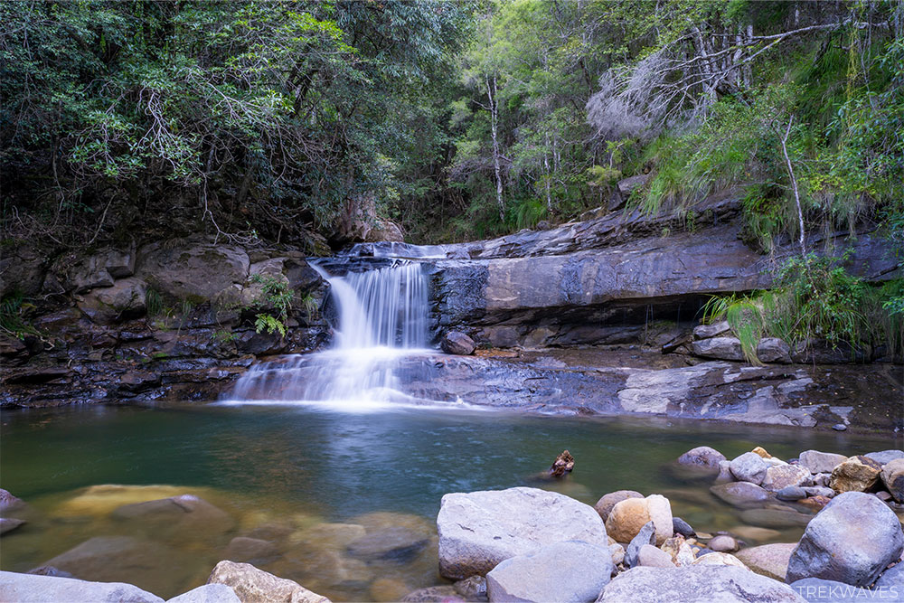
Victoria Cascades (Silver Cascades)
The cascades are located only 100 meters past the signpost. To get there, you’ll need to cross over a pile of tree branches and maneuver around a couple of rocks. Thankfully, it’s nothing too challenging to manage.
The cascades are beautiful, and I was fortunate to visit this spot on a weekday, having the entire place to myself for about an hour.
Although I didn’t go for a swim due to the late autumn chill, it’s undeniably one of the best swimming spots in the Blue Mountains and a delight for photographers.
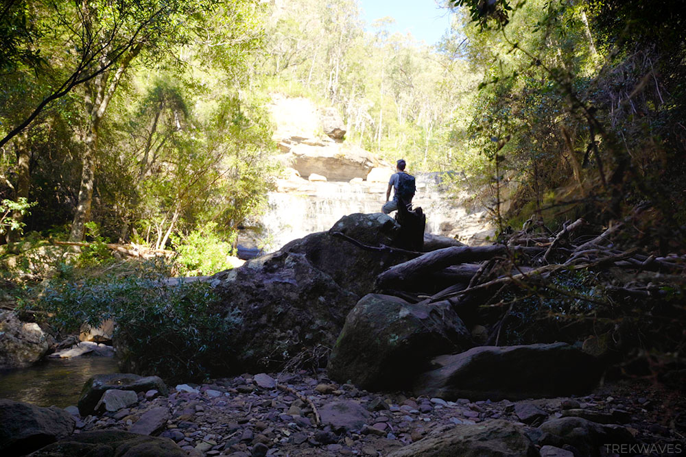
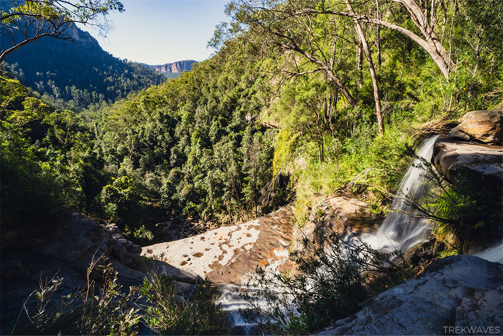
Top of Victoria Falls
After soaking in the captivating ambiance of Victoria Cascades, it’s time to head down to the base of Victoria Falls.
To do that, return to the junction and follow the sign to Burra Korain.
Shortly after, you’ll encounter another point where the trail splits, giving you the opportunity to explore a quick side trail to the top of the falls.
This area features a flat rock platform where you can walk and look down, but be careful as it’s unprotected with a steep cliff edge.
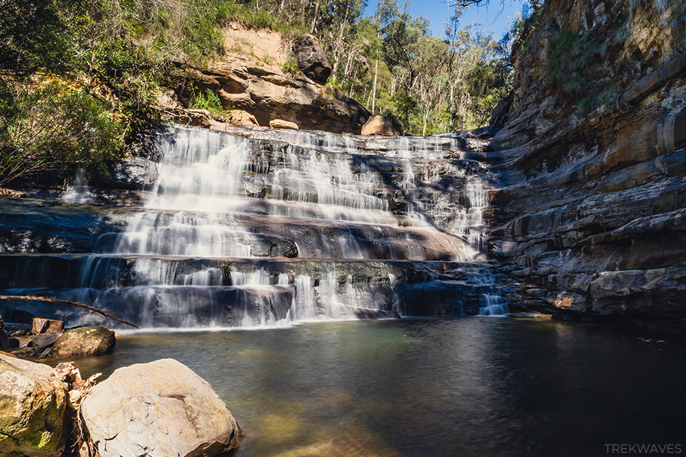
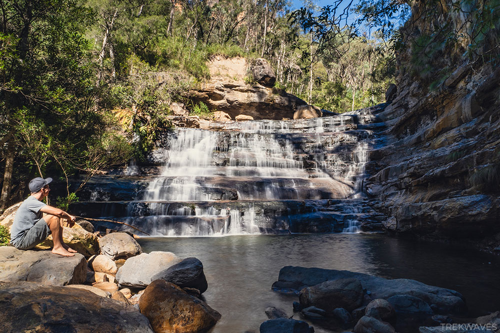
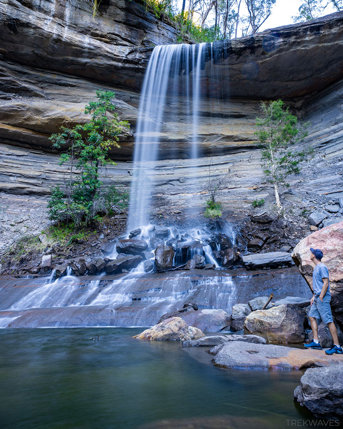
Trail to the Base of Victoria Falls
Finally, you’ll come to the last segment of the trail, leading down to the base of Victoria Falls.
A sign advises of unfenced sections and a slippery surface, but it’s nothing to be concerned about.
Just note that the steps may be wet, and the trail could be muddy, so exercise caution and take your time.
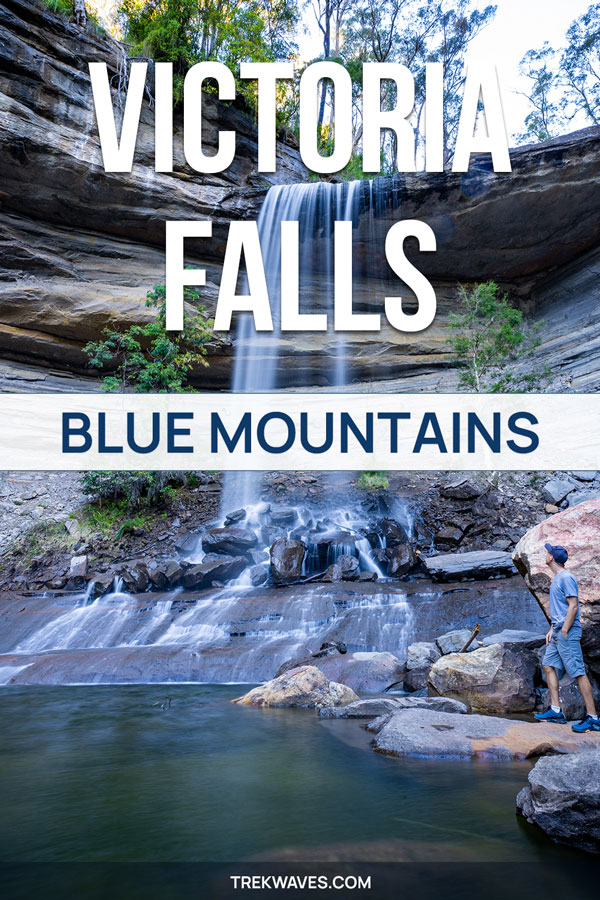
When you finally reach the base, take a moment to acknowledge your achievement and marvel at the incredible sight of one of the most stunning waterfalls in the Blue Mountains.
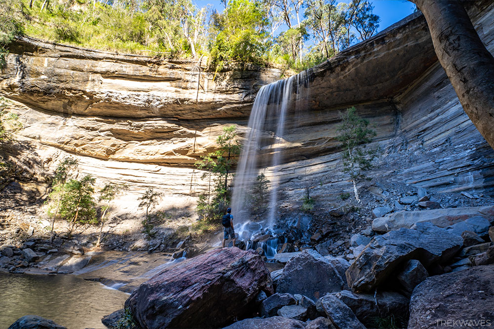
Again, I chose not to go for a swim here, but the pool didn’t seem too deep, and the bottom looked less rocky than at Victoria Cascades.
Therefore, it should also make for a great swimming hole on a hot summer day.
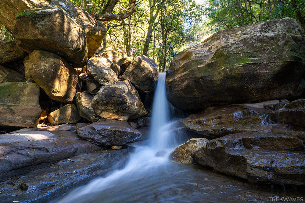
Trail to the Burra Korain Campground
This part of the walk is optional, but I strongly suggest including it if you have the time.
It’s a lot of fun and allows you to explore small side trails along Victoria Creek. You’ll be hopping on rocks and discovering beautiful, small cascades throughout this walk.
It’s worth noting that while this trail was very enjoyable, it’s actually much more technical than the entire Victoria Falls Track.
There are a few slippery sections in the first part of the trail, so make sure to wear appropriate shoes. Plus, the middle section of the trail is overgrown by fields of ferns.
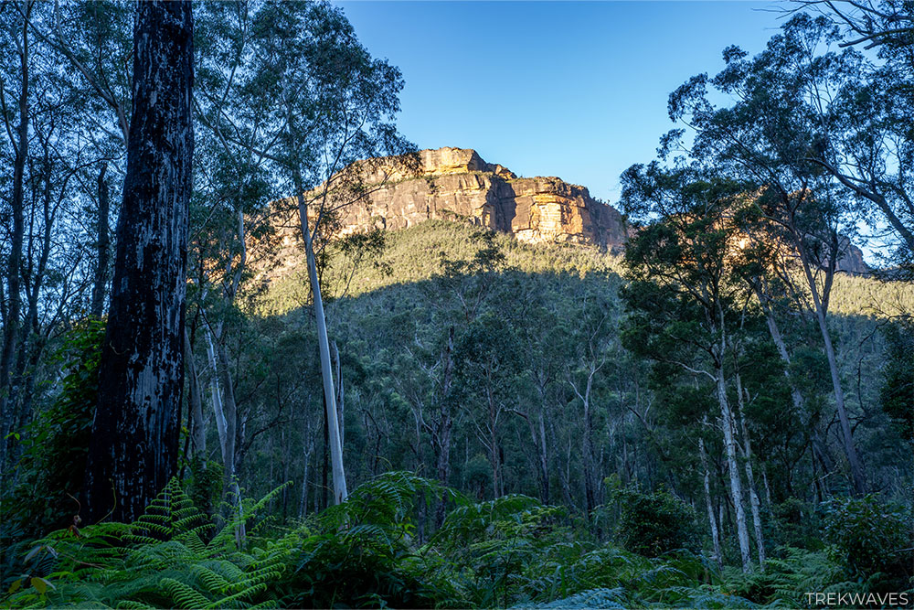
When I finally arrived at the Burra Korain Campground, I was greeted by an incredible sunset casting its warm glow on the imposing walls of Burra Korain Head, visible right above the campground.
Reflecting back on that final part of the walk where I decided to explore the trail to Burra Korain Campground, I can’t help but think that, perhaps subconsciously, I was trying to postpone the inevitable climb back to the car park 🙂
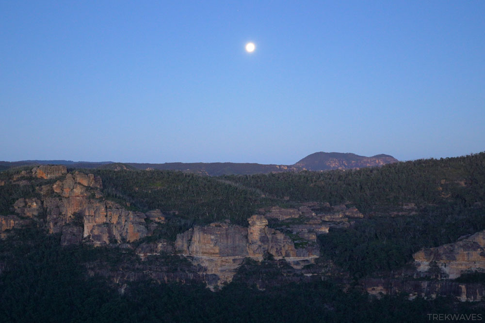
But after all, I finally made it back to the car park to enjoy the amazing display of the full moon illuminating this incredible part of the Grose Valley.
It was such an amazing walk and a perfect ending to the day!
Found it Helpful? Pin it For Later!
Frequently Asked Questions (FAQs):
How long does the trail take?
- Few hours or half-day if you want to go to Burra Korain Camground
What about signage and trail quality?
- There are plenty of signs and it is relatively easy to navigate it
How difficult are the trails?
- It’s not a technical trail but it requires a good fitness
What essentials should I carry?
- Plenty of water, snacks, hat and a swimwear
Is the trail wheelchair accessible?
- No
When is the best time to visit?
- You can visit at any time of the day since the trail offers plenty of tree cover
Is there phone service?
- There is no signal at the bottom of the falls
Can I bring my dog?
- Pets and domestic animals (other than certified assistance animals) are not permitted