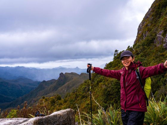
In mid-May, I set off on a trip of over 1,000 kilometres from Sydney to spend 5 days hiking some of the best trails in the Central, Southern, and Northern Grampians.
After nearly a week of trekking in the Grampians I’m convinced that this park has some of the best day hikes in Victoria, suitable for different fitness levels and preferences.
From leisurely walks and easily accessible lookout points to the challenging 13-day, 164-kilometer Grampians Peaks Trail, there’s something for everyone here.
All the trails here are well taken care of and clearly marked, so you won’t have any trouble finding your way around.
So, let me share a quick guide and tell you which day walks I found most enjoyable in Grampians National Park.
Where is Grampians National Park Situated?
The Grampians (Gariwerd) National Park is situated in western Victoria, Australia, approximately 260km west Melbourne and 470km south-east of Adelaide.
Located at the southernmost point of the Great Dividing Range, Grampians National Park has been on the National Heritage List site since 2006.
The park covers 167,000 hectares and features 69 named mountains, the tallest being Mount William at 1167 meters.
The distinctive saw-toothed ranges of the Grampians rise from the plains, creating a dramatic end to the Great Dividing Range.

Where Should I Stay in Grampians?
If you’re visiting the Grampians for the first time, Halls Gap is the perfect place to stay.
Not only does it offer direct access to some of the top hiking trails in the Central Grampians, but it’s also just about an hour’s drive from the best hikes in both the Northern and Southern Grampians.
Halls Gap is a small town but features a few nice restaurants, cafes, a general store, and a very helpful Visitor Information Centre with brochures and maps available.
Here, you’ll have the chance to see cockatoos, parrots, blue wrens, emus, deer, and many kangaroos roaming freely in the Halls Gap Valley.

Best Day Hikes in Grampians
Before I share my list of day walks in Grampians National Park, I want to let you know that I loved every one of these trails and I don’t have a favourite.
I’ve arranged the walks by altitude, starting with the lowest and moving to the highest.
And if you read through to the end of this article, I’ll show you 4 additional short walks to the best lookout spots in Grampians.
Alright, let’s jump right into this list of best day walks in Grampians National Park.
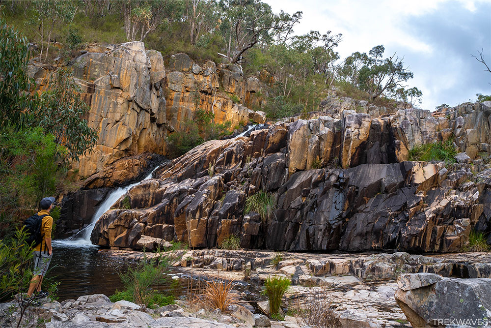
#1 – MacKenzie Falls To Fish Falls
- Start & finish: MacKenzie Falls Car Park, Old Mill Road
- Distance: 3.9 km return
- Elevation gain: 164m
- Time: +2 hours
- Difficulty: Medium
- Location: Central Grampians
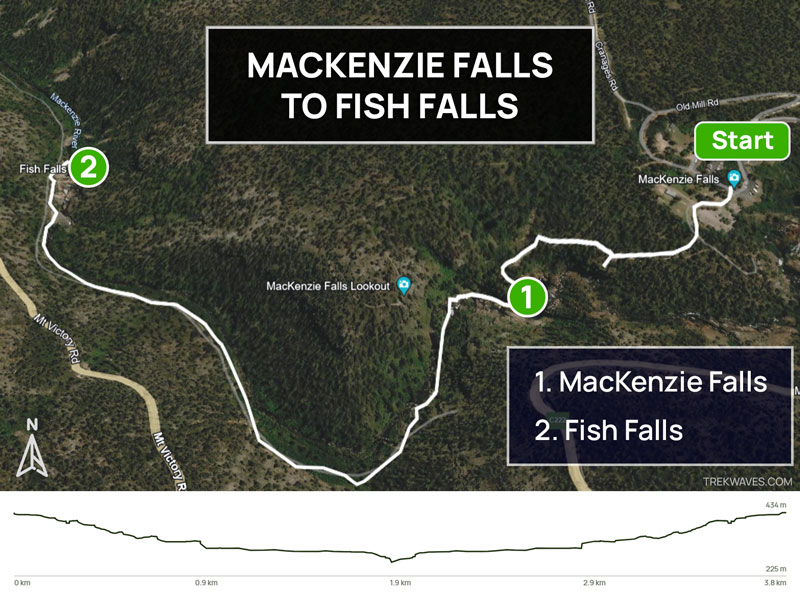
When you arrive at the MacKenzie Falls car park, the information board might make it look like there are tons of walking tracks, but there are actually just two main ones:
- MacKenzie Falls Lookout
- MacKenzie Falls Base (and onward to Fish Falls and Zumsteins)
The walk I’m recommending here is the second one. On your way down to the base of MacKenzie Falls, be sure to take a detour to Broken Falls Lookout and then follow the signs to Cranages Lookout.
From Cranages Lookout, you’ll start a steep descent, offering amazing views all the way to the base of MacKenzie Falls.

Having visited Iceland and witnessed some of the world’s most spectacular waterfalls, I have to say the base of MacKenzie Falls is genuinely impressive and definitely lives up to its reputation.
I can see why it’s the most popular spot in the Grampians. However, most people stop at the base of the falls.
If you’re already there, I highly recommend continuing along the MacKenzie River—the views at Fish Falls and the walk itself are equally remarkable.
#2 – Hollow Mountain (with Gulgurn Manja Shelter)
- Start & finish: Hollow Mountain Car Park
- Distance: 4 km return
- Elevation gain: 189m
- Time: +2 hours
- Difficulty: Medium / Hard
- Location: Northern Grampians
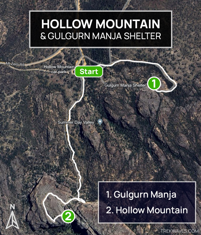
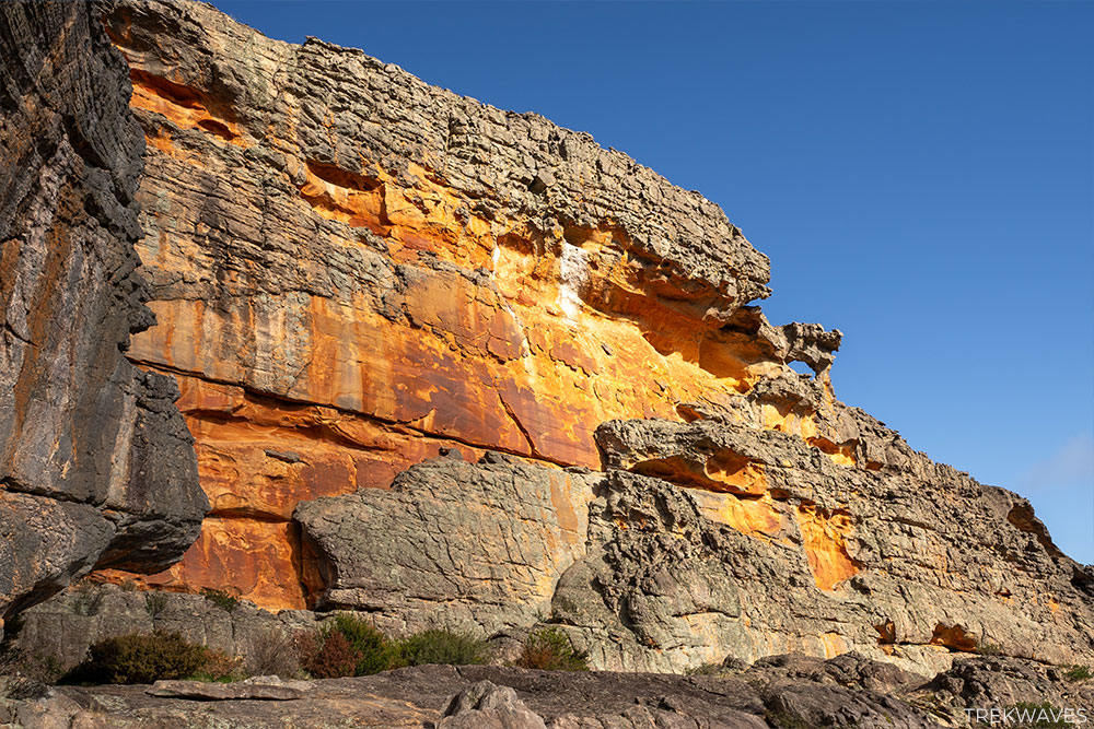
Hollow Mountain’s beauty took me by surprise. The pictures you see online truly don’t do it justice, and I firmly believe it’s a place you can’t miss when visiting the Grampians.
The sandstone cliffs showcase a vivid spectrum of colors, ranging from bright reds to yellows, greys, and whites, often forming unique stripes.

Hollow Mountain is a mecca for rock climbers, and climbing to the summit offers a thrilling adventure.
Expect lots of rock scrambling and navigating through narrow caves, making it a basic introduction to rock climbing. However, there’s nothing overly technical or steep to tackle along the way.
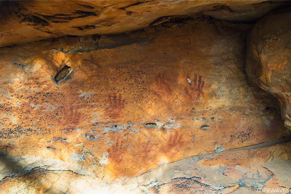
While you’re in the area, don’t forget to take a walk to Gulgurn Manja, which translates to “hands of young people.”
At the shelter, you’ll witness ochre-stained handprints believed to be from many generations of young people, likely aged between 8 to 12 years old.
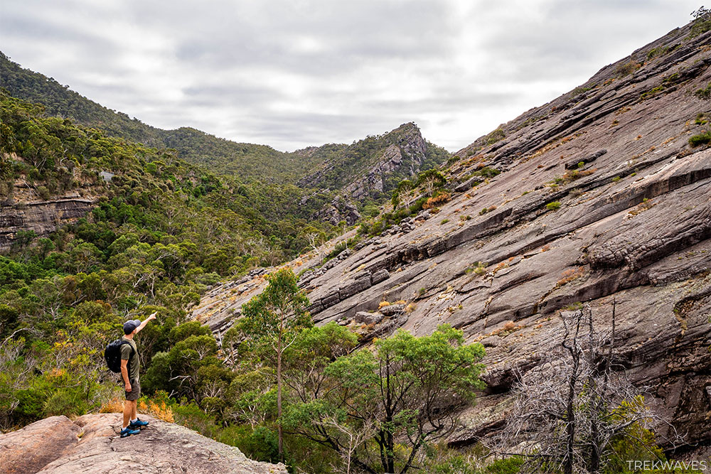
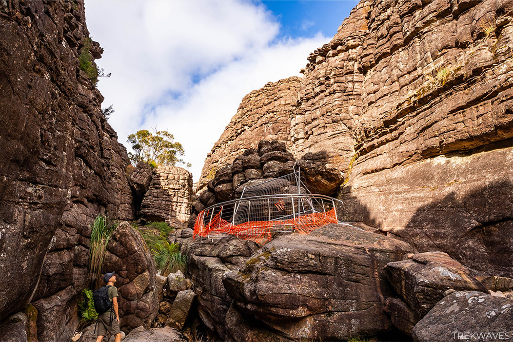
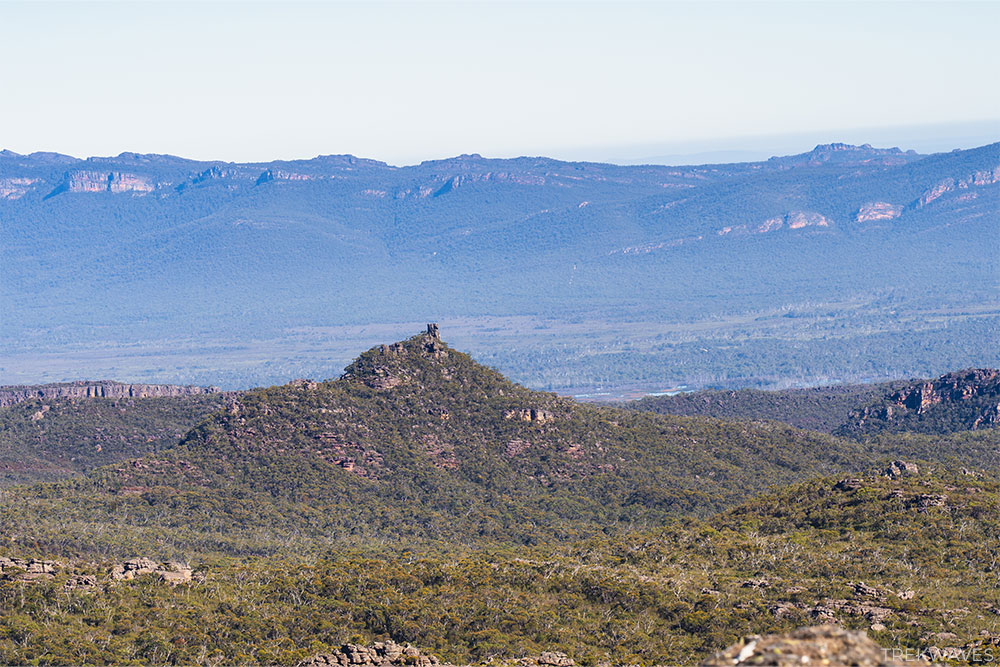
#3 – Halls Gap to The Pinnacle Loop
- Start & finish: Halls Gap Caravan Park Reserve
- Distance: 10km loop
- Elevation gain: 500m
- Time: At least half day
- Difficulty: Medium
- Location: Central Grampians
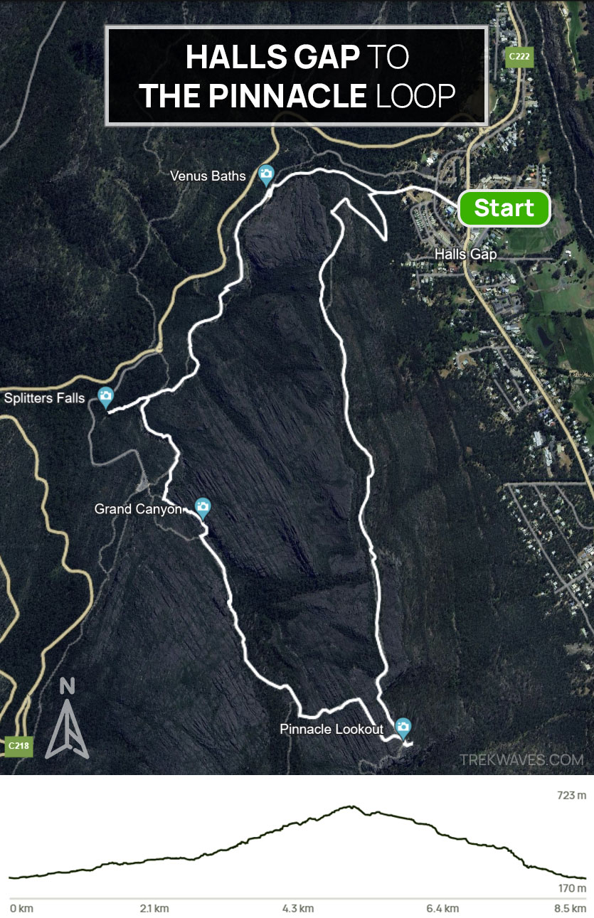
The Pinnacle walk is the most popular hike in Grampians for many good reasons.
If you have just a day or two in the Central Grampians and want to experience a walk that takes you through various landscapes—stunning rock pools, a waterfall, rock caves, and canyons—ending at an incredible summit with great views, this is definitely the hike to choose.
Although most hikers reach the Pinnacle summit from Wonderland Carpark or Sundial Carpark, I highly recommend starting from Halls Gap and doing a loop.
The views and ambiance of the first part of the walk, which goes through Venus Baths and Splitter Falls, are just incredible.
Right now, as I write this post, the trail through the Grand Canyon to the Pinnacle is closed.
You can still visit the Grand Canyon, but you’ll need to retrace your steps back to Wonderland Carpark, which adds about +1 km to your overall walk.
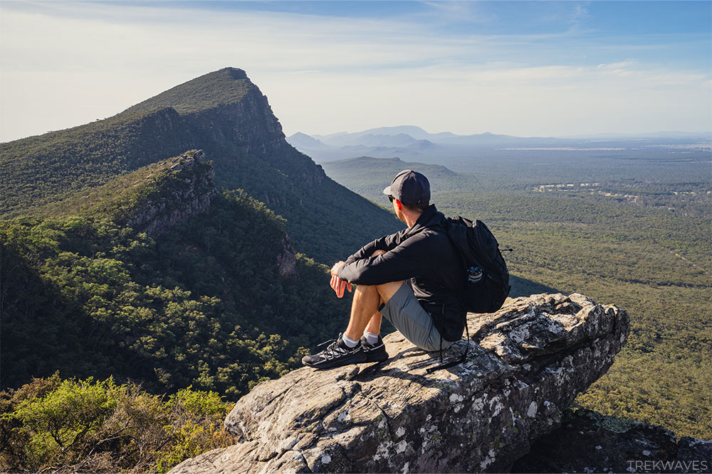
The Pinnacle summit is considered by many to be one of the best vantage points in Grampians National Park, providing stunning scenic views across the wide expanse of western Victoria.

#4 – Mount Rosea (return via Burma)
- Start & finish: Rosea Carpark
- Distance: 10.8km loop
- Elevation gain: 555m
- Time: At least half day
- Difficulty: Medium / Hard
- Location: Central Grampians

Climbing to Mount Rosea’s summit is a thrilling adventure that almost feels like playing a video game, with the constant challenge of finding yellow arrows to lead you through stunning rock formations along the path.
The trail starts in a green, fern-covered forest, transitions to sandy and rocky terrain, and then becomes a blend of rock hopping and squeezing through rocks, with amazing views along the way.

Reflecting on my experience on this track, I’d probably choose to skip the loop and do the 9km return hike next time.
The second part of the hike (after the descent from Mount Rosea) mostly went through the forest, and all the little creeks I passed were dried up.
The loop route is ideal on hot, sunny days—once you begin the descent toward Burma Track, you’ll quickly enter the bush and enjoy complete shade coverage for the remainder of the walk.
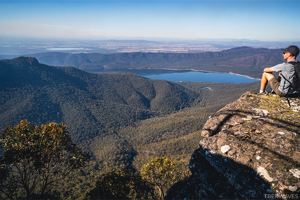
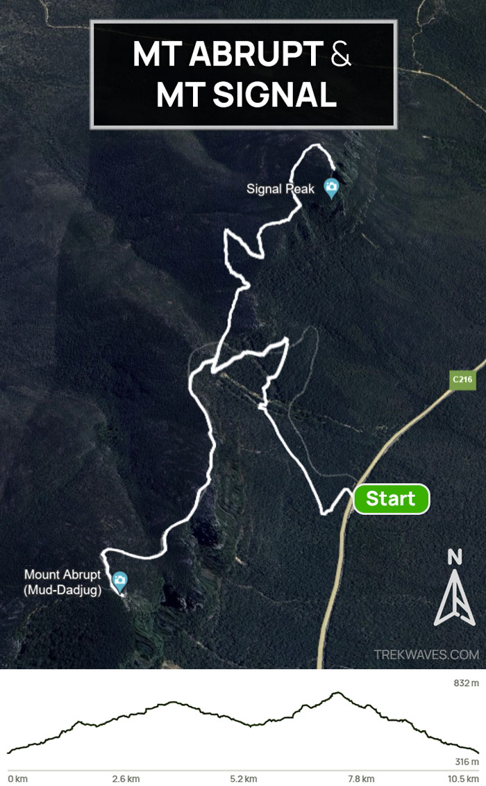
#5 & #6 – Mount Abrupt & Mount Signal
- Start & finish: Mt Abrupt Car Park on Grampians Road
- Distance: 10.5km return
- Elevation gain: 653m
- Time: At least half day
- Difficulty: Medium / Hard
- Location: Southern Grampians
I had seen photos of Mount Abrupt’s distinctive ridgeline long before visiting the Grampians, and those images stayed with me.
The way those peaks cut across the horizon reminded me of Seceda in the Dolomites—reason enough to make this hike my first priority when I finally arrived.

The hike to the summit of Mount Abrupt was fairly easy for me, with no technical sections or rock scrambling, though there are plenty of steps.
After reaching the summit of Mt Abrupt, if you still have time and energy, I suggest heading to Mount Signal on your return, since the steepest section of the trail is already behind you.

If you have to pick between these two trails, I’d suggest Mount Abrupt, as northern view from top of Mount Signal is a bit obstructed by trees, but it’s still equally stunning.
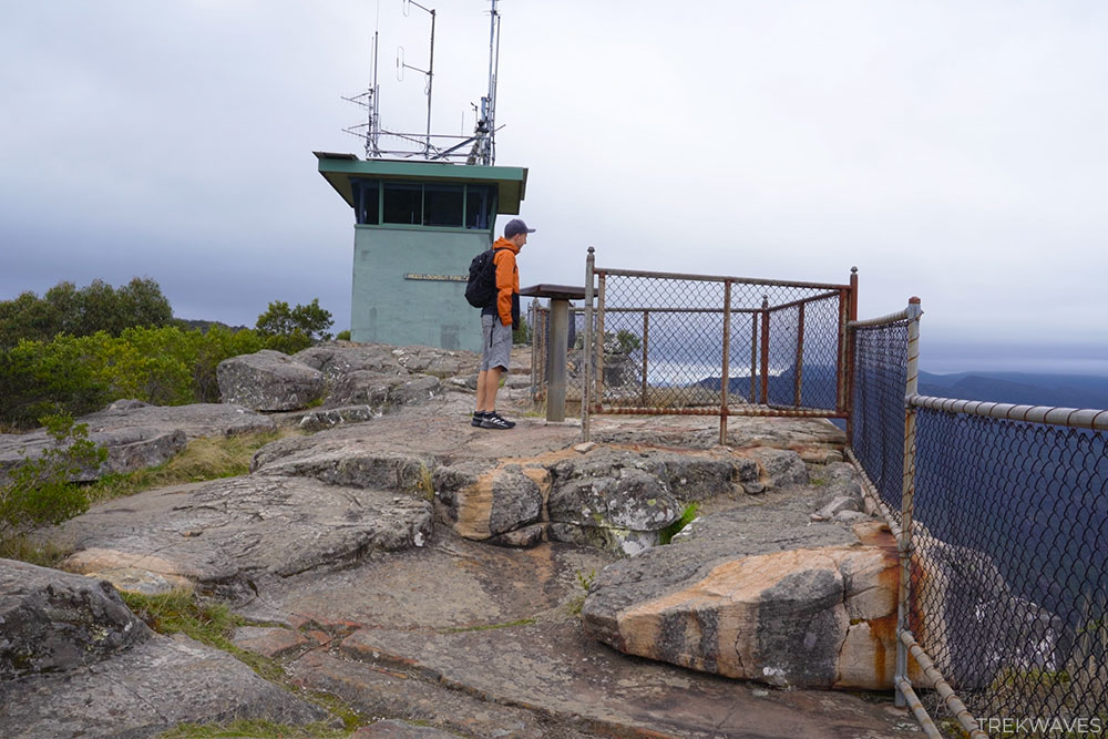
#7 – Mount William
- Start & finish: Mount William Car Park
- Distance: 3.8km return
- Elevation gain: 228m
- Time: 1.5-2 hours
- Difficulty: Easy / Medium
- Location: Central Grampians
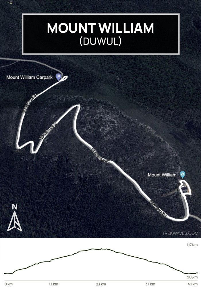
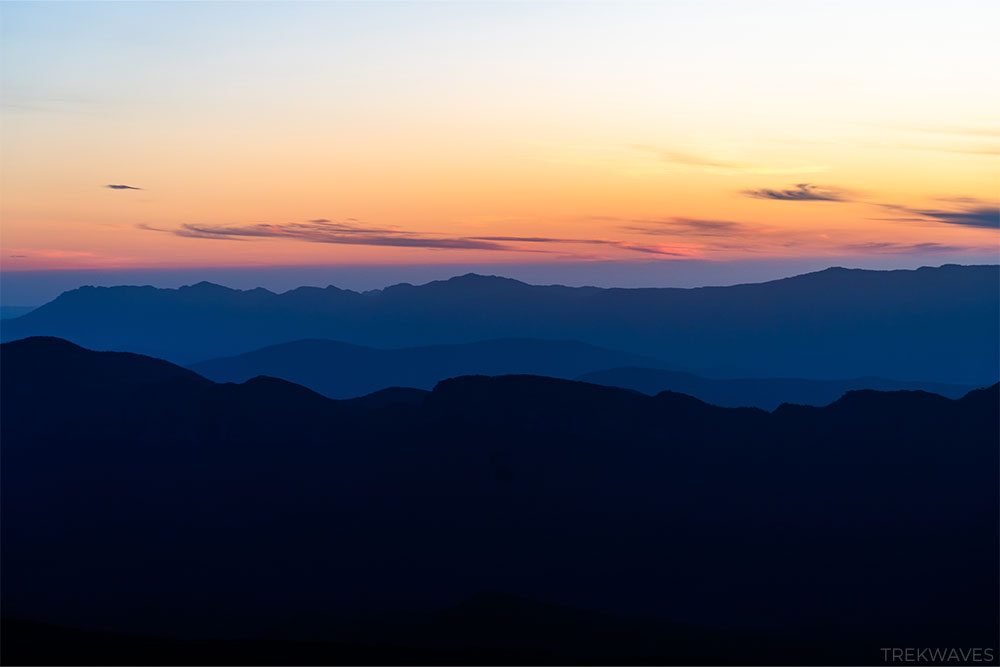
The hike to Mount William, the highest peak in the Grampians at 1,167 meters, isn’t the most exciting since it’s just a walk along a steep, sealed road.
However, the 360-degree views from the summit make it absolutely worth it.
I decided to head over there around sunset, and it was a great choice. Even though it was a bit cold at the summit in the middle of May, I was the only one there to take in the magical moment.

When you reach the summit of Mount William, look for a stone pillar located beyond the fenced tower.
The pillar has a plaque about Major Mitchell on its front and a directional board on top indicating the directions and distances to various visible landmarks.

4 Best Lookouts in Grampians National Park
If your time in the Grampians is limited, there are several incredible and easy-to-reach lookout points that you can drive straight to, offering some of the best views in the park.
As soon as I arrived in the Grampians, I headed straight to these 4 lookout points to get a general feel and overview of the park.
They are all located in the Central Grampians, a short drive from Halls Gap.
#1 – Boroka Lookout
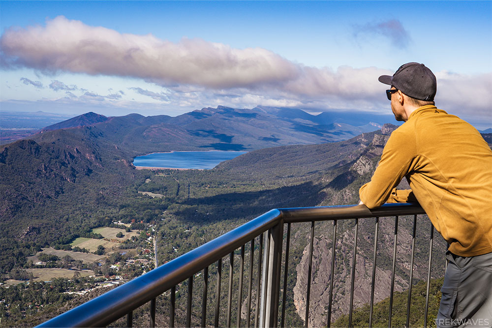
Boroka Lookout stood out as one of my favourite viewpoints, offering panoramic views of Halls Gap, Lake Bellfield, and the eastern Grampians.
It’s conveniently located along Mt Difficult Road, just 15km from Halls Gap, and is wheelchair accessible.
The lookout features two large viewing platforms, conveniently situated just 90m from the car park.
While it’s renowned for sunrise views, I didn’t have the chance to witness it myself, not being much of an early riser.
#2 – Reed Lookout
Reed Lookout is situated along Mount Victory Road, approximately 12 km from Halls Gap on the way to Mackenzie Falls.
The lookout spot, positioned 100m from the car park, is behind the Reed Lookout Fire Tower, which is visible from the car park.
From the Reed Lookout, you’ll be treated to breathtaking views spanning the entire Victoria Valley, Victoria Range, Serra Range, Lake Wartook, and the Mt Difficult Range.
Facing westward, the lookout offers an ideal vantage point for watching the sunset.

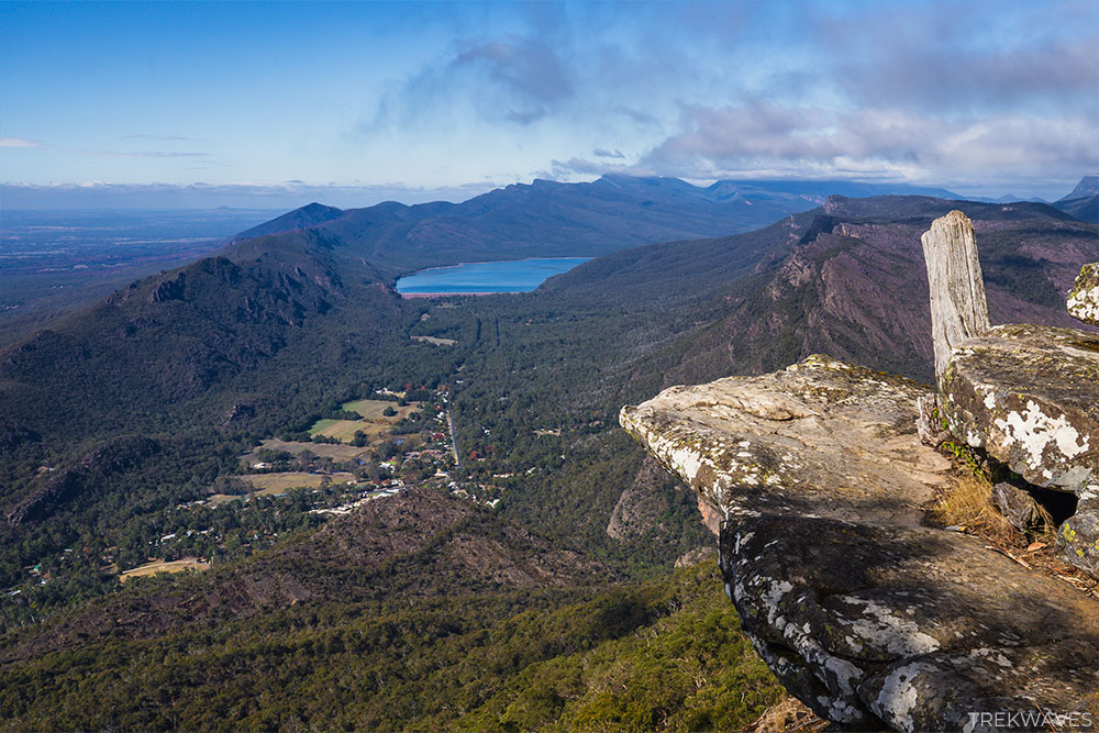
#3 – The Balconies
The Balconies lookout is accessed from the same car park as Reed Lookout, but you’ll need to take an easy 2km return walk to reach the Balconies viewing platform.
At the start of the walking track, you’ll see a series of stunning stone platforms, perfect for photos with the views over Lake Wartook and the surrounding mountain ranges.

Upon arrival to the Balconies, you’ll be treated to views of the Victoria Valley and the surrounding ranges, as well as the unique rock formations protruding from the mountain.

#4 – MacKenzie Falls Lookout (The Bluff Lookout)
This was the final lookout I visited on my first day in the Grampians. After that, I headed down to the base of MacKenzie Falls and then continued on to Fish Falls, which was the first walk mentioned in this article.
The walk to the viewing platform (also know as The Bluff Lookout), offering a full view of MacKenzie Falls in all its glory, is an easy, wheelchair-friendly 1.9km return stroll through stringybark forest.
Lookout offers a fantastic view of MacKenzie Falls, but if you’re a photographer aiming to capture crisp, detailed shots without cropping, bring along a longer lens.
The waterfall sits quite a distance from the viewing platform, so a longer lens will help you get those stunning, up-close shots.

Found It Helpful? Pin It for Later!